A front will move through Western Washington this evening. Wind will be the biggest story with this storm. Here's what NWS Seattle forecasts for tonight-tomorrow's winds.
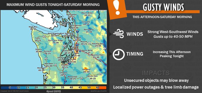
Most of us can expect winds gusting 35-50 mph through tomorrow morning. There is a higher than normal risk of falling trees with this storm, due to the very highly saturated soil from all our recent rain.
Expect 0.25-0.5 inches of rain with this storm. Scattered showers are possible Saturday as well.
As this storm moves on through tonight, it will pull in much colder air. Highs through the next few days will reach the low-mid 40s, with lows 28-36! This cooling factor will allow rivers to fall along with snow levels, decreasing flooding. The Puyallup River will fall below flood stage tonight & tomorrow. It will still be feet higher than normal, but the worst is over. The same goes for all other rivers around the region...with two exceptions. The White River in Auburn, Pacific, and Sumner will stay high through next week, and so will the Green River in Auburn (falling on Sunday).
Snow levels will become quite low next week, though at this time it looks like the air will be a bit too dry to support lowland snow. (Stay tuned!)
Here are two pictures of the Puyallup River's...at its highest level in 5 years. The top was taken by me at the Milwaukee Ave. Bridge and the bottom was taken by @BonneyLakeWX on the Alderton Bridge.


No comments:
Post a Comment