Tuesday, May 30, 2023

Gradual Warmup, Extended Warmth Expected

FastCast—Wednesday, May 31 to Sunday, June 4:

The past few days have been cooler than normal (by a couple degrees) due to a persistent marine layer that has moved in each morning, burning off in mid-afternoon. This has kept highs in the mid 60s to low 70s, near average for late May. Similar conditions will prevail on Wednesday, with mostly cloudy skies and highs in the low to mid 60s, potentially into the upper 60s if clouds burn off. Thursday will start off cloudy and become sunny, with highs reaching the upper 60s to low 70s. Additionally, Wednesday and Thursday morning’s lows will be on the chilly side, likely in the low to mid 40s. Conditions will become mostly sunny for Friday through Sunday, with highs in the mid to upper 70s, with some areas reaching the low 80s, mainly away from the water. From Thursday to Sunday, a stronger breeze off the water will bring cooler highs. Expect lows through Sunday to remain in the mid to upper 40s. There is a potential for warmer conditions into next week…so stay tuned!

————————————————————

Continue reading the full blog below!

Another day of morning to early afternoon clouds and potential afternoon sun is ahead on Wednesday. Below is the GFS forecast for highs.


Wednesday’s highs will reach the mid to upper 60s in the lowlands, with some areas north of Everett remaining in the low 60s. The coast will only reach the mid to upper 50s, and Eastern WA will reach the upper 60s to mid 70s. 

On Thursday morning, lows will be chilly. Let’s take a look at the GFS and European forecasts. First, the European (more likely) forecast for Thursday morning’s lows.


The European model shows lows in the lowlands dropping to the mid 40s, with some outlying locations dropping into the low 40s.

The GFS model shows a colder forecast, seen below.


This less likely forecast shows locations west of the Cascades dropping to the upper 30s to low 40s on Thursday morning, which is unlikely but still within the realm of possibilities.

Thursday’s highs will be warmer as clouds burn off and flow turns offshore, bringing an end to the morning clouds for awhile. Below is the GFS forecast for Thursday’s highs.


The GFS shows lowland highs in the mid to upper 60s north of Everett and in the upper 60s to mid 70s south of Everett. The coast will reach the upper 50s to low 60s, and Eastern WA will reach the low to mid 70s.

Friday’s highs will be warmer yet again, as seen in the GFS forecast below.


On Friday, expect highs in the mid 60s to low 70s from Everett north and in the mid to upper 70s from Everett south. The coast will again reach the upper 50s to low 60s, and Eastern WA will increase into the mid 70s to low 80s.

Now, let’s take a look at the extended outlooks from the NWS Climate Prediction Center. First, let’s look at the temperature outlook for June 5-9 (next week).


This outlook shows a 70-90% probability of above average temperatures across Washington to begin June, a strong signal for extended warm weather (and sun).

Next, the precipitation outlook for June 5-9, seen below.


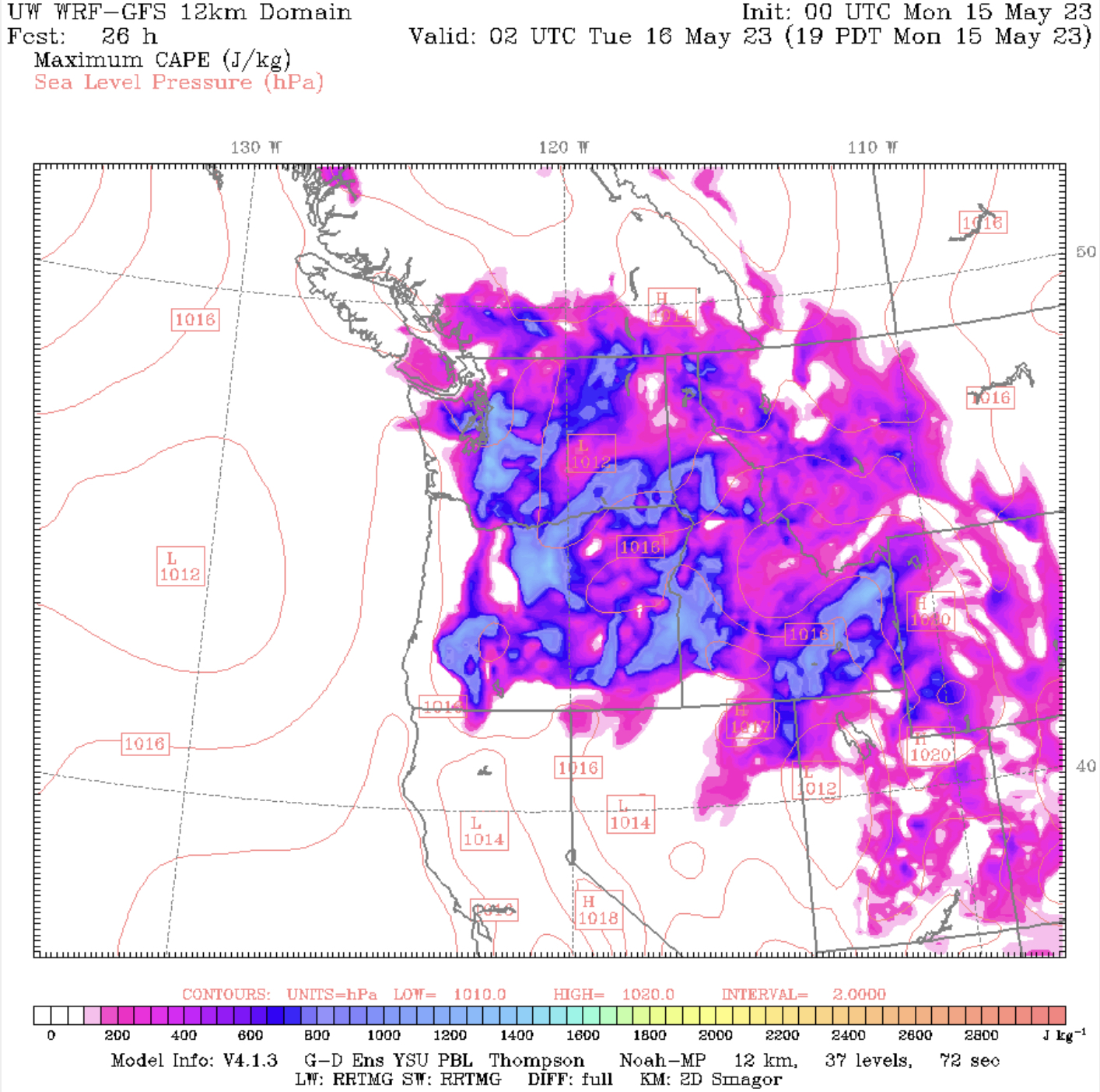
This forecast shows a 33-40% probability of below average precipitation across Western WA, with average precipitation likely in Central WA, and a 33-40% probability of above average precipitation in SE WA. Also, note the 60-80% probability of above average precipitation over Northern CA, Nevada, Utah, and parts of Idaho, Wyoming, and Colorado. This is due to consistent showers and thunderstorms setting up over these areas.

Nice weather is ahead, and warm (and above average) temperatures are expected to continue through next week. Stay tuned!

Friday, May 26, 2023

Memorial Day Weekend Forecast

FastCast—Saturday, May 27 to Wednesday, May 31:

A relatively nice Memorial Day weekend is in store for Western Washington. No rain is expected west of the Cascade crest, with only a chance of scattered showers from the mountains eastward. Through the weekend, expect lowland highs in the upper 60s to low 70s, with mostly cloudy mornings transitioning to sunny afternoons. Partly cloudy conditions will persist on Tuesday and Wednesday, with highs in the mid 60s to low 70s. Through Wednesday, expect lows in the mid 40s to low 50s. 

————————————————————

Continue reading the full blog below!

A pleasant Memorial Day weekend is ahead for Western Washington, with near-average temperatures and dry conditions. Let’s take a look at high temperatures for the weekend.

Below are highs on Saturday, from the NAM high-resolution forecast.


Expect lowland highs in the upper 60s to low 70s, and in the mid 50s on the coast. Eastern Washington will reach the mid 70s to mid 80s.

Sunday’s highs will be similar, as seen in the NAM forecast below.


On Sunday, expect highs in the mid 60s to low 70s in the lowlands, in the mid 50s to low 60s on the coast, and in the mid 70s to upper 80s in Eastern Washington.

Low temperatures will actually be slightly below average over the next few days. Below is the NAM forecast for lows on Sunday morning.


Expect morning lows in the mid 40s in outlying areas and in the low 50s in the metro area. In Eastern Washington, expect lows in the mid to upper 50s.

Finally, let’s look at Monday’s highs, from the European model, seen below.


Monday will likely be the warmest day of the weekend, with highs in the lowlands in the upper 60s to mid 70s (this model likely runs cool). The coast will reach the upper 50s to low 60s, and Eastern Washington will likely reach the low 80s to low 90s. 

Enjoy the relatively pleasant Memorial Day weekend! Be sure to watch for brief thunderstorms in the mountains and scattered around Eastern Washington.


Tuesday, May 23, 2023

Late Week Warmup Ahead

FastCast—Wednesday, May 24 to Saturday, May 27:

After a few cooler days with the stronger influence of marine air, sunnier and warmer conditions are ahead through the end of the week and into the weekend. On Wednesday, expect mostly sunny conditions in the lowlands, with highs in the upper 60s to low 70s and lows in the mid 40s. Temperatures will continue to rise in the lowlands on Thursday and Friday, with highs reaching the upper 70s to low 80s, except colder near the water. Lows will be in the mid 50s. Temperatures will decrease on Saturday, as clouds increase, dropping highs to the mid 70s. No rain is expected through the weekend!

————————————————————

Continue reading the full blog below!

After a few cooler days, highs will be on the rebound in the second half of this week. Let’s take a look at the forecasts! We will examine the GFS and NAM forecasts, which each show a slightly different forecast. 

We will start below with the NAM forecast for highs on Wednesday.


The NAM shows highs in the mid to upper 60s in the lowlands, upper 50s to low 60s on the coast, and upper 60s to upper 70s in Eastern Washington.

The GFS forecast for Wednesday, seen below, is warmer.


The GFS shows highs in the lowlands in the mid 60s to mid 70s, in the upper 50s to mid 60s on the coast, and the upper 60s to upper 70s in Eastern Washington, similar to the NAM.

Next, let’s take a look at Thursday, starting with the NAM forecast.


It’s a noticeable increase from Wednesday to Thursday. Lowland highs will increase to the low to mid 70s, the coast will increase to the upper 50s to low 70s (warmest off the beaches), and Eastern Washington will increase to the mid 70s to mid 80s. 

Let’s compare this to the GFS forecast for Thursday.


The GFS shows lowland highs increasing to the upper 60s-low 70s north of Seattle, and mid to upper 70s south of Seattle. It also shows highs in the low 60s to low 70s, and Eastern Washington in the mid 70s to low 80s. 

Finally, a look at Friday, which will likely be the hottest day of this brief warmup. We will start with the NWS NBM model (NAM doesn’t reach this far out).


The NWS NBM forecast shows lowland highs in the mid to upper 70s, the coast in the mid 60s, and the Willamette Valley and Eastern Washington in the upper 70s to mid 80s.

Let’s compare this with the warmer GFS forecast for Friday, seen below.


The GFS forecast shows a far warmer situation for the lowlands, with highs on Friday reaching the mid 80s from Seattle to Olympia. This is somewhat unlikely, but is within the realm of possibilities. This forecast shows mid 60s on the coast and upper 70s to mid 80s for the Willamette Valley and Eastern Washington.

Finally, let’s take a look at the extended forecast outlooks from the NWS Climate Prediction Center (CPC)

First, let’s look at the temperature outlook for May 29-June 2.


There is roughly a 33-60% probability of above-average temperatures in Washington, increasing as you go east, with extreme Western WA having an equal chance of above or below average temperatures.

Next, let’s look at the precipitation outlook for May 29-June 2, also from the CPC.


There is a 33-50% probability of below average precipitation from the Cascades westward, an equal chance of above or below average precipitation for most of Eastern Washington, and a 33-40% probability of above average precipitation for extreme SE Washington.

Stay tuned for a look at the Memorial Day Weekend forecast on Thursday night!

Friday, May 19, 2023

Chance of Thunderstorms & A Big Cooldown

FastCast—Saturday, May 20 to Tuesday, May 23:

After a brief incursion of Alberta smoke to the Pacific Northwest, a cooldown and return to more seasonable weather is expected. However, there is first a chance of thunderstorms across the region, with a potential for severe thunderstorms in Eastern Washington & Oregon on Saturday and Sunday. There is a chance of thunderstorms in the lowlands from late Friday night through early Saturday morning, though this chance isn’t represented too well in most forecasts. Saturday will be partly sunny in the lowlands, with highs in the mid to upper 70s and lows in the upper 50s. Sunday will bring dramatic change across the state (more on that below), and the lowlands will have overcast skies, with highs in the mid 60s and lows in the mid to upper 40s, a large and refreshing change from the past week of warmer temperatures. There is also a chance of light showers on Sunday, with the most likely scenario being a trace to 0.2” of rain in more concentrated areas of showers. Expect drier and partly to mostly cloudy conditions on Monday and Tuesday, with highs in the mid to upper 60s and lows in the mid to upper 40s.

——————————————————

Continue reading the full blog below!

Before a return to more seasonable temperatures and cloudier conditions, another area-wide chance of thunderstorms is ahead, with severe thunderstorms possible in Eastern Washington and Oregon. Let’s take a look at the forecast. 

Let’s start with the instability forecast for 3 AM Saturday from the UW WRF model.


The UW forecast shows CAPE of 800-1200 over the Cascades and Western Washington very early Saturday morning. This means that there is a potential for thunderstorms. As of 11 PM, some storms have already popped up on radar in the foothills of Snohomish and Pierce Counties. Fast-moving thunderstorms are possible overnight and into early Saturday morning. Any storms that do develop will bring brief lightning, possible brief heavy rain, and gusty winds. Storms will move quickly from south to north.

Instability and other key ingredients for thunderstorms will remain present on Saturday and Sunday east of the Cascades. This will produce a severe thunderstorm risk for eastern parts of Washington and Oregon this weekend. Below is the Storm Prediction Center (SPC) outlook for Saturday.


Notice the large dark green region indicating a marginal risk of severe thunderstorms from South-Central Oregon along the east slopes of the Cascades into British Columbia. The biggest threats with these storms are localized 60+ mph wind gusts and brief 1+ inch hail.

The SPC outlook for Sunday shows the continuation of favorable conditions for severe thunderstorms across the Inland Northwest.


Sunday’s risk area is further east, and includes WA’s far eastern tier, the eastern third of Oregon, most of Western ID and the panhandle, and far western Montana. This risk area also includes larger population centers such as Spokane, Coeur d’Alene, Boise, Missoula, and Lewiston.

Again, the biggest threats will be severe wind gusts (60+ mph) and severe hail (1+ inch). 

Sunday will also bring a major cooldown for the region. First, let’s take a look at what to expect on Saturday. Below is the high-resolution NAM forecast for high temperatures on Saturday.


Expect highs in the mid to upper 70s in the lowlands (cooler near the water, especially in the North Sound), in the mid 50s to low 60s on the coast, and sweltering in the upper 80s to upper 90s in Eastern Washington, hottest in the lower Columbia Basin.

Quite a change is in store for Sunday, as a trough replaces the dominant ridge. Below is the NAM forecast for Sunday.


Highs in the lowlands will drop to the upper 50s to low 60s, and the coast will drop down to the mid to upper 50s. Eastern Washington will also cool significantly, down to the upper 70s to low 80s.

What will the 24-hour temperature difference be? Take a look below at the NAM forecast for 24-hour difference at 3 PM Sunday.


The NAM shows 10-20ยบ of cooling across the state, most pronounced in the lowlands, mountains, and Eastern WA. Sunday will bring a return to more seasonable temperatures across the Northwest.

Finally, as a trough moves in on Sunday, there is a chance for light showers in the lowlands. Below is the NAM forecast for precipitation through 5 AM Monday.


Notice 0.1-0.25 inches of rain on the coast, heaviest in showers. The lowlands will have areas of showers bringing a trace to 0.25” of rain, heaviest in a possible Convergence Zone between Seattle and Everett. The Cascades and Eastern WA will have sporadic and hard-to-predict precipitation amounts, since rain will only be confined to thunderstorms. Any storms that do develop could bring rapid heavy rain (up to 1” in the strongest storms), with the potential for flash flooding. 

Be aware if you are in thunderstorm risk areas. Storms can develop quickly and without much warning. Enjoy a final “warm” day in the lowlands on Saturday!

Thursday, May 18, 2023

Alberta Wildfire Smoke Update

No FastCast today…just a brief update on Alberta wildfire smoke.

I’m sure everyone noticed the significant haze over the region on Wednesday and now on Thursday, which has produced very red sunrises and sunsets and a bit of an orange tint to the sun. This is due to smoke from large wildfires burning in Alberta, Canada (the province to the east of British Columbia).

The 8 AM satellite image from UW Atmospheric Sciences shows the smoke across Washington.


The smoke is quite noticeable across most of the state, along with marine stratus clouds that made their way inland to parts of the Kitsap Peninsula overnight.

Is this smoke impacting air quality? Let’s take a look at the 8 AM readings from the PurpleAir AQI map.


Notice that air quality remains “good” across the majority of Washington, with “moderate” to “unhealthy for sensitive groups” in parts of northern and far eastern Washington. Air quality is far worse over British Columbia, Alberta, and Montana.

So, how long will the smoke last? Let’s take a look at the RAP-Smoke Model to find out.

We will start with vertically-integrated smoke (aka smoke aloft). Below is the RAP-Smoke forecast for 10 AM Thursday.


At 10 AM, the heaviest haze is beginning to move out of Western Washington, with heavy smoke aloft across most of Eastern Washington, and generally across the entire northern United States.

Next, let’s take a look at 4 PM Thursday.


By 4 PM, the smoke has made progress moving out of Western Washington, with only light concentrations remaining. However, heavy smoke aloft is present from Eastern Washington all the way to the Mid-Atlantic, with the heaviest smoke over parts of the High Plains and Upper Midwest.

Finally, let’s look at 2 AM Friday.


By 2 AM, the heaviest smoke is concentrated east of the Cascades. Notice the heavy smoke aloft over New England. There will be some smoky sunrises across the country on Friday.

Now, let’s shift gears and look at near-surface smoke, also from the RAP-Smoke model. Near-surface smoke is what will impact air quality.

Let’s start with near-surface smoke at 10 AM Thursday.


Because this smoke is aloft, the areas with the highest chance for degraded air quality will be in the Cascades, Rockies, and areas where smoke has mixed down to the surface. At 10 AM, this is most likely in far northern and eastern WA, the northern half of Idaho, and eastward to Nebraska, Minnesota, and NE Iowa.

Let’s skip forward to 4 PM Thursday.


By 4 PM Thursday, concentrations of near surface smoke are found from the Cascades eastward, with degraded air quality likely in Eastern Washington and in Central & Northern Idaho.

Finally, let’s take a look at 2 AM Friday.


By 2 AM, degraded air quality remains across most of Eastern Washington (with lighter concentrations of smoke from the Tri-Cities westward) and most of Idaho, essentially on a line from Boise to Pocatello northward. Other areas of degraded air quality will remain present across the Plains and Midwest, as far south as Kansas.

One benefit of the smoke aloft over Western Washington is that it provides fiery red and orange sunsets. Take a look at this photo I took last night in Federal Way at sunset!


Tuesday, May 16, 2023

Warm Temperatures & Mountain Thunderstorms Continue

FastCast—Wednesday, May 17 to Sunday, May 20:

With the hottest temperatures and most widespread thunderstorms behind us, a few more “hot” days are ahead for Western Washington before a return to more seasonable temperatures by Sunday. On Wednesday and Thursday, expect hot temperatures, with lowland highs in the low to mid 80s, with colder temperatures near the water. Lows will remain on the warmer side, likely in the upper 50s to low 60s. Temperatures drop a bit on Friday and Saturday, with lowland highs in the upper 70s to low 80s, and lows in the mid to upper 50s. Clouds will be around on Friday morning and then will increase through Saturday. Conditions look to return to seasonable normals by Sunday for the lowlands, with highs in the upper 60s to low 70s, lows in the low 50s, and mostly cloudy conditions. For the entire period, expect partly to mostly cloudy conditions, highs in the low to mid 60s, and lows in the low 50s on the coast. Eastern Washington will be getting hotter through Saturday, with highs in the mid 80s to upper 90s and lows in the mid to upper 60s. Thunderstorms are possible in the Cascades and across Eastern Washington through the end of the week and into the weekend. Remember to use caution if recreating and be aware when driving. Pay extra attention if you are around burn scar areas during thunderstorms, as there is a higher chance of flash flooding.

————————————————————

Continue reading the full blog below!

For many, Tuesday brought relief from the summer-like heat experienced in the past few days. Another round of warmer temperatures is ahead before a gradual cooldown this weekend. Let’s take a look at the temperature forecast.

Below is the NAM high-resolution forecast for Wednesday’s highs.


This forecast was 1-4ยบ too cold for the lowlands on Tuesday, so knowing that, expect lowland highs in the upper 70s near the water to the mid 80s inland. Highs on the coast will only be in the low to mid 60s. Eastern Washington will have highs in the low 80s near Spokane and the mid to upper 80s for the rest of the region.

Temperatures will be warmer on Thursday, as seen in the NAM forecast below.


This forecast shows Thursday’s highs in the mid 70s north of Everett and in the low 80s south of Everett, but this is likely underdone. The coast will only reach the upper 50s to low 60s. This forecast also shows Eastern Washington reaching the mid 80s to low 90s.

Perhaps a better representation of Thursday’s highs is found from the European model’s forecast. Wednesday’s highs may be similar to these in the lowlands.


The European model shows highs in the mid 70s to low 80s from Everett northward and in the low to mid 80s from Everett south. The coast will likely reach the upper 50s to mid 60s, and Eastern Washington will reach the low 80s to mid 90s, hottest from I-90 southward.

Thunderstorms will continue to be possible on Wednesday and Thursday, mainly over the mountains. Let’s take a look at the instability (CAPE) forecast for Wednesday evening from the UW WRF model.


On Wednesday evening, notice the high instability (CAPE values of 800-1500) over the Olympics and Cascades, plus the North Cascades and areas near Spokane. There are also high CAPE values over Vancouver Island’s central mountains.

The same general situation is expected on Thursday evening, and the UW WRF forecast is below.


On Thursday, instability is relegated to the Cascades, with CAPE values in the 800-1700 range. 

Finally, let’s take a look at the extended forecast outlooks from the NWS Climate Prediction Center. First, let’s take a look at the temperature outlook for next Monday to Friday.


This outlook shows an equal probability of above or below normal temperatures for Western Washington, with a 33-50% probability of above average temperatures in Eastern Washington. (Keep in mind…“normal” temperatures in May are in the mid to upper 60s).

Next, let’s take a look at the precipitation outlook for next week, also from the CPC.


Expect a 33-40% probability of below average precipitation for Western WA & OR, with an equal chance of above or below average precipitation for Eastern Washington, and a 33-50% probability of above average precipitation for extreme SE Washington and most of Idaho and far eastern Oregon, due to the Southwest monsoon.

Above-average temperatures are expected to continue through the end of this week! Enjoy the sun!

Sunday, May 14, 2023

Monday Thunderstorm Update

No FastCast tonight...continue reading the full blog below!

The combination of an incoming upper-level low and the current heat wave (among other factors) will bring a widespread chance of thunderstorms on Monday. Let's take a look at the details!

Thunderstorms will form along the Cascades, and will move west into the lowlands from approximately 4 PM onward, continuing at times into the night. Remember that any storm will contain lightning, gusty winds, and potential hail and heavy rain. Precipitation will be spotty because these storms will be high-based (causing precipitation to evaporate before reaching the ground).

Let’s start with the forecast for instability (CAPE Index) from the UW WRF forecast for around 7 PM Monday.


Notice CAPE values of 800-1600 around the lowlands and parts of Eastern Washington and Oregon. 

Let’s examine another CAPE forecast, this time from the NAM high-resolution model.


The NAM also shows high CAPE around the region, with values of 500-2000 in the lowlands. Notice the area of high instability to the west of Olympia, where there will be a boundary between warmer air and the marine push, which could increase convection.

Another way to see where there’s a chance of thunderstorms is to look at simulated satellite images. First, let’s look at the HRRR forecast for Monday evening. 


Notice the thunderstorms moving off the Cascades. This will be most likely from around 4 PM onward.

A similar prediction can be seen on the NAM forecast below, for Monday evening.


The NAM shows thunderstorms being a bit more widespread. Just a note…the colors on these maps show the temperatures at the top of the clouds, with colder temperatures (noted on the legend at the bottom) representing stronger storms.

To be clear…these are just predictions, and the actual places that thunderstorms develop will be determined in real-time on radar. Be sure to monitor the sky, and go indoors if you hear thunder or see lightning.

One of the key factors in producing a great environment for thunderstorms on Monday will be the continuing heat wave. Below is the NAM forecast for high temperatures on Monday.


Expect highs in the lowlands to be quite similar to Sunday, likely reaching the mid 80s to low 90s. The coast will be significantly cooler, likely in the low to mid 70s, after reaching record highs in the upper 80s to low 90s. Eastern Washington will be hot, with highs in the mid to upper 80s, potentially the low 90s in the Columbia Basin.

Another aspect of the thunderstorm environment on Monday will be higher humidity…bringing higher dewpoints, which will make it feel quite muggy outside, especially in the afternoon. Below is the NAM forecast for dewpoints at 5 PM Monday.


Notice dewpoints in the low to mid 60s in the lowlands. This is not normal for May, and it will contribute to destabilizing the atmosphere, preparing the environment for thunderstorms. 

One final note…low temperatures won’t drop below the upper 50s, and many areas will stay in the 60s. Let’s take a look at the NAM forecast for lows on Monday morning.


Expect lowland locations to only have lows in the mid to upper 60s, likely approaching record warm low temperatures. Eastern Washington will also remain in the low to mid 60s, and the Portland area will remain in the mid to upper 60s.

Remember to watch the sky, and for thunderstorm updates, be sure to check my Twitter (top right of blog).

Saturday, May 13, 2023

Heat & Thunderstorms Ahead Across Washington

 FastCast—Sunday, May 14 to Wednesday, May 17:

The hottest days of this heat wave are ahead on Sunday and Monday. Highs in Western Washington will reach the mid 80s to low 90s, cooler near the water and north of Everett. Overnight lows will only drop into the upper 50s to mid 60s, far warmer than we typically experience at this time of year. Monday will not only be hot, but also humid. An upper-level low moving in from the Desert Southwest will bring increased moisture into the atmosphere, bringing an increased chance of thunderstorms across Washington state, especially from Monday afternoon into the night and again on Tuesday afternoon and into the night. Monday looks to have the best conditions for thunderstorm development. For more about the potential for thunderstorms, keep reading below. Much warmer than average temperatures will continue on Tuesday, with partly cloudy conditions and highs in the upper 70s to low 80s. Another round of potential heat looks to build starting around Wednesday, with lowland highs increasing back to the low to mid 80s (cooler near water & north of Everett). Expect overnight lows to continually be in the upper 50s to low 60s, with some urban areas not cooling below the mid 60s. Remember, water temperatures are 30-50ยบ below air temperatures. Take significant safety precautions if you are planning to recreate in the water during this heat wave!

————————————————————

Continue reading the full blog below!

A dynamic couple days of weather are ahead for Washington state, with significant heat, potential thunderstorms, and interesting local weather features in the forecast. 

Let’s start with the NAM high-resolution forecast for Sunday’s highs, seen below.


The NAM shows highs in the lowlands reaching the mid to upper 80s, except cooler (upper 70s to low 80s) near the water. Some locations may reach the low 90s. Offshore flow will bring hot temperatures to the ocean beaches, with highs in the upper 70s to mid 80s. Eastern Washington will also be warm, with highs in the low 80s to low 90s, warmest in the Columbia Basin.

Note: Although not shown in this blog, Sunday morning’s lows will be on the warm side, only dropping to the upper 50s to mid 60s, with isolated urban spots staying in the upper 60s.

One important aspect about Sunday’s conditions will be the breezy easterly (offshore) winds that will be present in some areas. Below is the NAM wind gust forecast at 10 AM Sunday.


Notice the gusty offshore flow, including traditional “gap winds” near Enumclaw/Tacoma and Portland. Parts of Eastern Washington will gust 25-35 mph, bringing a potential for areas of blowing dust and reduced visibility. 

In Western WA & OR, these offshore (downslope) winds will compress and warm the air, increasing high temperatures.

Next, let’s take a look at the NAM forecast for Monday’s highs, seen below.


The NAM shows another hot day on Monday, with lowland highs in the mid to upper 80s, except in the low 80s near the water. Isolated locations will reach the low 90s. Offshore flow will be weaker on Monday, as seen by the fact that the coast will cool from the upper 70s to mid 80s down toward the mid 70s to low 80s, with the warmest temperatures north of Hoquiam. Eastern Washington will likely reach the mid 80s to low 90s.

Monday’s weather situation will be more complicated than Sunday. An upper-level low will approach the Northwest from the Desert Southwest, and will advect monsoon moisture northward into the region. This will bring an increase in humidity (making it feel muggier) and a far more unstable atmosphere, increasing the chance of area-wide thunderstorms. 

Below is the UW forecast for CAPE (Convective Available Potential Energy, aka amount of instability in the atmosphere) at 7 PM Monday.


Notice widespread CAPE across the Northwest, with potentially very high values of 1000-1500 across the lowlands, the southern tier of WA/northern tier of OR, parts of Eastern OR, and areas of Idaho. 

Paying attention to the increased CAPE over the lowlands, you can tell that the atmosphere will be primed for thunderstorms, with far more instability than usual (normal CAPE values here are in the 100-300 range).

Additionally, it will be quite muggy, with dewpoints (temperature where water condenses, forming dew, and a measure of mugginess), significantly higher than typical for this time of year. Below is the NAM forecast for dewpoints at 7 PM Monday.


Notice high dewpoints in the low to mid 60s across the lowlands and Willamette Valley. This will be noticeable outside and will contribute to the increased thunderstorm potential.

Again, the best chances for thunderstorms will be from Monday afternoon into the night, with most storms being high-based, meaning that their cloud base is high and they don’t produce as much precipitation.

However, with details still uncertain, stay tuned to the blog & my Twitter. I will have a blog update by Sunday night.

Brief Spring Atmospheric River Bringing a Wet Weekend

  FastCast--Saturday, May 4 to Thursday, May 9: A fast-moving atmospheric river will bring a wet weekend to the Pacific Northwest. With the ...