Saturday, July 31, 2021

Photo Tour of the Wenatchee Area Burn Scars

This special blog post features my photos from the burn scars of the Red Apple and Batterman Road Fires that burned around 12,000 and 14,000 acres, respectively. I visited the Wenatchee area this on July 29th to document the fires and share photos of their impact with the readers of my blog.

Red Apple Fire:

In mid-July, a fire started off Red Apple Road northeast of Wenatchee, near the Sunnyslope and Monitor areas. This fire, soon named the Red Apple Fire, began to spread rapidly toward the Columbia River and neighborhoods in the hills north of Wenatchee. It prompted evacuations for hundreds of residents, and as we’ll see in this blog, burned very close to homes. The fire burned just over 12,000 acres before being contained about 2 weeks later.

Homes in the Sunnyslope, WA, area surrounded by burned areas but saved thanks to extraordinary efforts from firefighters.

In the InciWeb map below, you can see the area burned by the Red Apple Fire and the general location of the fire. The black circle is approximately where the fire started, and the blue rectangle is where all my photos were taken.


We begin in the Monitor area, just off US-2 and on the southwestern corner of the burned area.

This photo, from a field beside the Hot Rod Cafe in Monitor, shows just how close the fire got to the bottom of the hill (and structures).

About a mile east of the Hot Rod, the fire made a close approach to houses, making for quite the contrast between houses and a scorched hillside.

As we are about to see, this was far from the closest that this fire came to houses. 

The remaining photos of the Red Apple Fire’s burn scar are in the neighborhoods of Sunnyslope, an area of relatively new houses built into the wildland and on a hillside, making them very prone to fires.


In this photo, with the road for perspective, the fire burned right to the edge of the road, only stopping in the gravel on the roadside. Notice how some trees are half-scorched and the fire came within feet of houses.

In this part of the neighborhood, the trees weren’t so lucky, and are now standing dead. In this case, the only thing that stopped the fire’s advance was the road.

This next photo is very striking to me, because it shows what a fire’s heat can do. The plastic fence is melted, even though the fire barely burned past it.


All the hills into the distance from where this photo was taken are burned as well, a familiar sight in this neighborhood.


This photo demonstrates the incredible effort of our firefighters. They were able to save this house, although all the land on all sides of the house is burned. I can only imagine how grateful those homeowners are.


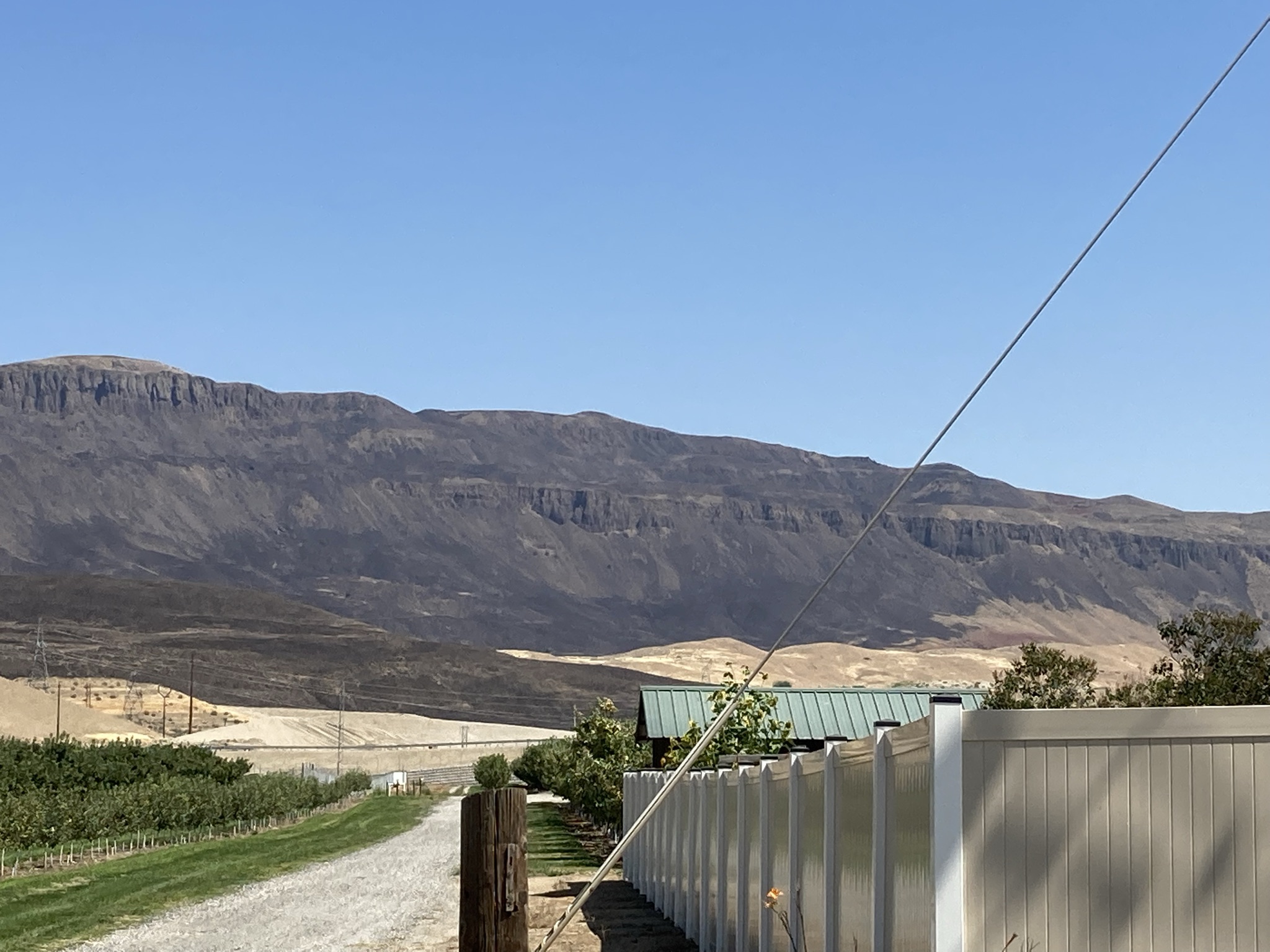
We have now made it to the eastern side of the Sunnyslope area. This photo shows a few of the 12,000+ acres burned by the Red Apple Fire. 

This fire had the potential to cause large amounts of damage due to the neighborhoods it burned very near to, but due to the extraordinary efforts of firefighters, many houses were saved.

Batterman Road Fire:

On my way out of Wenatchee, I quickly stopped to see the burn scar of the Batterman Road Fire, a grass fire that burned 14,000+ acres just outside of East Wenatchee in early July. (Map below, photos taken in blue outlined area).


I was only able to capture a small area of this fire, because most of the burned area is north and east of where I was, and in remote areas with rough terrain and few roads.

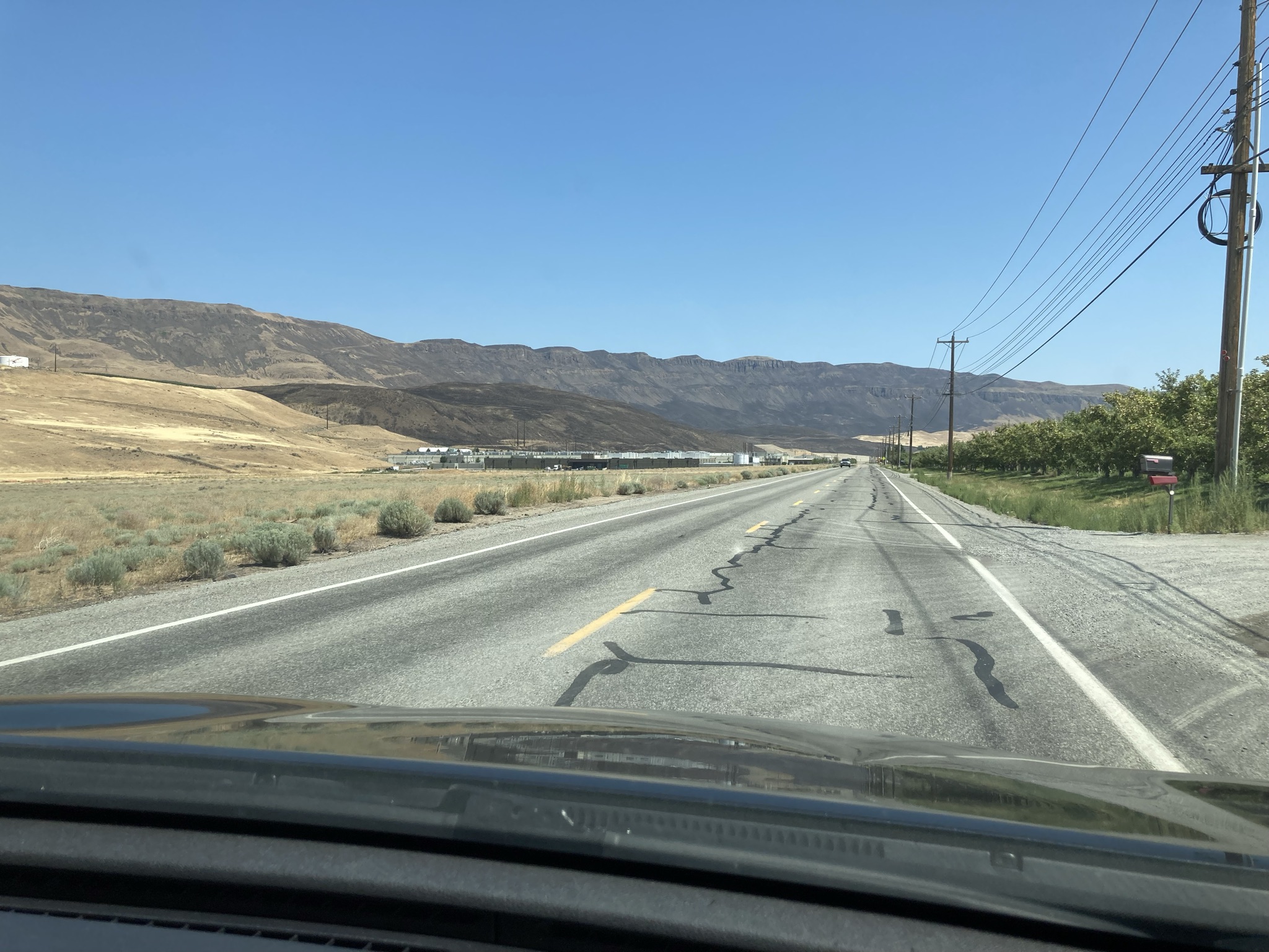
This photo, taken heading east near the Wenatchee Airport (Pangborn Memorial) in East Wenatchee, shows some of the burned area from the Batterman Road Fire, including its close approach to a power substation and a couple warehouses at the bottom of the hill.

This photo shows just how steep some of the terrain was that this fire moved up. It left a stark contrast between the dry grass and dark burned areas.

These areas around Wenatchee that have been burned will be prone to landslides and debris flows (as all burn scars are) when heavy enough rain comes. 

It was interesting to get up close and document areas burned by wildfires, and it was a reminder of the damage wildfires can do if they’re given the chance. Be sure that you’re being smart when using or around fire, and remember…

Image found here.

Friday, July 30, 2021

Heat & Smoke in Western Washington, Big Changes Ahead

Friday was the hottest day of this short heat wave, with many interior locations reaching the low 90s. The Cascade Foothills reached the mid 90s. Portland reached the mid 90s to near 100, and Eastern Washington was scorching at 100-110 degrees! Puget Sound area highs are below.

Perhaps you noticed the haze moving north into our area on Friday. This is a plume of wildfire smoke from fires in California and Oregon. This smoke is higher in the atmosphere and isn’t currently impacting surface air quality, but skies will be quite hazy. Below is the HRRR Smoke model for 7 PM Friday.

A moderately heavy concentration of smoke aloft is over our area. Below is a cross section of the smoke overhead at the same time. (How to read this: Olympics on left, Cascades on right, Seattle area in middle).


Smoke doesn’t reach the surface except in the mountains. 

Heavy smoke aloft is expected to continue through at least Saturday. Below is the forecast for 3 PM Saturday. Some of this smoke may be coming from fires in Eastern Washington and Idaho.


Smoke may not be as visible on Saturday and Sunday due to clouds moving into the area, though hazy skies are to be expected. There's a small chance that some small amounts of smoke may mix down to the surface (air quality to the moderate category).

As noted earlier, clouds are expected Saturday and through midday Sunday. The Weather Underground forecast for Federal Way is below.


Once clouds move away, another hot day is expected on Monday. Bottom line: expect highs of 80-85 degrees each day except Monday, which will be hotter (85-90 degrees). Temperatures will be a bit cooler by the water and warmer in the valleys & foothills. Lows will be in the upper 50s to low 60s area-wide. 

A major change is on the way as well. Take a look at the extended forecast for Federal Way.


You saw that correctly! Rain!!! A system moving in late next week will possibly bring measurable rain showers to our area. More details on this are still evolving, so stay tuned for updates! Let's time it out below...

Below is the UW forecast for rain through 5 PM Monday. In the next few days, monsoonal moisture moving up from the Southwest will bring rain and thunderstorms to Eastern WA & OR and parts of Idaho.


Now for what you've been looking forward to since our last heat wave...the RAIN forecast for Western Washington! This is a long-range forecast and will likely change some, so be aware that amounts here are far from certain.


Wow! The entire state of Washington is forecast to get 0.25-1.5 inches of rain (depending on location) by 5 PM next Friday (August 6th)! Most of the Pacific Northwest will get substantial precipitation, a very welcome change for the region.

Stay tuned for updates about smoke and potential rain!

Wednesday, July 28, 2021

Heat Wave Begins & Large Wildfires in the North Cascades

Wednesday, which ended up being a couple degrees warmer than predicted, was the start of the next heat wave in the Pacific Northwest. Below are Wednesday's high temperatures in the Central Puget Sound area.


Most locations south of Seattle reached the mid-upper 80s, with a few locations east of I-5 hitting 90 degrees. North of Seattle, highs peaked in the low-mid 80s, and in Eastern WA and Portland, temperatures were in the 90s.

Temperatures in the upper 80s to low 90s will become more widespread across the Puget Sound area on Thursday and Friday. Below is the Weather Underground forecast for Federal Way.


Thursday and Friday will likely be the hottest days of July. Highs in the upper 80s to low 90s are likely, a bit cooler near the water and hotter in the valleys & foothills. Additionally, low temperatures of 58-65 degrees are likely from Thursday night to Sunday night.

Temperatures drop to the mid 80s on Saturday, and by Sunday we’re back to the lower 80s. High clouds moving around the periphery of a ridge will keep us cloudy on Sunday and Monday.

Friday will likely be hottest day of this heat wave, with temperatures in the upper 80s to potentially mid 90s across Western Washington. Below is the NWS HeatRisk for Friday.


A moderate to high HeatRisk is likely for Western Washington, highest in the foothills and valleys. 

Besides the heat, a major concern right now is the two large fires burning in the North Cascades. These are the Cedar Creek Fire (35,685 acres, 13% contained) and the Cub Creek 2 Fire (52,832 acres, 18% contained). 

Below is the InciWeb map of these two fires. Cedar Creek is on the left (west of Winthrop) and Cub Creek is on the right (north of Winthrop).


The most concerning aspect of this situation is the eastward spread of the Cedar Creek Fire toward Sun Mountain Lodge and the town of Winthrop. The fire is less than 2 miles from Sun Mountain Lodge, which is evacuated and closed until further notice. The zoomed in map below shows the proximity of the east edge of the Cedar Creek Fire to Sun Mountain Lodge (blue circle) and the town of Winthrop (red oval).


This is an evolving and likely worsening situation, and the weather isn’t expected to help. Temperatures in the 90s, humidity of 15-30%, and winds up to 30 mph are expected in the next few days. The fire will likely continue to spread for the foreseeable future. I'll have updates about this situation in future blogs.

The Cub Creek 2 Fire is having a lesser impact overall, but has burned over 50,000 acres in only 12 days.

The Lodge webcam image below shows the fire actively burning on the far left of the image, disturbingly close to the lodge.

You can stay updated with the latest information regarding these fires by clicking below:

Cedar Creek Fire-InciWeb

Cub Creek 2 Fire-InciWeb

Sun Mountain Lodge Webcam

Stay tuned and stay cool! Potential chances of showers/thunderstorms may exist in the next few days, but more on that in the next blog.

Monday, July 26, 2021

Next Heat Wave Ahead for the Pacific Northwest

After a stretch of mostly comfortable weather, the next “heat wave” is on the way. It will be nothing like the previous heat wave for the Seattle area. However, temperatures of 87-90+ degrees are likely, especially Seattle southward. In Eastern Washington, temperatures of 100-110 degrees are likely, which will only worsen the wildfire and drought situation. Down in Portland, temperatures will reach the mid to upper 90s.

The UW forecast model above shows temperatures at 5 PM Thursday in Western Washington. Upper 80s to low 90s are likely, mainly south of Seattle and away from the water.

In Eastern Washington, temperatures of 100-110 degrees are likely, which will only worsen the wildfire and drought situation. 

First up is the Weather Underground forecast for Federal Way.


Tuesday and Wednesday will begin with marine clouds for some locations, then become sunny. Wednesday through Saturday will be above 85 degrees in most locations, especially away from the water. Thursday and Friday will be the hottest days, with temperatures of 85-87 degrees near the water and 87-93 degrees away from the water and in the valleys. 

In Eastern Washington, another round of extreme heat is in store. Below is the forecast for the Tri-Cities. 


Thursday through Saturday will be the hottest days, with temperatures at or over 105 degrees in the hottest spots in Eastern Washington. This will exacerbate ongoing drought and wildfire concerns. 

One more note…light concentrations of smoke aloft may impact Western Washington over the next few days, especially by Wednesday. No impact to air quality is expected at this time. The HRRR Smoke map below is for 5 PM Wednesday.


Again, the only impact of this smoke for Western WA will be some slight haze high in the atmosphere. Much different story east of the Cascades over the next few days.

Remember, wildfires of concern can be found by clicking below:

InciWeb Incident Management System

Drought information from the US Drought Monitor can be found on the right side of the blog, as can forecasts and current conditions.

Saturday, July 24, 2021

Nationwide Smoke & A Long Stretch of Warm Weather Ahead

Wildfires in Western States are making their presence known across the entire country. Take a look at the HRRR Smoke model below for Saturday morning, showing smoke aloft.


Just incredible. Almost the entire country has smoke overhead. Smoke aloft is particularly heavy over parts of the Midwest & Southeast, along with the West, where the fires are burning.

How much of this smoke is reaching the surface? Let’s take a look at near-surface smoke, also on Saturday morning.


Much less reaching the surface, thankfully. The highest near-surface concentrations are over the West, Midwest, and Southeast. (The heaviest near-surface smoke is in Washington’s Methow Valley, where air quality measurements have reached astounding numbers of 450-1000+).

The staggering impact of the smoke is evident in this webcam image taken on Friday in Chicago, more than 1,500 miles east of the fires.


More reminiscent of a West Coast scene than the Midwest. 

Thankfully, Western Washington will remain smoke-free through at least the next few days, due to predominantly westerly/northwesterly winds that will keep smoke out.

We are also entering into what will likely be an extended period of warmer weather. Below is the forecast for Federal Way from Weather Underground.


Expect mostly sunny weather, with the exception of increased clouds at times from late Monday to Thursday morning. Highs will be in the low-mid 80s with lows in the mid-upper 50s. 

Additionally, our next period of hot temperatures is beginning to take shape next week. High temperatures of 85-90 degrees are possible from Wednesday to  Saturday.

Temperatures over 80 degrees are likely through the start of August.

Our dry streak is currently at 38 days, and with no rain for at least 10 days, reaching 50 straight days without rain seems likely. This will allow drought coverage to continue worsening across the state.

A note about my recent absence from blogging: I took a vacation this past week to Long Beach, WA. It was sunny each day (amazing for the Washington Coast)! I took the photo below from Bell’s View in Cape Disappointment State Park, looking north. You can see the entire 30-mile peninsula and all the way to the Olympic Mountains (nearly 100 miles) on a totally clear day!


Friday, July 16, 2021

All of Washington State Under Drought Coverage

As of Thursday, July 15, all of Washington State is now “officially” impacted by drought.

The latest outlook of the US Drought Monitor shows extreme drought now present in Eastern Washington, as well as an increase in drought coverage in Western Washington, specifically the northern and southern parts of Puget Sound, the NW tip of the Olympic Peninsula, and the southern I-5 Corridor. Another notable addition is that the Cascades are now in “abnormally dry” conditions.


It is only mid-July, and 100% of Washington state is under some kind of drought coverage, compared to only 39% in 2020. With most locations not getting measurable rain on Friday, the dry streak has reached 30 days, with no end in sight (except possibly for the coast, where marine pushes may bring some rain).

Friday was also the coolest day in nearly a month. High temperatures are below.


Most locations reached 65-73 degrees, with some mountain locations staying in the 50s! For most areas, it hasn’t been this “cold” since mid-June. Some areas even received drizzle!

We will gradually warm up over the next few days. That is shown in the Weather Underground forecast for Federal Way.


Temperatures warm to the mid 70s, about average for this time of year. Sunday and Monday are a bit warmer, with highs of 75-80 degrees.

For updated & accurate information regarding active wildfires, click the link below:

InciWeb Incident Management System

You can click on an active fire and view the area burned, fire updates, photos, maps, and more.

Tuesday, July 13, 2021

Cooler Weather Ahead, Dry Streak Likely to Continue

After a stretch of warmer days, with afternoon highs in the 80s, a few cooler days are ahead. These days even include a tiny chance of rain…but it is likely that the dry streak will continue.

The UW 7-day forecast below shows a possibility of rain, but it’s not all that likely.


This forecast gives 0.01-0.1 inches of rain to the Puget Sound area. The best chance of rain is from late Thursday to early Saturday, however even at this time, the NWS forecast shows a chance of rain peaking at a whopping 11%…so it’s not very likely.

It is likely that the dry streak will reach 30 days (on Thursday). Also, July 2017 was the last time Seattle reported 0.0” of rain in a month…at this rate, we’re well on our way to the next completely dry month.

Below is the Weather Underground forecast for Federal Way.


Temperatures decline to the mid 70s on Wednesday, to the low 70s on Thursday, and all-day clouds keep highs potentially below 70. Starting on Saturday, temperatures will warm up to the mid 70s and then to the 80s by Sunday. Similar temperatures, of 75-80 degrees, will continue through next week.

Wildfire Update:

Burbank Fire (I-82 near Selah): 12,000 acres, 80% contained

Lick Creek Fire (formerly Dry Gulch Fire): 58,000 acres, 20% contained

Snake River Complex: 88,600 acres, 0% contained

Bootleg Fire: 201,900 acres, 0% contained (photo below, found here). It is now the largest fire of the year in the US, and major fire growth is expected to continue.


3 new fires in Washington State to watch:

Varden Fire (NW of Winthrop): 1,000 acres, 0% contained, has closed SR-20 until further notice

Chuweah Creek Fire (13 mi. north of Grand Coulee): 10,000 acres, 0% contained, has burned at least 7 structures in Nespelem

Red Apple Fire (between Wenatchee & Cashmere): 1,000 acres, no containment number available, evacuations in place

Due to recent thunderstorms and very dry conditions, expect more fires and fire growth in the northern tier of Washington state. 

Sunday, July 11, 2021

Pacific Northwest Wildfires Explode in Size

In the 3 days since my last blog, wildfires in the Pacific Northwest have exploded in size. This blog will take a look at the 3 biggest fires in the PNW right now. As of 7 PM Sunday, these are the stats:

1. Bootleg Fire: 150,800 acres, 0% contained (Klamath County, OR)

The Bootleg Fire is approximately the size of Chicago (~235 sq. mi.).

2. Snake River Complex: 54,400 acres, 0% contained (Nez Perce County, ID)

The Snake River Complex is approximately twice the size of San Francisco (~46 sq. mi x2).

3. Dry Gulch Fire: 46,350 acres, 20% contained (Asotin & Garfield Counties, WA)

The Dry Gulch Fire is approximately the size of Spokane (~70 sq. mi.).

A large pyrocumulonimbus cloud grows from the Bootleg Fire in South Central Oregon. Image found here.

Let's start with location. Below is the location of the Bootleg Fire from Google Maps.


The fire is 35 mi. NE of Klamath Falls and 85 mi. NE of Medford. The stunning aspect of this fire is the incredible growth in the past 24 hours ending Sunday evening. The fire has grown nearly 74,800 acres in 24 hours. That is similar to the area of Salt Lake City...burned in one day.

The incident commander said in a Saturday news release that, "The fire behavior we are seeing on the Bootleg Fire is among the most extreme you can find and firefighters are seeing conditions they have never seen before."

The smoke plume has been massive, creating pyrocumulonimbus clouds. The satellite image below shows the plume on Saturday evening.

Image found here.

The plume stretched all the way to Idaho...across half of the state of Oregon, over 200 miles.

Now to the Snake River Complex, on the Washington/Oregon-Idaho border. Its location is below.


This fire is comprised of the Shovel Creek and Hoover Ridge fires, burning a total of 54,400 acres in west central Idaho. It is likely 0% contained. The image below shows the fire burning along the Snake River.

Image found here.

The next fire is just 25 miles NW of the Snake River Complex. The location of the Dry Gulch Fire and Silcott Fire (now contained) is below.


As of Sunday evening, the fire was reported to have burned 46,350 acres and is 20% contained, progress from recent days containment-wise. The fire is reported to be started by a lightning strike. A photo of the fire burning over rolling hills of vulnerable grasses is below.

Image found here.

Weather conditions at all three fires will continue to fuel fire growth over the next few days, making it hard for fire crews to gain ground on these massive fires.

Additionally, a new fire called the Burbank Creek Fire is burning just off I-82 north of Yakima. The approximate location of the fire is below.


The fire started on Saturday, and as of Sunday evening it is reported to have burned approximately 7,000 acres and be 50% contained. This is significant considering it started roughly 24 hours ago. Below are 2 photos of the burned area taken by Gunner Hicks from I-82 Westbound on Sunday afternoon.


One of the most striking things about these fires burning across the Pacific Northwest is the fact that it is still early July, quite early for major wildfires. Additionally, there are 300 fires actively burning in British Columbia. 

The good news is that for now, Western Washington will NOT have to deal with wildfire smoke due to predominantly easterly winds (the situation is not as nice for our friends in Eastern WA/OR, ID, and parts of MT). Updates on the smoke situation will be provided if necessary.

A dangerous and likely destructive wildfire season is off to an early start, and large fires will likely continue to burn across the West through the fall.

Stay tuned.

Short Spring Heat Wave for the Pacific Northwest

  FastCast--Thursday, May 9 to Tuesday, May 14: A spring "heat wave" is ahead for the Northwest, with the warmest temperatures see...