Today is turning out to be a beautiful Memorial Day around Western Washington! Below are temperatures at 4:15 PM.

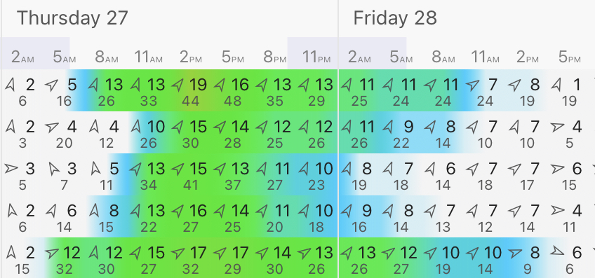
Below is the forecast for Puyallup from Weather Underground.

Wow! Temperatures on Tuesday and Wednesday will likely reach the mid to upper 80s across the Puget Sound area, warmest in the valleys & foothills. Temperatures decrease through the rest of the week, with a chance of rain returning by the weekend.
Below is the UW forecast for temperatures across Washington at 4 PM Wednesday...the warmest day of the week.

Most of the state is warm...except the coast, where cooler air will be slowly moving in. It’ll be downright hot in the Columbia Basin, with highs of 100-105 degrees possible in the Tri-Cities. Records will be broken there.
On an even broader scale, the Western US will be under the familiar summer “heat dome” pattern (although it isn’t summer just yet). Below is the UW forecast showing the major upper air high pressure ridge causing the unseasonably hot late spring temperatures.

You can see how the ridge completely dominates the West, especially California, where temperatures are skyrocketing into the triple digits today.

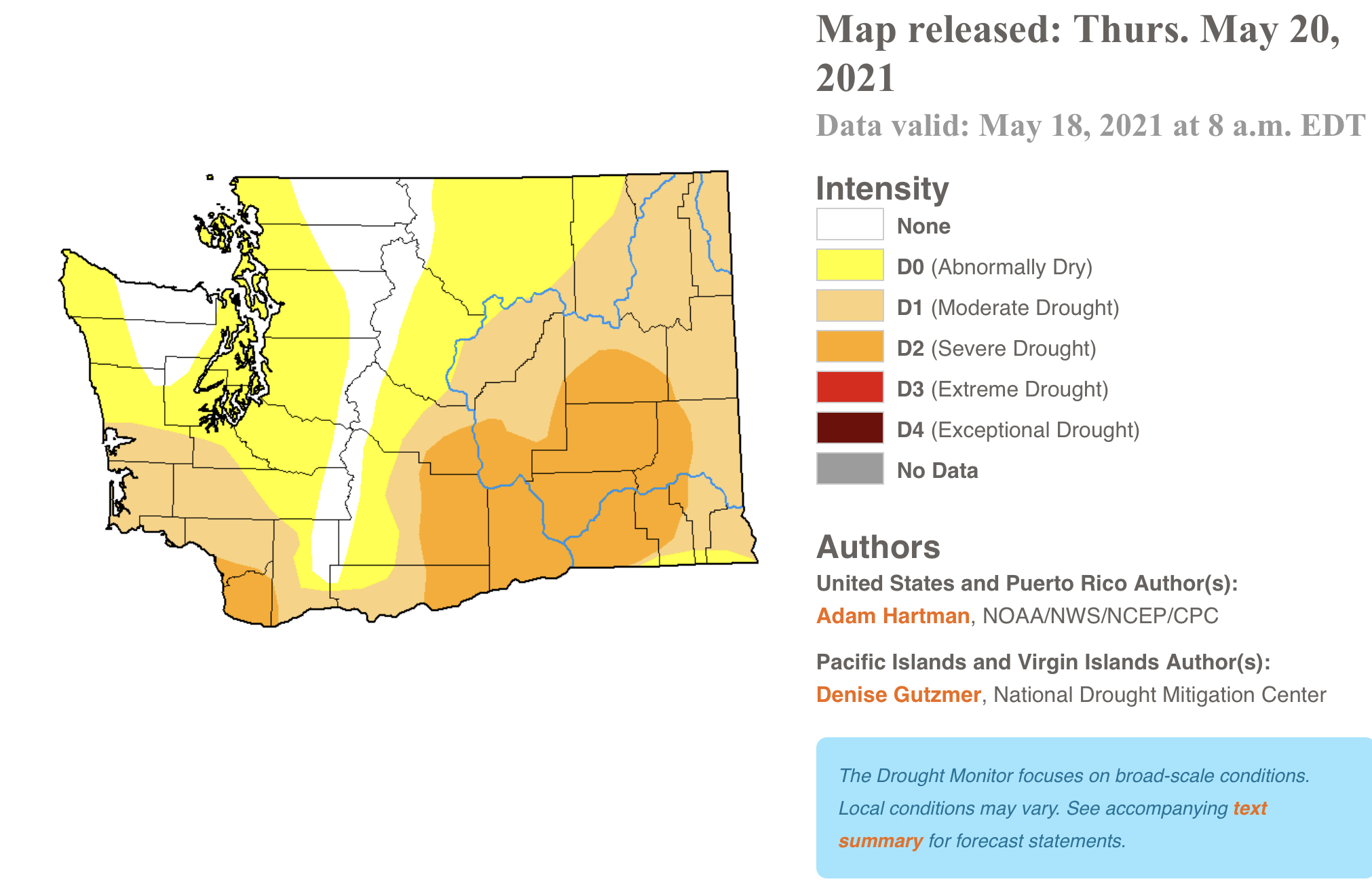
More 100+ degree temperatures will be observed across parts of the Western US in the coming days. This will continue to make the drought situation worse, including in Washington, where I expect drought coverage to continue increasing. Stay tuned.
Enjoy the sun! Our warmest temperatures so far in 2021 are likely on Tuesday and Wednesday.