Monday, January 29, 2024

Warmth Continues, Next Round of Rain & Cooler Temperatures Ahead

 FastCast--Tuesday, Jan. 30 to Saturday, Feb. 3:

Record high temperatures have occurred across the Pacific Northwest over the past couple days, as the region lies in the warm sector to the south of an atmospheric river impacting British Columbia. This has brought highs in the upper 50s to mid 60s to Western Washington, something that will continue over the next couple days. On Tuesday, expect mostly cloudy conditions with highs in the upper 50s to low 60s, lows in the upper 40s to low 50s, and a chance of morning showers. Rain is expected across the region from Wednesday to Thursday, totaling around 0.25-0.75", more north of Seattle. On Wednesday and Thursday, expect highs in the mid to upper 50s, with lows in the mid 40s to low 50s. Rain will taper off by midday Thursday, and a dry start to February is expected. Friday will be partly cloudy, with highs in the low 50s and lows in the low 40s. Saturday will also be partly cloudy, with temperatures dropping further to highs in the mid to upper 40s and lows in the mid 30s. In the mountains, expect snow levels to remain above 6,000 feet through Wednesday night, before dropping to 3,000 feet by Friday. However, little (if any) snow will fall at the passes.

---------------------------------------------------------

Continue reading the full blog below!

An unseasonably warm few days will continue for the Pacific Northwest, as the region is stuck in the warm sector to the south of a strong atmospheric river impacting British Columbia. Let's take a look at the forecast!

First, the European model forecast for highs on Tuesday, seen below.


This forecast shows highs in Western Washington in the upper 50s to low 60s, with the coast reaching similar temperatures, and the Willamette Valley/Oregon Coast reaching the upper 50s to mid 60s. Eastern Washington reaches the low 40s to mid 50s, warmest in the Palouse region.

Let's compare this to the NAM high-resolution forecast for highs on Tuesday, seen below.


This forecast is much warmer, showing Western Washington reaching the upper 50s to mid 60s, warmest around Bellingham and from Seattle to Olympia, especially in SE King County and E. Pierce County, due to downsloping SE winds. This forecast shows highs in the mid 50s to mid 60s for Western Oregon, and highs in the mid 40s to mid 50s in Eastern WA (again, warmest in the Palouse region).

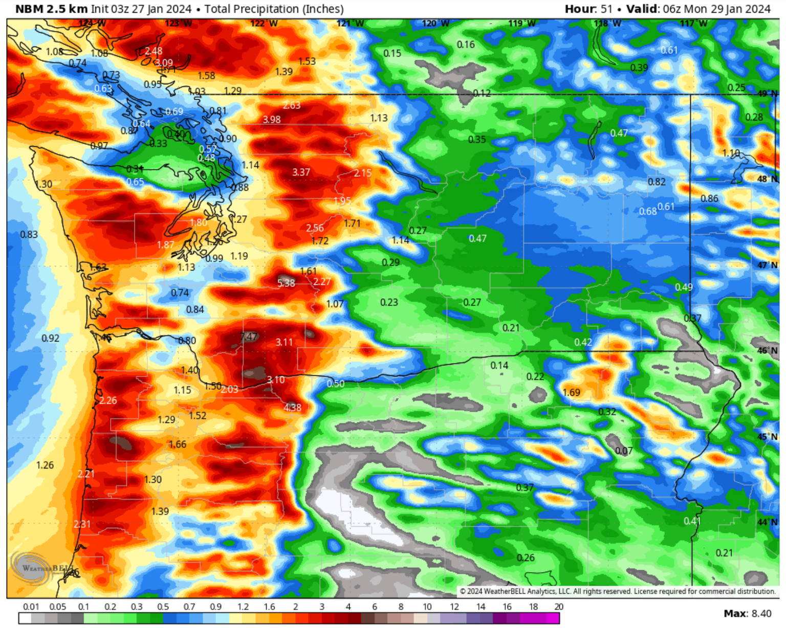
The next round of rain is also ahead for the region. There is a chance of showers from late Monday night into Tuesday morning, but most of the rain will fall from Wednesday morning to early Thursday morning. 

Below is the European model forecast for total rain through Thursday.


This forecast shows 2 rain shadows in the lowlands, a broad area of 0.1-0.2" of rain from Everett to the Canadian border, and an area of 0.15-0.25" of rain from Olympia to Enumclaw. The rest of the lowlands should pick up 0.25-0.5", except up to 0.8" on the Kitsap Peninsula. The coast will receive 0.5-1.25", most north of Ocean Shores. Expect 0.75-1.25" in the Cascades and 2-3" in the Olympics, with 0.05-0.3" in Eastern WA (more possible in mountains).

Let's compare this to the GFS forecast, also showing total rain through Thursday, seen below.


This shows a mostly similar forecast, with a rain shadow from Port Angeles to Skagit County (0.15-0.25" in this area). The remainder of the lowlands will receive 0.3-0.6" in this forecast, except up to 1" on the Kitsap Peninsula. The coast will get 0.5-1", except 0.3-0.4" south of Ocean Shores. This forecast shows 0.1-0.4" for most of Eastern WA, except up to 0.6-0.9" for the eastern slopes of the Cascades. Additionally, this forecast shows 0.5-1.5" in the Cascades and 2-4" in the Olympics.

Finally, let's take a look at the upcoming temperature drop, as we slowly return to seasonable temperatures across the region.

Below is the European Ensemble forecast for highs and lows in Seattle.


Expect relative warmth to continue through Thursday, before highs plummet to the 40s to low 50s, with lows dropping to the mid 30s by the weekend.

Let's also take a look at the forecast for temperatures in Spokane, seen below.


This forecast shows "warmer" temperatures continuing through midweek, before dropping off by the weekend. Lows will remain in the 30s for the duration of this forecast.

Enjoy the spring-like warmth through Thursday, as we won't encounter similar temperatures for awhile!

Friday, January 26, 2024

Atmospheric River Update: Heavy Rain & Balmy Temperatures

No FastCast tonight…continue reading below for an update on the atmospheric river and upcoming abnormally warm temperatures.

Let’s start tonight’s update by taking a look at the rain forecasts, starting with the European model forecast for rain through late Sunday night.


Through Sunday night, expect 1.2-2” of rain for the lowlands, with less (0.8-0.9”) around Whidbey Island. The coast will receive 2-3”, with 2.5-4” in the mountains. Eastern Washington will receive 0.3-0.75”.

To see the reason for this heavy rain, below is the European Ensemble forecast for precipitable water (amount of water vapor in the atmosphere) on Saturday evening.


Notice the large area of moisture stretching from Hawaii to the Northwest, a true “Pineapple Express.” This is the atmospheric river that will bring our heavy rain and associated balmy temperatures.

Now, let’s take a look at the GFS forecast for total rain through Sunday night, seen below.


This forecast shows 1.4-2” for the lowlands, up to 3” for the Kitsap Peninsula and Hood Canal area, and only 0.2-0.7” NE of the Olympic Peninsula in the typical rain shadow area. Additionally, expect 2-3” on the coast and 2-5” in the mountains. Eastern Washington gets 0.15-0.6” in this forecast. 

Now, here is a look at the National Weather Service’s National Blend of Models (NBM) high-resolution forecast for rain through Sunday night.


This high-resolution forecast is a combination of all forecast models, and is run by the NWS. This shows 1-1.5” in the lowlands, 1.3-2” on the coast, and 2-6” in the mountains. Eastern WA gets 0.2-0.8” in this forecast.

Let’s take a look at the flooding forecast from the NWS Advanced Hydrologic Prediction Service


Expect the Skokomish River in Mason County to reach moderate flood stage, with the Grays River in Wahkiakum County reaching minor flood stage. The Snoqualmie/Snohomish, Nooksack, White, Chehalis, Green, Naches, Cowlitz, and Bogachiel Rivers will reach bankfull, with other rivers rising but not reaching bankfull. Most rivers will crest on Sunday.

A contributing factor to the rises on rivers will be a prolonged elevation of snow levels. Expect snow levels to remain at 6,500-8,000 feet from Friday night to Wednesday. 

Now, let’s switch gears and look at upcoming temperatures. Atmospheric rivers bring strong (and moist) S-SW flow from Hawaii, which will bring a surge in temperatures for the entire region.

Below is the European model forecast for highs on Sunday.


In the lowlands, expect highs reaching the upper 50s to low 60s, with some areas south of Seattle reaching the mid 60s. The Willamette Valley and Oregon coast will be quite toasty, with highs in the low to mid 60s, and some areas from Salem southward reaching the upper 60s. The WA coast will reach the upper 50s, and Eastern Washington will reach the mid 40s to low 50s.

Next, let’s look at Monday’s highs, also from the European models, seen below.


Monday will be another warm day, with highs in the upper 50s to mid 60s for the entirety of Washington and Oregon west of the Cascades. Eastern WA will be up to the mid 40s to upper 50s. 

Also, note that highs in the mountains will reach the low to mid 40s, contributing to the very high snow levels.

Another way of visualizing these temperatures is looking at the temperature anomaly. Below is the European model forecast for temperature anomaly (departure from average) on Sunday afternoon.


West of the Cascades, these temperatures will be 10-20º above average, with temperatures 5-10º above average east of the Cascades (up to 20º above average for Eastern Oregon). Safe to say that this atmospheric river and its strong S-SW flow will make it feel like “spring”, if only for a couple days.

Stay tuned for more information (and stay dry)!

Thursday, January 25, 2024

Significant Atmospheric River to End January

FastCast—Friday, Jan. 26 to Monday, Jan. 29:

The end of January will be punctuated by a significant atmospheric river will bring 2-3” of rain to the lowlands through late Monday. The heaviest rain will fall from late Friday to early Sunday, with standing water and ponding expected across the region. Additionally, moist subtropical flow due to the atmospheric river will bring very warm temperatures for January, with highs from Saturday to Monday reaching the upper 50s to low 60s, with isolated areas reaching the mid 60s on Sunday and Monday. Friday will only be in the upper 40s to low 50s. Expect lows in the mid to upper 40s. Another potential cause for concern is massive rises in snow levels in the Cascades and Olympics. On Friday, snow levels will hover around 4,000 feet, but by Saturday, they will have skyrocketed to 7,000-8,000 feet. It appears likely that snow levels will remain at 6,000+ feet through the middle of next week. During this time, the Cascades will receive 3-5” of rain, with 4-6” in the Olympics.

——————————————————————

Continue reading the full blog below!

A significant atmospheric river is expected to impact the Pacific Northwest over the next few days, with the heaviest rain impacting the region from late Friday night through early Sunday (longer in BC). This atmospheric river will bring heavy rain, potential urban and river flooding, and abnormally warm temperatures to the region.

Below is the European model ensemble forecast showing precipitable water late Friday night.


Precipitable water is a measure of the amount of moisture in the atmosphere, which shows atmospheric rivers. Note the huge area of moisture that extends from Hawaii to the Pacific Northwest, which is where the term “Pineapple Express” originates from. 

This atmospheric river will impact Western Washington from Friday to early Sunday, with areas of showers continuing through Monday and Tuesday. Let’s take a look at the total rain forecasts.

First, the forecast for total rain through late Monday night from the European model.


This forecast shows 1.5-2.75” of rain across the lowlands through Monday night, except 0.8-1.5” in a rain shadow to the NE of the Olympic Peninsula. On the coast, expect 3.5-4.5”, with the Cascades getting 3-6” and the Olympics getting 4-6”. Areas from Shelton northward along the Kitsap Peninsula will get 2.5-3.5”. Even Eastern Washington will be getting rain with this system, with 0.2-0.5” expected.

Now, let’s compare this to the GFS forecast, also showing total rain through Monday night.


This forecast is generally less rainy than the European, with more rain for areas Portland southward. However, it shows 1-2” of rain for the lowlands, except 0.2-0.8” in a very notable rain shadow NE of the Olympic Peninsula. The coast gets 2-3”, with 3-6” in the mountains. Eastern Washington gets 0.2-0.5”, except up to 0.75” from Grand Coulee to Spokane.

Another impact of this atmospheric river will be abnormally warm temperatures due to strong S-SW flow. Below is the European model forecast for highs on Monday.


This forecast shows highs west of the Cascades reaching the upper 50s to low 60s. Even the mountains themselves will reach the mid 30s to low 40s, with most of Eastern Washington reaching the low 40s to low 50s. 

Finally, let’s take a look at the NWS Advanced Hydrologic Prediction Service forecast for potential river flooding.


As of the writing of this blog, forecasts aren’t showing this atmospheric river as a widespread river flooding event. The Skokomish River in Mason County will likely reach moderate flood stage, with the Snoqualmie/Snohomish, White, Nooksack, Chehalis, Cowlitz, and Grays Rivers reaching bankfull stage. Even if a river doesn’t reach bankfull, every river will rise due to this storm. Stay tuned for updates as this forecast can change. 

Since this is an atmospheric river situation, and some uncertainty remains as to rain totals and their impacts, I will have another update on Friday night. Stay tuned!

Tuesday, January 23, 2024

Consistent Wet Pattern Continues

FastCast—Wednesday, Jan. 24 to Friday, Jan. 26:

Consistent rain will continue across the Northwest through the end of this week. Even heavier rain is ahead over the weekend and into the final week of January. Across the lowlands, expect 0.5-1.25” of rain, with the potential for less rain over the North Sound due to a rain shadow. Most rain will fall from early Wednesday to late Thursday, with a break on Friday, before rain starts again Friday evening, continuing through the weekend. Through Friday, expect highs in the upper 40s to low 50s, with lows in the low to mid 40s. In the mountains, snow levels will remain between 4,000 and 4,500 feet, before rising rapidly late Friday night. Stevens and White Passes will receive up to 5-8” of snow through Friday. 

————————————————————

Continue reading the full blog below!

A rainy pattern will continue across the region after a nice break in the rain on Tuesday. Systems will move through from Wednesday to Thursday and then from Friday into the weekend. Let’s take a look at the forecast!

First, the European model forecast for total rain through Friday night.


Expect 0.75-1.25” of rain for the lowlands and Willamette Valley, with some areas, mainly from Port Angeles to Everett, getting 0.4-0.6” of rain due to the rain shadow. The coast will get 1-2”, and Eastern Washington will get 0.15-0.4”. 

Let’s compare this to the GFS forecast through Friday night, seen below.


This forecast shows a more expansive rain shadow, mainly from Everett to Bellingham (0.3-0.5”), with the rest of the lowlands getting 0.6-0.9” of rain. The coast will get 1-2”, with Eastern WA getting 0.1-0.35”.

Now, let’s take a look at the snow forecast from the European model through Friday evening.


This forecast shows 8-12” at Stevens and White Passes through Friday, with less likely at Snoqualmie Pass as snow levels hover near or above pass level. Some lower elevations of Eastern Washington (mainly on the east slopes of the Cascades) could receive 1-3” of snow.

Let’s compare this to the GFS forecast for snow through Friday night, seen below.


This forecast also shows 8-12” at Stevens and White Passes, with potential for 0.5-3” of snow north of I-90 and along the east slopes of the Cascades.

Finally, let’s take a look at the potential rain through the end of January. Below is a graphic comparing the European Ensemble (left) and GFS Ensemble (right), showing total rain through the evening of January 31st.


These forecast shows that the lowlands could receive 3-5” through the end of the month, with up to 5” in the Willamette Valley, and 0.5-1.5” in Eastern Washington and Oregon. The WA & OR coasts will be slammed with 5-8” of rain through the end of the month (isolated higher totals are possible).

Additionally, forecasts predict snow levels likely rising to 7,000-8,000 feet for the Olympics and Cascades, and remaining there for multiple days. This could bring flooding impacts across the region, so stay tuned over the next few days for more information.  

Saturday, January 20, 2024

Very Rainy Week Ahead for the Pacific Northwest

FastCast—Sunday, Jan. 21 to Friday, Jan. 26:

After a prolonged arctic outbreak brought frigid temperatures to the Pacific Northwest, the pattern has changed, and a wet and somewhat warmer pattern has replaced it. Continual systems will bring rounds of rain to the lowlands through this week, with a couple breaks in the rain on Tuesday and Thursday. Through Friday, the lowlands will receive 2-2.5” of rain, with a rain shadow bringing less from Everett to Port Angeles. Expect highs to reach the upper 40s to low 50s across the lowlands each day. This will be a change from the past few weeks, and as a part of that change, snow levels will increase to 4,000-5,000 feet in the mountains. This will bring up to 12-18” of snow to Stevens and White Passes, and higher ski and recreation areas will receive as much as 24-36”.

———————————————————

Continue reading the full blog below!

A rainy week is in store for Western Washington, with multiple systems bringing rounds of rain to the region, with snowfall for the higher passes and ski areas. Let’s take a look at the forecast.

First, the European model forecast for total rain through Friday night.


This forecast shows the lowlands receiving 2-2.5” of rain, except less in a rain shadow along the northern Olympic Peninsula. The coast will receive 3.5-5” through Friday, with Eastern Washington receiving 0.4-1”, more closer to the Cascades. Expect areas from Shelton to Bremerton to receive 2.5-3.5”.

Let’s compare this to the American (GFS) model, also showing total rain through Friday night.


This forecast shows 1.5-2.5” of rain in the lowlands, with a very pronounced rain shadow along the northern Olympic Peninsula. The coast will receive 3-5”, with Eastern WA receiving 0.5-1.25”, except 0.3-0.4” in the Columbia Basin.

This may seem like a lot of rain over one week, but that is because of multiple systems that will move through. Generally, expect steady rounds of rain from Sunday to Monday, from Wednesday to early Thursday, and from Friday into next weekend.

Next, let’s take a look at the forecast from the European model showing total snow through Friday.


This is a bit of a difficult forecast for the passes, since snow levels will likely remain at 4,000-5,000 feet. Areas over those levels will likely receive 1-2 feet of snow, except some areas like Paradise and Crystal Mountain, which could receive up to 3 feet. Some parts of Eastern Washington will receive 2-4” of snow, mainly Ellensburg and Wenatchee. Spokane will get up to 0.5”.

Finally, let’s take a look at the temperature forecast for the Seattle metro area, shown below on the European model ensemble forecast.


Expect highs to reach the upper 40s to low 50s, with lows rising to the upper 30s to low 40s. These temperatures are significantly warmer than last week, and are more seasonable for January.

Stay tuned for more information about the continuing wet & active pattern.

Thursday, January 18, 2024

Winter Weather Moves Out of Western Washington

 FastCast--Friday, Jan. 19 to Monday, Jan. 22:

After a week-long round of winter weather conditions across most areas west of the Cascades, winter weather is nearly done in Western Washington. Areas of freezing rain are still expected in the Cascades, gaps, and foothills through the weekend, as cold air works its way out of the region. Up to 0.5" of ice is possible in these areas (see below for forecast). Parts of Eastern Washington will continue to see snow and freezing rain, and gap winds will continue for some parts of the foothills. In the lowlands, expect temperatures to return to more typical January norms. On Friday, expect mostly cloudy and drier conditions, with highs in the low to mid 40s and lows in the mid 30s. The foothills may drop below freezing, bringing a potential for icy conditions. Precipitation will move out of the area entirely by midday Friday. Showers are possible late Saturday through Sunday, with the next system slated to move into the area by Monday. Through Monday, expect lowland highs in the mid to upper 40s, with lows in the mid to upper 30s.

---------------------------------------------------------------------------

Continue reading the full blog below!

Winter weather is slowly departing Western Washington, but impacts are still expected over the next couple days. Let's take a look at what to expect.

Below is the European model forecast for freezing rain through early Saturday.


This forecast shows 0.1-0.25" of freezing rain in the Cascades, with isolated areas getting up to 0.5". The Portland area could get an additional 0.1-0.4" of ice, especially near the Columbia River Gorge. Areas in the southern half of Eastern WA could get up to 0.1" of freezing rain, mainly on Friday morning.

Snow is also expected for parts of the region through Saturday morning. Below is the HRRR high-resolution forecast.


Expect an additional 4-6" of snow at the passes through Saturday. Eastern Washington will get 1-4" of additional snow, with the most from I-90 southward.

If you are driving across the passes, remember that you will encounter freezing rain on the west side, then snow on the east side. Prepare & drive accordingly, as these hazards can create difficult driving conditions.

With low pressure offshore, gusty gap winds have been blowing for most of Thursday, and will continue through Friday. Below is the HRRR forecast for peak gusts through late Friday.


This forecast shows easterly gusts in the foothills (from Enumclaw to Gold Bar) of 40-50 mph, with lowland areas from Federal Way northward gusting 20-30 mph. Areas of stronger offshore winds will be found along the coast and Strait (gusts 35-45 mph possible).

Rain will continue through early Friday morning for the metro area, clearing the region entirely by midday Friday. Below is the HRRR forecast for rain from Thursday evening to midday Friday.


Expect an additional 0.2-0.4" for the metro area through Friday, with up to 0.6" from Olympia to the coast. The northern coast could get up to 1" of rain through Friday.

Finally, here's a look at forecasted low temperatures on Friday morning from the European model.


This forecast shows lows in the mid 30s, with most areas dropping as low as 32-33°. This means temperatures will be very marginal for re-freezing and ice formation in the lowlands. The foothills will drop to the upper 20s to low 30s, bringing a higher chance of black ice and slick roads. Be aware on Friday morning!

It's been a crazy few days of weather across the region. Extended forecasts show the region returning to a typical January pattern, but the potential for more active weather through the next few weeks remains. Stay tuned!

Wednesday, January 17, 2024

Next Storm Bringing Potential Winter Weather Across Western WA

Another storm is ahead for the region, bringing more potential winter weather impacts, including freezing rain, snow, and rain. Let's take a look at the forecast.

(School impacts: KOMO News School Delays/Closures Page)

Note on freezing rain: If freezing rain does fall, it will likely start between 6 and 9 AM Thursday morning, earlier in the lowlands, and later in the foothills/passes.

We'll start with the European model forecast for freezing rain on Thursday, seen below.


This forecast shows freezing rain mostly relegated to the Cascade foothills (0.1-0.3"), with up to 0.05-0.1" from Seattle/Bellevue northward to Bellingham. 

Let's compare this to the NAM high-resolution forecast, which shows temperatures slightly cooler to start, bringing a hugely different freezing rain forecast.


This forecast, with slightly colder temperatures, shows 0.2-0.5" of ice from Tacoma to Everett, with up to 1" in the foothills and on the Kitsap Peninsula, and even 0.2-0.5" at the passes. This also shows up to 0.2" of ice near Bellingham.

This solution is much less likely, but is still a slight possibility.

Next, let's take a look at temperatures as precipitation begins on Thursday morning.


The NAM (left) has temperatures of 29-32° from Tacoma to Everett, and around Bellingham, while the European (right) has temperatures of 32-34° from Tacoma to Everett, and in the mid to upper 20s in Whatcom County. This will be a situation where a couple degrees' difference is all it will take to bring rain or freezing rain. 

Additionally, there have been reports of areas (including Federal Way and Bothell) where it is quite icy despite temperatures being above freezing. This means it doesn't need to be sub-freezing to cause icy conditions. 

Next, let's take a look at the snow forecast, starting with the European model.


The European model forecast shows up to 8-12" at the passes through Friday, with a potential for a trace to 0.25" from Snohomish County northward, plus a dusting to 1" in the foothills and along the Strait.

Let's compare this to the NAM forecast, seen below, showing snow through Friday.


With a slightly colder and more dynamic system, the NAM shows a band of 1-3" of snow from Bellingham south to Marysville, including the San Juans. This forecast also shows 8-12" at the passes, with a trace to 3" along Hood Canal and in the foothills (mainly around North Bend), plus a dusting to 1" along the western Strait.

Finally, a look at expected rain through Friday, first from the European model, seen below.


This forecast shows 0.5-0.75" of rain in the lowlands, except a rain shadow around Everett (0.35-0.45"). The coast will get 0.8-1.2", with up to 0.9" around Olympia.

Here's the comparison from the NAM high-resolution forecast, seen below.


The NAM shows 0.6-1.2" for the lowlands from Everett southward, with 0.4-0.8" from Everett northward. The Kitsap Peninsula and Olympia area get 1.5-2" in this forecast, with 1.5-2.5" on the coast.

This is a difficult-to-forecast system ahead, with marginal differences in temperatures bringing vastly different conditions, especially in regards to freezing rain. Remember to stay alert and be careful outside!

Tuesday, January 16, 2024

Live Updates: Potential Ice Storm, Localized Snowstorm for Pacific Northwest

Live Updates on the freezing rain and snow situation across the Northwest:

This blog post will be updated hourly with new information, so stay tuned!

11:15 PM--Final Update: The band of precipitation that has brought areas of accumulating freezing rain is moving north, and will exit the metro area over the next hour. Snow is beginning in Whatcom County and SW BC, and will continue there through tomorrow. Below is a look at snow for the entire state through Wednesday night, with the NAM high-resolution forecast on the left and the European model forecast on the right.


The NAM forecast shows 0.5-1" of snow from Everett northward to Mount Vernon, with 2-3" in Skagit County and along the Strait, and 6-10" for Whatcom County. The NAM also shows 12-24" for the passes and 2-8" for most of Eastern Washington (6-8" for Spokane). The European model, meanwhile, shows 1-2" for Skagit County, 4-8" for Whatcom County, 1-2" on the Strait, and none from Marysville southward. The passes get 10-24" in the European model forecast, with Eastern WA getting 3-10", with 0.5-1" for the Columbia Basin and 7-9" for Spokane.

One more note: As a low pressure system moves in to our south, additional precipitation is possible overnight. The European model forecast for precipitation at 3 AM Wednesday is below.


Notice more freezing rain across portions of the metro area early Wednesday morning, with pockets of normal rain near sea level and snow in Whatcom County. 

If freezing rain accumulates will all depend on temperature and the temperatures of roads. Areas with freezing rain on roads tonight could still have freezing rain on roads on Wednesday morning. 

Stay updated on school closings and delays here: KOMO News School Delays Page

------------------------------------------------------------------------

9:00 PM: Conditions vary across the region, with most areas from Federal Way and Auburn northward to SeaTac reporting freezing rain sticking to trees and trash cans, etc., but not roads. Areas including Olympia, Lake Tapps, and parts of Bonney Lake report freezing rain sticking to roads. 

Temperatures across the region are very marginal. However, note how a slight difference in temperatures (30° in Olympia vs. 32° in Federal Way & SeaTac) can bring much different effects for freezing rain.


------------------------------------------------------

7:40 PM: Rain is now falling at my house in Federal Way, and since rain began, temperatures dropped from 33.3° to 31.5°. Additionally, relative humidity rose as the atmosphere moistened quickly. It may be difficult to tell if rain or freezing rain is falling, as they look the same. Freezing rain will immediately freeze upon contact with surfaces. 

Note: forecasts did not have freezing rain starting to accumulate until 8-9 PM across the metro area. Some areas may start as rain, then change to freezing rain. Stay tuned

-------------------------------------------------------

6:40 PM: Freezing rain has turned I-5 near Kelso into a sheet of ice, as seen in the WSDOT camera image below.


Freezing rain is currently falling from the Centralia/Chehalis area southward, although not causing much of an impact around Centralia/Chehalis yet.

Below is a look at temperatures at 6:40 PM.


Most of the region is between 31 and 34 degrees, except some areas, mainly around Seattle, in the 35-37° range. Temperatures will likely go down a few degrees as precipitation begins.

Freezing rain is still expected to start between 7 and 8 PM for Tacoma and Olympia, and 8 to 9 PM for Seattle. Next update by 7:30 PM.

---------------------------------------------------

5:30 PM: Freezing rain is now impacting the Portland metro area, with the edge of the precipitation now between Kelso and Chehalis. Below is the radar image as of 5:10 PM (red is freezing rain).


Freezing rain is starting to coat streets in the Portland metro area, as seen in the ODOT image below in downtown Portland.


In addition to previous snow and ice pellets, the roads are getting covered by freezing rain.

Finally, here is a look at the latest forecast for total freezing rain from the European model (left) and American GFS model (right).


The European model (left) shows 0.1-0.2” of ice for areas Seattle south, with pockets of 0.05-0.1”. For areas from Seattle to Mount Vernon, the European model shows 0.2-0.5”. The American GFS model shows 0.1-0.25” for the entire region, with the most for areas Seattle eastward to North Bend. 

Next update by 6:30 PM. Stay tuned.

——————————————————————

4:00 PM: Freezing rain is now being reported as far north as Aurora, Oregon, which is 20 miles south of Portland. 

Although the radar map below shows precipitation north of Portland, it is falling into very dry air, so the air must be saturated before precipitation reaches the ground. So, basically, just because there is precipitation over an area on radar doesn't mean it is reaching the ground yet.


Areas where freezing rain has been falling for a few hours are already seeing impacts. Below is a ODOT TripCheck traffic camera image near Coburg, just north of Eugene, showing a vehicle in a ditch due to ice.


Stay tuned for the next update between 5:00 and 5:30 PM.

----------------------------------------------

2:10 PM: Precipitation is currently moving northward through the Willamette Valley. Freezing rain is falling and causing traffic issues in Eugene, with light snow being reported in Corvallis. 


This is about on-par with where the European model forecast showed precipitation at 2 PM, seen below.


This forecast has been correct with precipitation timing, temperatures, and (mostly) with precipitation type, except on the Oregon Coast, where some areas of freezing rain are currently falling.

Based on this forecast, freezing rain reaches...

Salem within the next hour

Portland from 3-4 PM

Olympia from 6-7 PM

Tacoma from 7-8 PM

Seattle from 7-8 PM (with pockets near the Sound with normal rain)

Everett from 9-10 PM

Precipitation reaches Whatcom County by 10-11 PM, but will fall as snow.

Stay tuned for the next update around 3 PM.

Short Spring Heat Wave for the Pacific Northwest

  FastCast--Thursday, May 9 to Tuesday, May 14: A spring "heat wave" is ahead for the Northwest, with the warmest temperatures see...