Wednesday, September 30, 2020

Smoke Aloft Impacting Western Washington

If you looked outside this morning, you saw hazy skies. That is smoke from California fires impacting Western Washington. Thankfully, this smoke is aloft, or not near the surface.

According to forecasts, smoke will likely settle some in the next day or two. Additionally, the overall pattern looks favorable for this California smoke to continue impacting our area through the next few days.

This smoke made its way in Tuesday night. You can see the boundary between the smoke aloft and the clear skies in this photo I took at sunset on Tuesday.


Now (Wednesday morning), that smoke is covering our skies with haze. Let's take a look at the HRRR Smoke forecast model data to see what we can expect.

Here is the vertically integrated smoke (smoke in a column of the atmosphere) at 9 AM Wednesday.


Almost the entire state of Washington is covered by this smoke. You can see the upper level smoke starting to wrap clockwise around a high pressure area in Central Oregon. The smoke is quite thick from Northern California all the way into British Columbia.

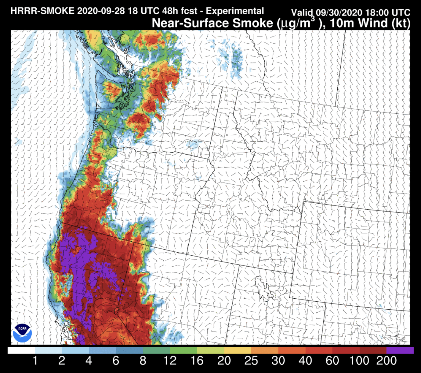
Here is the near-surface smoke at the same time (9 AM Wednesday).


You'll notice very thick near-surface smoke in Northern California, with smoke concentrations increasing in Western Oregon, the Cascades & Olympics, and in Western Washington.

Here is one more view, a smoke cross section for 9 AM Wednesday. The mountains on the left are the Olympics, then Puget Sound in the middle, and the Cascade mountains on the right.


This is the best view of the smoke. You can see the thick smoke aloft above the entire area. Notice how smoke is thickening some in the Puget Sound area. That is expected to continue through Wednesday. 

Here is 5 PM Wednesday. 


Smoke aloft is still heavy across the area. Low-level smoke is still impacting Puget Sound. The smoke aloft will slowly move out through Thursday, but another wave of California smoke will be pushing north. 

Expect that low-level smoke to continue through at least Thursday, as it will be harder to clear than the upper-level smoke.

Now let's talk air quality. Here is Puyallup's 9 AM reading.


Currently in the "moderate" category. This means that if you are extremely sensitive to smoke, you should not be outside. Everyone else is good to go. Expect air quality to stay in the moderate category through Wednesday. Some places could see it move to "unhealthy for sensitive groups" but that all depends on how much smoke settles to the ground.

This smoke event is not expected to be like our massive smoke event 2 weeks ago. This smoke will be more of a nuisance than a major problem.

Monday, September 28, 2020

Wildfire Smoke Returning to Western Washington

Wildfire smoke is returning to Western Washington. Smoke from California wildfires will be impacting the area from Tuesday night through at least Wednesday night. 

I’m sure you have images of the last smoke event in your head. However, current forecasts show that this upcoming event will be different. Smoke is coming from farther away (Northern California) instead of from Oregon, like last time. Because the smoke is from farther away, it will not be as low to the ground and therefore will not impact air quality as much.

This will be the kind of smoke that gives the air a bit of haze, but doesn’t significantly impact air quality. Expect some reddish sunsets as well.


Let’s take a look at the Monday afternoon satellite image. I have outlined the California smoke that will eventually impact our area.

A thermal trough will allow for winds to blow smoke north from California. This will also aid in pushing temperatures to 75-80 degrees from Wednesday-Friday.

Let’s take a look at the smoke forecast. These forecasts are from the NOAA HRRR Smoke model, showing vertically integrated smoke, or smoke in a vertical column of the atmosphere, not near the surface.

Here is 11 AM Tuesday.


Smoke has not reached Western Washington yet.

Here is 7 PM Tuesday. 


Heavy smoke over parts of Western Washington, but not on the surface. The sunset will be quite tinted.

By 11 PM Tuesday, heavy smoke aloft (upper-air) will cover most of Western WA.


Near surface smoke at this time will be confined to higher elevations. 

Here is 5 AM Wednesday. 


Smoke aloft is somewhat lighter over Western WA, but still very present.

Finally, here is 11 AM Wednesday. 


More of the same through Wednesday. This is the furthest extent of the forecast at this point.

Let’s shift gears and look at the near-surface smoke forecast. Here is the forecast for 11 AM Wednesday.


You’ll probably notice this smoke, but it will be nothing like a couple weeks ago. Expect only a small impact to air quality at this time.

Notice the color key on the bottom and the color over Western WA. The green is low-moderate smoke. (For comparison, we were in red/purple a couple weeks ago which is very heavy). 

The Puget Sound Clean Air Agency forecast discussion talks about the air quality situation going forward.


Air quality reaching moderate won’t have an impact on being outside unless you’re extremely sensitive to degraded air quality. 

The fact that this smoke is from California is what’s keeping us from having another widespread dangerous smoke event.

Stay tuned for updates on the smoke situation, and keep those in Northern California in your prayers.

Sunday, September 27, 2020

Large High Pressure Ridge Bringing Warm Temperatures

 After a week of rainy weather, a large ridge of high pressure is bringing sunny skies and warming temperatures to Western Washington.

First, let's take a look at total precipitation from 9/18 to 9/27.


The majority of the area receives 1.5-4.0 inches, with higher totals near the mountains and in areas impacted by strong showers.

Now...rain is behind us, and beautiful fall weather is here!

A massive ridge of high pressure is over the Western US right now.


This forecast model shows 11 AM Monday. Wow! That is a very dominant ridge! Sometimes, you can feel the high atmospheric pressure in the air. Common symptoms of high pressure are headaches.

One way of measuring atmospheric pressure is inches (inHg). Normal atmospheric pressure is 29.90" to 30.20". On Sunday, pressure in Puyallup was 30.38"-30.45" all day. High pressure up to 30.50" (high for our area). Here is a graph showing pressure all week.


Notice the large pressure change between the 25th and today (Sunday). Pressure dropped to 29.68" as a strong front moved through, and in the next 48 hours it rose to 30.45", peaking on Sunday morning. A big change of 0.77 inches! (Quite high for our area).

Now that we got a crash course in our recent atmospheric pressure changes, let's talk about the warm temperatures coming to the area. 

High temperatures of 75-80 degrees are likely this week. Having temperatures this warm at this time of year is quite rare.

Here is the 10-day forecast for Puyallup from weather.com.


Wow!! Warm temperatures with highs 75-80 degrees all of this week! This will make for some beautiful fall weather! A cooldown begins by next Sunday (Oct. 4th). 

Thursday, September 24, 2020

More Rain, Gusty Winds on Friday

Another rainy day is likely on Friday, with gusty winds likely as well. Here’s a short update.

Up to an inch of rain is likely through Friday, with the heaviest rain on Friday morning. The UW model’s 48 hour precipitation total is 0.3-0.7 inches of rain for the South Sound. More is definitely possible, with a more likely estimate being 0.5-1.2 inches.


By Friday afternoon, rain will turn to scattered showers and will be less widespread. Showers could linger through Saturday.

To go along with Friday morning’s heavy rain, winds gusting 20-45 mph are likely as well. A fast-moving frontal system impacting our area tomorrow is responsible for these winds.

Here is the Euro model’s wind gust forecast for Puyallup at 11 AM Friday.


Expect winds to increase early in the morning (4-6 AM), peaking from 8 AM-12 PM. Winds will gradually decrease throughout the afternoon.

It’ll likely be a stormy commute for most people on Friday morning. Winds will peak with gusts of 35-45 mph. Be prepared for tree damage and localized power outages, since this storm is still early in the season.

Wednesday, September 23, 2020

Wednesday Night Update

Wednesday has been a rainy day across Western Washington! Many areas have received over 1 inch of rain since 12 AM Wednesday. Daily rain totals have been 0.8-1.2 inches across the area.

More rain is expected Thursday through Saturday, with another 0.5-2.5 inches possible. Here is the UW Model rain forecast from Wednesday night through Saturday morning.


Wow! Looks like it’ll be quite wet across the area for the next few days. 

In addition, thunderstorms are possible on Thursday. Rain will be more showery on Thursday, rather than steady rain like Wednesday.  This will promote more convection, or development of strong showers/possible thunderstorms on Thursday. Here is forecast instability (CAPE Instability Index) on Thursday at 12 PM. 


Values of 200-500 CAPE across Western Washington. This will support a chance of thunderstorms, so be prepared and take caution!

The final aspect of this multi-way storm system will be gusty winds. Expect winds gusting 20-35 mph Thursday-Saturday. 

On Friday morning, a fast-moving and small low pressure center will move onto Vancouver Island. There is a chance that in its wake there could be a few hours of winds gusting 30-40 mph. This is only a chance, so don’t take it as something that is going to happen. 

Tuesday, September 22, 2020

Short Storm Update

The first autumn storm of the season will begin impacting our area early Wednesday.

Here’s the main points:
  • Rain will start on the coast Tuesday night, and it will start in the Puget Sound area early Wednesday morning
  • Expect high rainfall rates, totaling 1-2 inches by the end of the day Wednesday
  • The heaviest rain is likely Wednesday afternoon, and due to the heavy rain, localized street flooding is possible
  • Winds will gust 20-40 mph from Wednesday morning through at least Saturday
  • Power outages are possible due to this storm being early in the season
  • Additional rain totals of 0.5-1.0 inches are likely on Thursday and Friday, along with a chance of thunderstorms on these days
  • Storm totals of 1-4 inches are likely
Here is a graphic from NWS Seattle showing the impacts on Wednesday. (Click to enlarge).


For a more extended view, here is the forecast for Puyallup (including daily rain totals) from Wednesday to Saturday. This can be found on Weather Underground by searching Puyallup. 

This adds up to 3.33 inches through Saturday. That’s a lot of rain! This total will probably fluctuate, but expecting 1-4 inches of rain is a good assumption to make.

You might be wondering if this rain will cause river flooding. For this storm, river flooding is not expected. This is because rivers are still at relatively low summer levels. This storm will increase the levels but will not cause flooding. This would be a different story if we had a storm like this in a few months.

However, due to the easterly windstorm on Sept. 7-8, there is lots of debris in area storm drains. Because of this, localized urban & street flooding is possible. Take precautions on area roadways, as standing water can be hazardous.

Be safe & be prepared for impacts from this first storm of the season!

Monday, September 21, 2020

First Storm of the Season To Bring 1-4 Inches of Rain, Gusty Winds

The “first day of fall” is technically September 22nd, but the first full day of fall is September 23rd (Wednesday). This year, fall will waste no time getting started. 

The first storm of the season will impact our area on the first day of fall. The primary impact of this storm will be rain. Our area will receive 0.5-3.0 inches of rain through Saturday. Here is a graphic from NWS Seattle showing what to expect.


This outlines the main points of what’s coming. The heaviest rain and gustiest winds will be on Wednesday. Light rain could start Tuesday night, then increase on Wednesday. More rain and showers will be likely through Saturday.

Here is the UW model showing moisture in the atmosphere on Wednesday at 8 AM.


Reds and blues are high values of moisture. More moisture=more rain. This will be our first storm of the season.

Here is the forecast precipitation between 5 AM Tuesday and 5 AM Thursday. 


Expect 0.64-2.56 inches of rain during this time. The most likely outcomes are 0.8-1.5 inches of rain on Wednesday and 0.5-1.0 inches on Thursday. Additional rain on Friday and possibly Saturday is likely. Due to the possibility of high rain rates and subsequently blocked storm drains, urban flooding is possible. Be prepared!

On a broader scope...here is the total precipitation between Monday the 21st and Monday the 28th.


Wow...this will catch us up on rain and give us assurance in the reservoirs. The Puget Sound area gets 1-5 total inches of rain, with up to 5-20 inches in the mountains. It will sure feel like fall!!

Regarding winds...gusts of 20-40 mph are likely between Wednesday and Saturday. There is a chance of power outages since it is still early in the season.

There is also a chance of thunderstorms on Thursday as instability will be present with this weather system. While this is not likely, the window of opportunity is there.

Temperatures will reach the low 60s from Wednesday-Friday, with a highs a bit for the weekend.

The next few days will sure feel like fall!

Saturday, September 19, 2020

Clean Air Returns, First Storm of the Season Likely Midweek

The air is clean!! Puyallup’s 8 PM air quality reading & forecast shows the best AQI in over a week! 


It is now safe for everyone to be outside! If you went outside today, the air felt clean! The AQI forecast shows clean air lasting for the foreseeable future! Hopefully this is the last time for awhile that you will see air quality in the blog.

This month has flown by. Fire weather/smoke was first mentioned in the blog on September 2nd. After over 2 weeks, the fire weather and smoke event is finally over! Now, our attention turns to our first autumn storm of the season!

Here is the UW model showing moisture in the atmosphere at 11 AM Wednesday.

Reds and blues indicate more moisture in the atmosphere. See the current of moisture aimed at us? That is the upcoming atmospheric river event.

It’s literally what it sounds like. A river of moisture (rain) will set up and aim right at the Pacific Northwest. In winter, we call this a Pineapple Express (as air comes from the area of Hawaii). 

Now what you probably want to know...how much rain will we get?

The consensus among the forecast models gives our area 1-4 inches of rain and winds gusting 30-40 mph between Wednesday (23rd) and Friday (26th). Forecasts aren’t certain on exact storm track, timing, and impacts.

I will have this information in future blog posts. For now, be prepared for a typical autumn storm that will give us plentiful rainfall and send us in to a likely stormier fall/winter.

Enjoy the clean air!!

Friday, September 18, 2020

Air Quality Improving, Localized Heavy Rain & Thunderstorms

 Friday started smoky, but thanks to rain and marine air mixing in, air quality has dropped to the"moderate" category!! This is great news! Here is Puyallup's 9 PM reading and forecast. (Note: "today" is Friday, and that 100+ level is not expected again.)


Major improvement! In the moderate category, everyone can go outside, and the only people who need to stay inside are those who are unusually sensitive to slightly degraded air quality. By Sunday, "good" air quality is likely for the first time in over a week!

Air quality is improving because clean marine air is mixing down to the surface, in turn scouring out smoke and dramatically improving air quality. Increased marine air will help to bring AQI back to "good" levels over the weekend!

A little look back at our air quality journey. AQI got to "unhealthy" (150-200) last Friday. It was at "very unhealthy" (201-300) from Saturday to Tuesday, with a peak at "hazardous" (306) on Sunday night. AQI went back to "unhealthy" (150-200) from Wednesday-Thursday, before coming all the way from 145 to 77 today! Major improvement, but as you can tell, it took time. Now go and enjoy that clean air!!

Another good thing...it rained today! Here is a map of 24 hour rain totals (9 PM Thurs. to 9 PM Fri.).


Most areas receive 0.05-0.30 inches of rain, but you'll notice a whopping 1.0-1.4 inches in Federal Way. 

A storm cell with 20+ lightning strikes and very heavy rain moved very slowly over Federal Way from 6:15-7:45 PM tonight, resulting in over 1 inch of rain. Just to show how localized this is, Puyallup had 0.05 inches of rain, while Federal Way received over 1.25 inches. That's a 1.2 inch difference over just 10 miles!

Some scattered showers are still moving NE slowly through the Sound tonight. Saturday will feature scattered showers throughout the area and temperatures 65-70 degrees. Partly sunny weather with highs 65-70 degrees will prevail through Tuesday of next week. After that, a stronger storm system with widespread rain and breezy conditions will move in, likely impacting the area from the 23rd-26th.

The European model (via windy.com) forecasts a whopping 3.79 inches of rain in Puyallup during the next 10 days. The majority of this happens from the 23rd on.


At this time, forecasts are trending 1.5-4.0 inches of rain next week. This is still very far out forecast-wise, but be prepared for a lot of rain. Confidence is increasing that this will be our first autumn storm of the year!

Thursday, September 17, 2020

Chance of Rain & Thunderstorms, Smoke Improvement In Sight!

Thursday makes it 7 days of "unhealthy" air quality. That is a very long time to have degraded AQI in Western Washington. Thankfully, a chance of rain and shifting winds will bring improvement to the smoke situation through Friday and into the weekend, along with rain and a chance of thunderstorms.

Let's break it down. Here is the Air Quality Alert, which has been extended until 10 AM Saturday.


It is likely that we will see some kind of impact from smoke through Saturday. Below is Puyallup's 6 PM air quality reading and forecast.


We are out of the "unhealthy" category!!! We are now in "unhealthy for sensitive groups," an improvement from yesterday! From late Thursday through Friday, we will likely hover in the 110 (unhealthy for sensitive groups) to 160 (unhealthy) range. However, air quality is improving! This is a good trend that is likely to continue through the next few days, as the AQI forecast indicates.

Now let's look at the current near surface smoke situation. Here is 11 PM Thursday.


Smoke is still thick in the interior of Western Washington late Thursday night. This will keep air quality in the "unhealthy for sensitive groups" category through midday Friday.

However...look at 11 PM Friday. Wow!!


Barely any smoke in Western Washington! That is a sight that many of us in Western Washington will be happy to see! I still expect there to be some lingering smoke through Saturday morning, but there will be big improvement by the end of the weekend! As indicated in the AQI forecast earlier, air quality in the "good" category is likely by Sunday!

This is because winds that have been blowing from the south (bringing smoke) will shift to coming from the southwest (bringing cool and clean marine air). This will be a very welcome change!

Now...let's talk rain and thunderstorms. The NWS Storm Prediction Center (SPC) shows a risk of general thunderstorms over Western Washington, with a marginal and slight risk of severe thunderstorms over the Oregon Cascades, parts of the Willamette Valley, and South Central Washington. There is even a 2% tornado threat over the Oregon Cascades...that's very rare for the PNW...but I don't expect a big chance that tornadoes will form.

At 9 PM Thursday, thunderstorms have been moving up the Oregon Coast Range, with no impact to our area yet.

However, instability does exist over Western Washington and that will remain in place through Friday. There is a chance of thunderstorms in our area through the day Friday.

Let's take a look at the precipitation forecast from the UW WRF model. It looks likely that the best chance for rain in the Puget Sound area is from 5 AM Friday-5 AM Saturday.


The forecast shows that during this time, South/Central Puget Sound gets 0.15-0.50 inches of rain. Some places will get more, some will get less. Rain will end by Saturday, and dry but cool conditions, with highs 65-72 degrees will prevail from Saturday through the middle of next week.

By the second half of next week, a more widespread rain event is likely. Current forecasts indicate that our area will receive 0.50-3.0 inches of rain through the next 10 days. Stay tuned.

Bottom line: Smoke improvement is slowly beginning, 0.15-0.50 inches of rain is likely through Saturday, and there is a chance of thunderstorms through Friday.

Wednesday, September 16, 2020

Another Smoky Day Thursday, Rain & Thunderstorms Possible

Wednesday was another day of "unhealthy" air quality and very smoky conditions. In the satellite image below, you can see how thick the smoke was over Washington, thicker than the past couple days due to winds bringing more Oregon smoke.


It sure isn't fun to see all that smoke. Here is Puyallup's 7 PM Wednesday AQI reading & forecast.


AQI is "unhealthy" and will likely remain that way through Thursday. Improvement begins Thursday night and Friday, with AQI likely returning to "good" by the weekend! This is great news!

Before we get to rain, I want to show you an air quality graph from the Washington State Department of Ecology.


The graph above shows total unhealthy, very unhealthy, and hazardous air quality days from 2015-2020 across Washington. You’ll notice that 2018 was by far the worst AQI year in this period, with by far the most unhealthy and very unhealthy days. However, look at how large the hazardous category is in 2020. While other years have had overall worse AQI, 2020 has had a huge amount of hazardous air quality. This shows how “fire weather conditions” can differ from year to year, and that every year is different.

Let's talk about rain...it is coming, and I’m as excited as you are!! There is also a chance of thunderstorms Thursday night and Friday morning, going along with the rain.

Below is the UW WRF model, showing rain from 5 AM Thursday to 5 AM Saturday.


The forecast shows that our area gets 0.32-1.28 inches of rain! Expect most of the rain to be late Thursday into Friday. This will help to improve the air quality and squelch the smoke. Remember, rain will help clear the smoke, but marine air on Saturday and Sunday will be the real difference-maker. 

Back to rain...here is the 7-day rain forecast. 


This runs from Wednesday (16th) to next Wednesday (23rd). It shows a major 5-10 inch soaking of Vancouver Island, up to 5 inches on the WA coast, and up to 1.2 inches here in the lowlands. I’d expect this to fluctuate some, but it is likely that we will have over a half inch of rain through the next week.

Earlier, I mentioned the chance of thunderstorms Thursday night-Friday morning. The NWS Storm Prediction Center (SPC) has a risk of thunderstorms over all of our area, with a marginal risk of severe storms over parts of Oregon.


Let’s take a look at forecast models showing CAPE (instability, or Convective Available Potential Energy). 

Here’s 8 PM Thursday.


CAPE values of 200-600 over Puget Sound, with 1000+ over the coast, Cascades, and SW Washington/NW Oregon. This definitely supports thunderstorms. Expect storms to move north, typical for thunderstorm events in Western Washington.

Here’s 5 AM Friday. 


Still 100-400 CAPE around the area. Some forecasts are favoring thunderstorms in Puget Sound on Friday during the day, from 9 AM-5 PM. Don’t rule this out. The UW satellite simulation, below, shows a thunderstorm (circled in red) over Puget Sound at 3 PM Friday.


Instability is likely from Thursday night through Friday night, so don’t be surprised to hear a rumble of thunder or see some lightning. Remember to take safety precautions during thunderstorms.

Here’s a graphic from NWS Seattle showing some smoke safety and weather information.


Here’s the bottom line: Expect smoke to last through Thursday with some improvement, with major improvement by the weekend. Rain is likely and thunderstorms are possible from Thursday night through the day Friday.

Short Spring Heat Wave for the Pacific Northwest

  FastCast--Thursday, May 9 to Tuesday, May 14: A spring "heat wave" is ahead for the Northwest, with the warmest temperatures see...