It has been a windy and smoky 36 hours across the South Sound. Here’s the rundown/key points as of 2 PM Tuesday:
- As of 2:30 PM Tuesday, PSE reports 58K customers in the dark
- This is down from the peak of 86K around 10 AM
- Multiple wildfires/brush fires are burning around the South Sound
- Multiple homes in Bonney Lake have been evacuated due to a fire in that area
- Winds have generally subsided but are still gusting 20-30 mph at times
- It is very dry, with humidity under 20% which contributes to dangerous fire weather
- High temperatures of 80-95 degrees will also contribute to fire weather
- Smoke and generally unhealthy air quality will remain through at least tomorrow
This morning, a few school districts in the South Sound cancelled remote learning due to strong winds and power outages. Very rare for September.
Winds last night gusted 30-50 mph across the South Sound, but the high amount of power outages is due to the fact that trees are still fully loaded with leaves. In some areas, power substations have been impacted and fires have made power restoration difficult.
Here is the outage map as of 2:30 PM Tuesday:
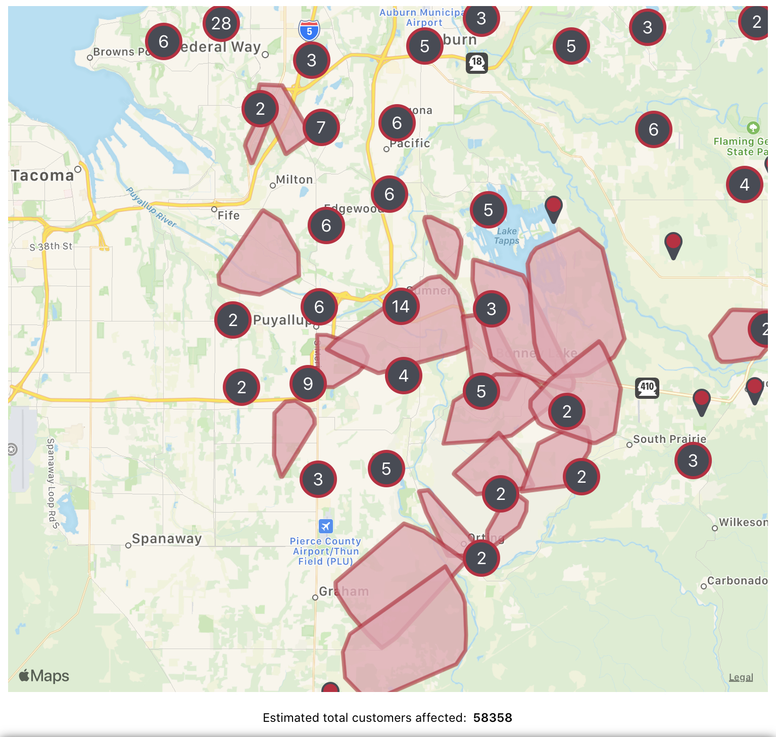
PSE’s customers out has dropped under 60,000, but you will notice large areas of Bonney Lake, Puyallup, Orting, Graham, and Sumner have no power as of 2:30 PM.
Here’s the forecast moving forward: Winds will turn more northerly as we move through the day. This will hopefully push some of the smoke out. Winds will be sustained 10-20 mph, with gusts 20-35 mph through the night. Forecast models are picking up on winds gusting 25-35 mph around midnight. Regardless, any winds will result in rapid fire spread.
Winds will likely shift back to coming through the gaps by tomorrow morning, which will likely bring in more smoke tomorrow morning.
Below is a map of current humidity (2:30 PM Tuesday).

These are incredibly low humidity values. “Normal” in Western Washington is 40-60% on a day like today. In addition, dew points are below freezing around most of the area.
There is also a chance of record high temperatures on Wednesday and Thursday, as winds will decrease and allow temperatures to increase to the upper 80s-low 90s in the South Sound. Again...conditions that will help fires spread.
Finally, here is the air quality map. Air quality in the Puget Sound area is currently moderate, with some areas worse. Parts of north and eastern WA are dealing with even worse air quality.
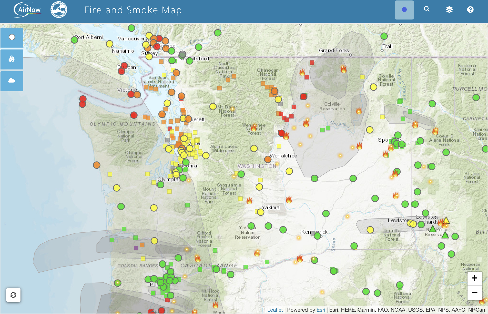
In addition, an Air Quality Alert is in effect until Wednesday morning. You can find the alert below.

The Red Flag Warning is still in effect until 11 PM Thursday.
It is incredibly important to be very mindful of anything you are doing outside that could cause a spark. As we have seen around the South Sound, fires will spread fast with just a small spark.
As I am finishing this blog post, winds are occasionally gusting 20-30 mph. It’ll be calm for a few minutes, then gusty for a few. Even though the winds have generally subsided, it is still important to stay cautious and safe.

No comments:
Post a Comment