No FastCast tonight...continue reading the full blog below!
The combination of an incoming upper-level low and the current heat wave (among other factors) will bring a widespread chance of thunderstorms on Monday. Let's take a look at the details!
Thunderstorms will form along the Cascades, and will move west into the lowlands from approximately 4 PM onward, continuing at times into the night. Remember that any storm will contain lightning, gusty winds, and potential hail and heavy rain. Precipitation will be spotty because these storms will be high-based (causing precipitation to evaporate before reaching the ground).
Let’s start with the forecast for instability (CAPE Index) from the UW WRF forecast for around 7 PM Monday.
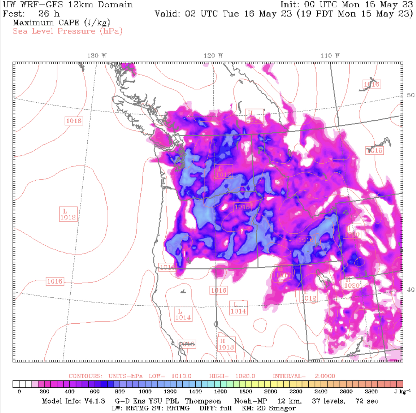
Notice CAPE values of 800-1600 around the lowlands and parts of Eastern Washington and Oregon.
Let’s examine another CAPE forecast, this time from the NAM high-resolution model.

The NAM also shows high CAPE around the region, with values of 500-2000 in the lowlands. Notice the area of high instability to the west of Olympia, where there will be a boundary between warmer air and the marine push, which could increase convection.
Another way to see where there’s a chance of thunderstorms is to look at simulated satellite images. First, let’s look at the HRRR forecast for Monday evening.

Notice the thunderstorms moving off the Cascades. This will be most likely from around 4 PM onward.
A similar prediction can be seen on the NAM forecast below, for Monday evening.

The NAM shows thunderstorms being a bit more widespread. Just a note…the colors on these maps show the temperatures at the top of the clouds, with colder temperatures (noted on the legend at the bottom) representing stronger storms.
To be clear…these are just predictions, and the actual places that thunderstorms develop will be determined in real-time on radar. Be sure to monitor the sky, and go indoors if you hear thunder or see lightning.
One of the key factors in producing a great environment for thunderstorms on Monday will be the continuing heat wave. Below is the NAM forecast for high temperatures on Monday.

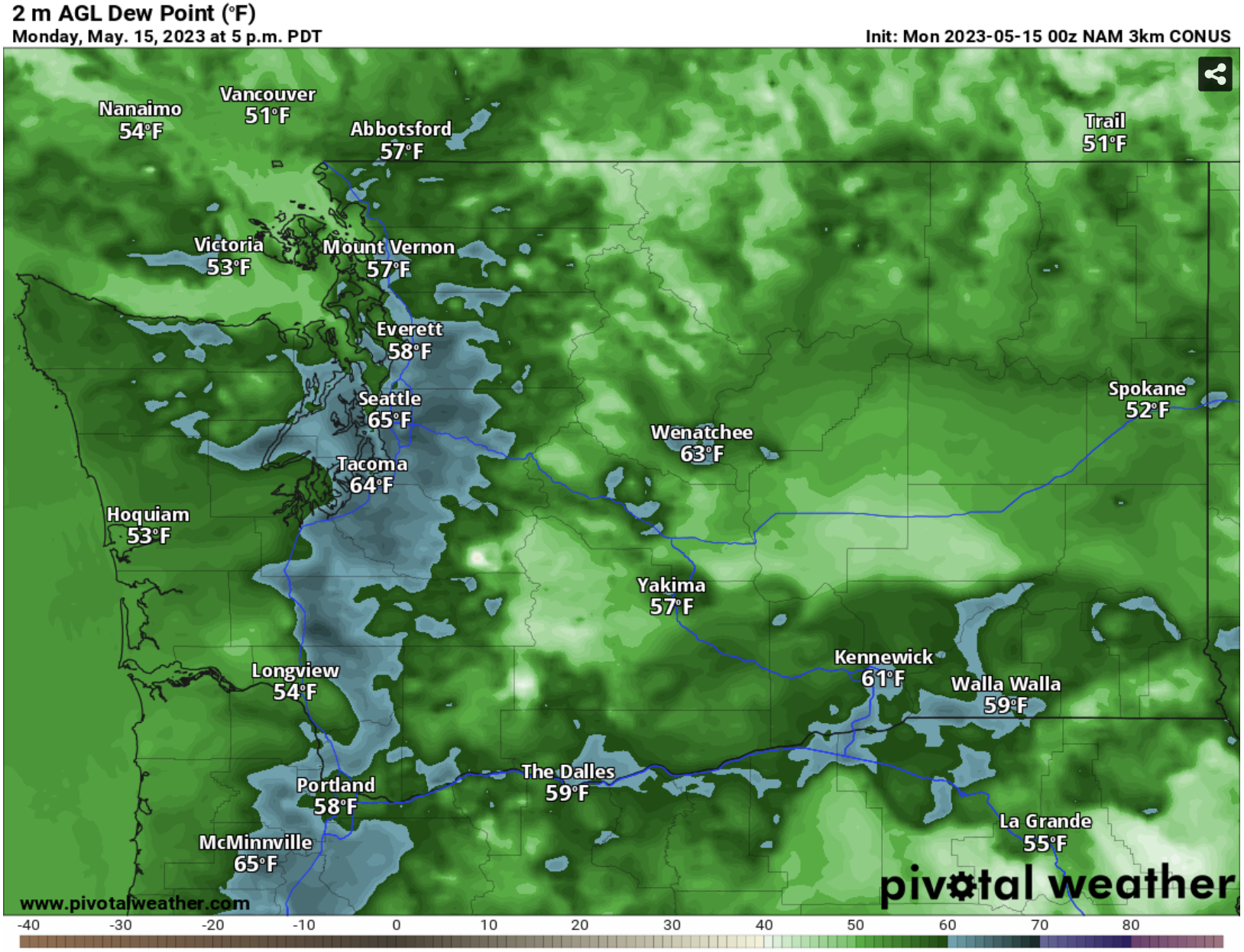
Notice dewpoints in the low to mid 60s in the lowlands. This is not normal for May, and it will contribute to destabilizing the atmosphere, preparing the environment for thunderstorms.


Thank you for the updates. They are helpful.
ReplyDelete