Why is it so muggy? 2 reasons...warm temperatures (in the 70s around most of the area), and high relative humidity & dew points. The muggy weather will fuel a chance of thunderstorms this afternoon and evening. Let’s examine the details and why it’s so muggy today.
Relative humidity (measure of moisture in the atmosphere) is quite high for midday in Western Washington. Take a look at this map showing current humidity.


Wow...humidity between 55 and 75 percent...at mid-afternoon. This is pretty rare for Western Washington, to have values like this at this time of day. Normally, we would have 30-50%.
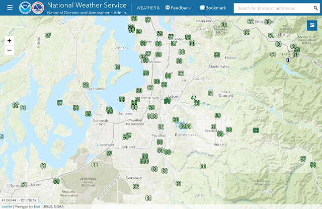
Higher humidity leads to higher dew points, and in turn more “mugginess.” Here’s a map showing current dew points at 3:30 PM. Normal dew points on an average day at this time are around 45°.

Whoa! Look at that! Dew points of 55-65 degrees, with some isolated spots higher or lower. This is why it feels so muggy. You’d expect to see these kind of numbers in the Midwest rather than the PNW.
This muggy atmosphere and warm temperatures will fuel some instability through the afternoon and evening. The HRRR forecast model shows CAPE (instability) values of 200-800 j/kg. That is decent instability for our area.

I would expect the highest chance of thunderstorms to be near the mountains and foothills between 3 and 8 PM. Isolated storms in the lowlands wouldn’t be out of the question, though!
Some storms could contain dangerous lightning, heavy rain, gusty winds, and possibly some hail. Best to be prepared and go indoors for at least 30 minutes after hearing thunder.

No comments:
Post a Comment