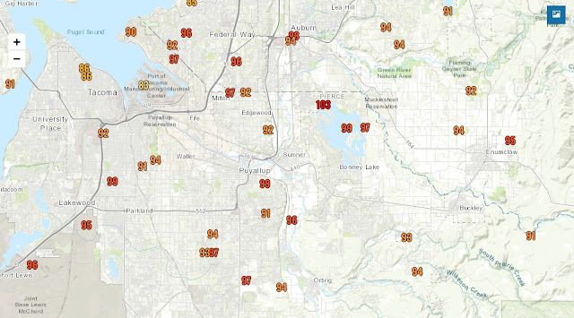
Monday was the hottest day in over a year, and the hottest of 2020 by far. Take a look at maximum high temperatures around the area on Monday. Nearly all values above 90 degrees. Whew! What a scorcher!
We had a significant cooldown today (Tuesday), with many places 5-15 degrees cooler than yesterday. This graph shows the temperature change over 24 hours.
Highs today were 80-85 degrees. While temperatures in the 80s isn’t “cool” for us, it’s noticeably cooler than the mid 90s.
However...heat isn’t done with us yet. Wednesday and Thursday will feature heat building again in Western Washington. Highs will be 83-89 on Wednesday and 87-95 on Thursday. Hot yet again...
Don’t worry...relief (sort of) is on the way after this. Take a look at the weather.com forecast for Puyallup. Hot for the next 2 days, then somewhat cooler.
“Cooldown” only offers one day below 80 degrees. However, these are near-normal temperatures for our area around this time of year.
If you want real heat...take a trip to Eastern Washington, where high temperatures of 100-115 degrees are likely later this week.
Yes...that forecast says 111 degrees in Kennewick. Yikes. That’s desert Southwest heat.
Thankfully, it won’t get nearly that hot here, but regardless, remember to take heat safety precautions!


No comments:
Post a Comment