We have had a record-breaking stretch of April weather, with the warmest 7 day stretch in Seattle history for April. Multiple records were broken and we went over 5 days with no clouds in sight.
However, change is upon us. Thursday was the coolest day in over a week and the cloudiest in nearly 2 weeks, a summer-like gap between cloudy days. Rain makes its return this weekend as well, ending the longest dry spell since September 2020.
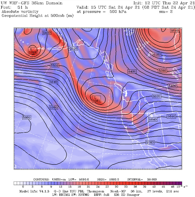
This weather pattern change is due to the breakdown of the massive and persistent high pressure ridge that brought our spring heat wave. Two maps from the UW forecast model are below. The top one is for last Saturday (peak of the heat) and the bottom one is for 8 AM Saturday.
The high pressure ridge is completely gone, replaced by a low pressure trough that will bring clouds and rain.
Below is the Puyallup forecast from Weather Underground.
Rain is likely to return late Friday night through Saturday. Temperatures reach the low-mid 60s with the exception of Saturday, where highs struggle to reach the low 50s. The highest chance of rain is on Saturday, with a dry day Sunday and chances of showers to start next week.
The UW forecast below shows expected rain through 5 AM Sunday.
Expect 0.3 to 0.75 inches of rain from Friday night to late Saturday. This will be our first rain in nearly 2 weeks, so be prepared for some slick spots on the roads. Higher rain totals are expected near the coast, in the foothills, and north of Everett.
A return to more traditional spring weather is in the forecast. The rain should be refreshing to the atmosphere after our record-breaking heat & sun!


No comments:
Post a Comment