

As the temperature warms into the mid-40s for today's cold high...this snow will melt. It will give way to rain, as a cold front moves through today. This cold front will also draw in cold NE winds. Let's get right to the details...
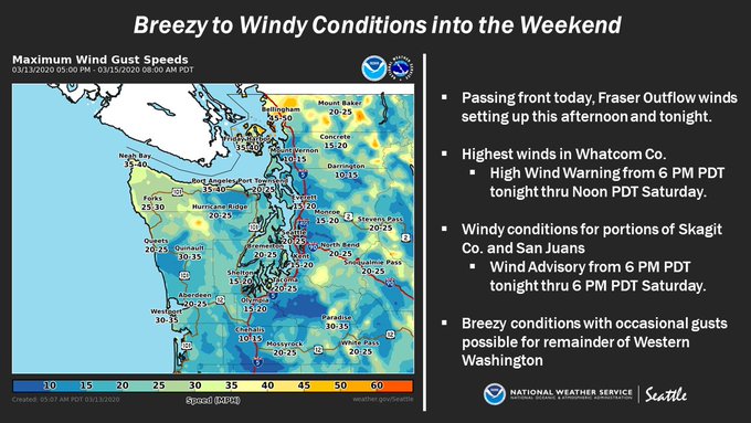
This graphic from NWS Seattle shows the expected winds. In the Central & South Sound, expect NE winds 15-25 mph, with gusts 25-40 mph from Friday afternoon through midday Saturday.
Another weather impact that will be arriving is unseasonably cold temperatures. Lows on Saturday, Sunday, and Monday will dip below 30 degrees, and it will be as cold as the mid-20s in some spots. Another graphic from NWS Seattle shows some expected low temperatures this weekend.
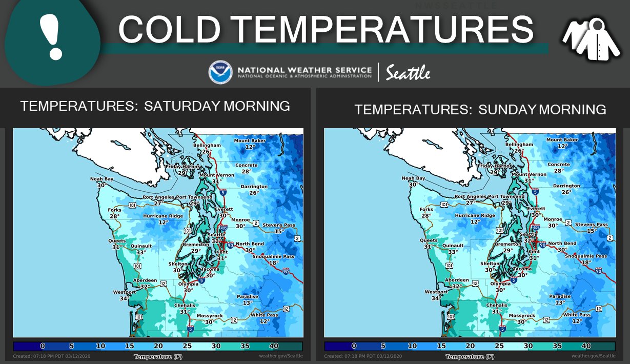
Remember, it will most likely get colder than this at times, especially in the valleys and closer to the mountains. Expect dry conditions with lows 24-30 degrees.
High temperatures will stay in the mid-upper 40s through Sunday. After that, expect sunny days and cold+clear nights! Highs approach 60 degrees by the middle of next week!!

No comments:
Post a Comment