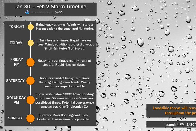
Here's an outlook from NWS Seattle showing our expected weather conditions through Sunday. (Yes it does say rain/snow mix possible...stay tuned :)
Wednesday and Thursday will feature 0.3-0.6 inches of rain, with winds gusting 20-25 mph. This will be "routine" for us with what we've been seeing lately. (Speaking of which, the month has seen 5-8 inches of rain depending on where you live...that's crazy!!)
This forecast from NWS Seattle shows expected rain from Thursday evening to Saturday evening.
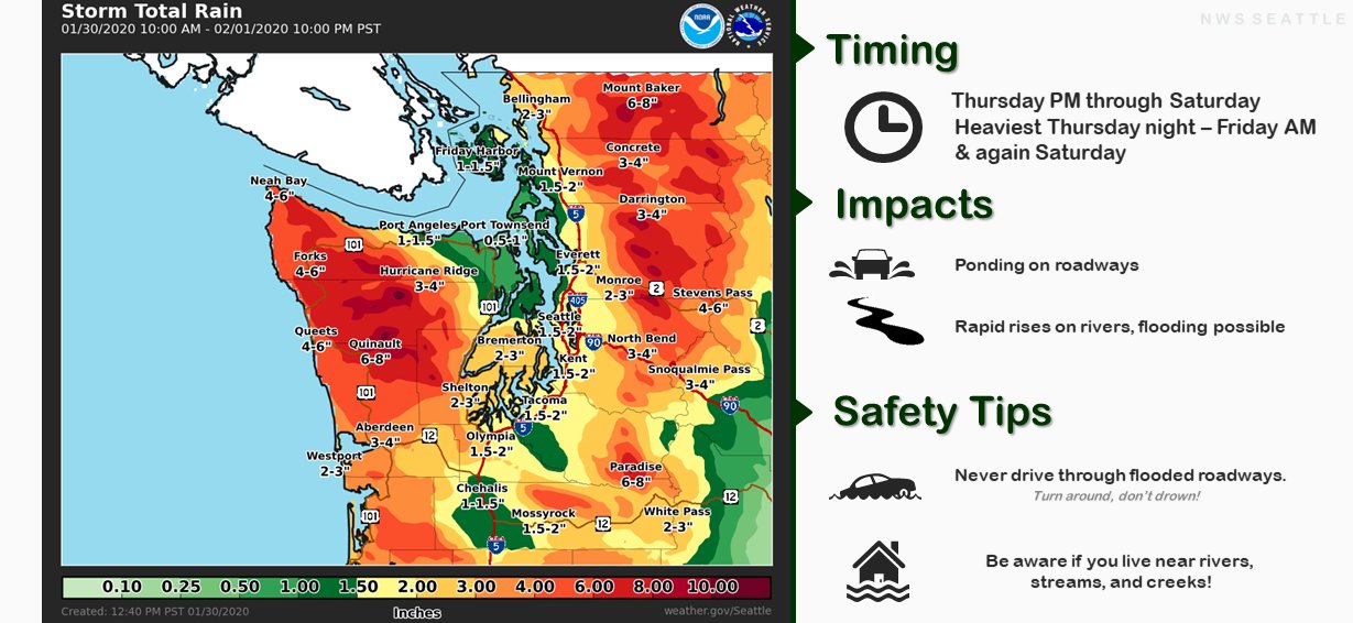
As you can see, our area will get 1.5-2 inches of rain. The majority of this rain will occur Friday and Saturday.
A storm system moves in to the area late Thursday, and rain from that system continues through Friday evening. Winds from this system will gust 25-45 mph (stronger from 6 pm and on through the night). Rain will total 0.5-1 inch.
The biggest, rainiest, and windiest system moves in early Saturday morning, after a break Friday night. This system will bring 0.7-2 inches of rain. Winds will gust 35-45 mph through the day, peaking from 12 midnight to 7 am.
Here's an overview of hazards for the next few days. Be prepared for all these events!
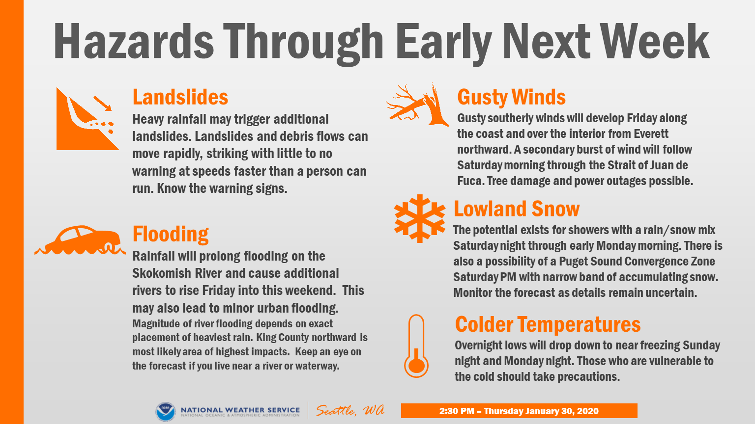
Here's an overview of hazards for the next few days. Be prepared for all these events!
A Flood Watch has been issued for these storms. 1-3 inches of rain in the lowlands and 4-7 inches in the mountains before snow levels fall on Sunday. Rivers will undoubtedly rise...more on that below. As always, find forecasts and alerts at NWS Seattle.
Flooding is likely with these storms. Be very careful for ponding and standing water on roads, especially freeways. Rivers will rise, so use caution, as floodwaters will be fast-moving and hazardous. Here's the graph for the Puyallup River at Puyallup.
The Puyallup River will rise to 19-22 feet, less than 6 feet from flood stage. This will flood some roads very near the river. Use caution in the valley, especially around the river and levees. Check river & flooding conditions on the NWS Flooding Site.
After the rain and storms move through, it should clear up and cool down, with temperatures around or below freezing. Some weather forecasts show a chance of snow...stay tuned!!

No comments:
Post a Comment