An atmospheric river is aimed straight at the area from now through Saturday.
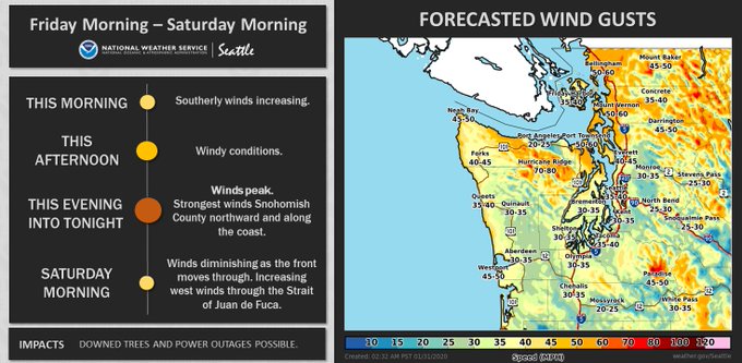
A new hazard is windy conditions. Winds will increase through the day Friday, peaking late Friday afternoon through Friday evening. Winds gradually diminish through the night. Peak winds will be sustained 30-40 mph with gusts to 50 mph. Due to the large amount of rain we've received recently, soils will be more saturated, increasing the power outage potential. This graphic from NWS Seattle shows expected winds.

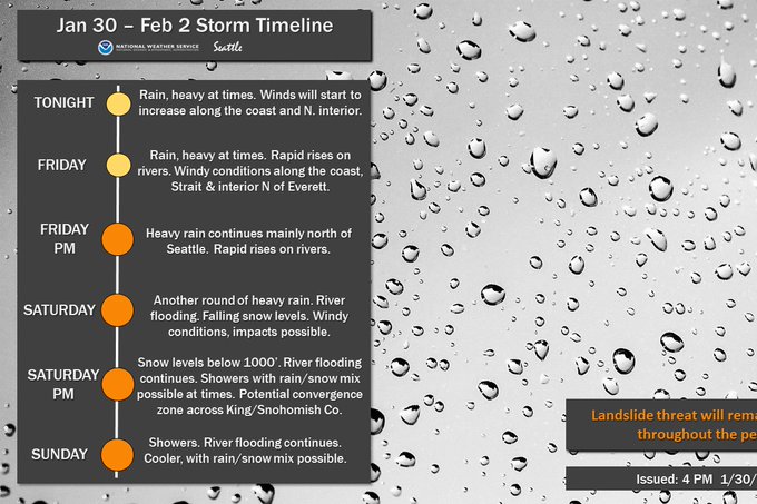
There's a chance that windy weather will continue through Saturday morning. Watch the forecasts! Here's a timeline of the weather through Sunday.

Expect 1-2 more inches of rain through Sunday. This will keep the landslide and flooding threats high. You'll notice that it says rain/snow mix possible on Saturday night and Sunday. There is a small chance of this happening, but it most likely won't happen. There are other small chances of snow through Tuesday...but stay tuned to the blog for the latest updates!!

No comments:
Post a Comment