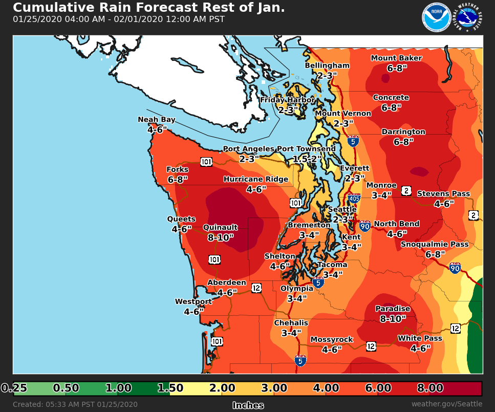
At this point, it seems that we are locked in this rainy pattern through the end of January, with another 2-4 inches of rain possible. This map from the NWS shows expected rain through the end of the month. With 3-4 inches likely, the total will be 8-9 inches for January!
Let's take a look at what to expect this upcoming week...
Saturday will start with an early morning system, with rain tapering to showers through the day.
Rain will become steadier on Sunday, with around 0.4 inches possible. Some locally windy conditions are also possible beginning Sunday. (Graphics from NWS Seattle).
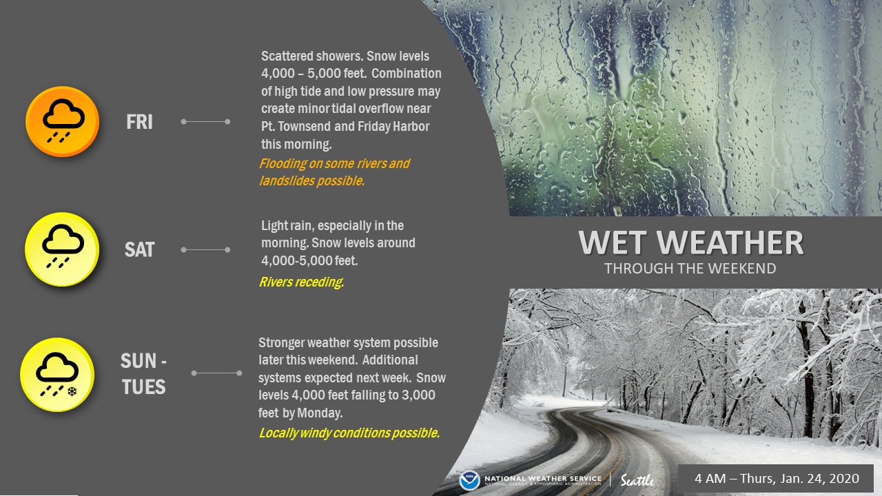
Additional systems bringing around a half inch of rain per day are likely from Monday to Friday. Windy conditions are possible through Tuesday.
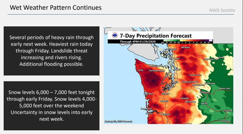
Forecasts show 1-2 inches of rain likely through Wednesday. With all this rain expected, I wouldn't be surprised to see rivers stay higher than normal or in some cases in flood stage for the next week. You can check the current river conditions here at the NWS Hydrology & Flood Site.
You can see that the river has crested, around midnight Friday morning. Normal level is around 12 feet, but the graph shows that the river will stay between 15 and 17 feet for the foreseeable future. This is 3-5 feet higher than normal. No major impacts are expected at this time, but a drive over the river will reveal that it is significantly higher than usual.
In addition to this ongoing flooding threat, there is an increased threat of landslides in Western Washington, due to high soil moisture and instability.

No comments:
Post a Comment