After a windy day on Thursday, even more wind and rain is likely on Friday, through the weekend, and on Monday.
Below are the peak wind gusts on Thursday.
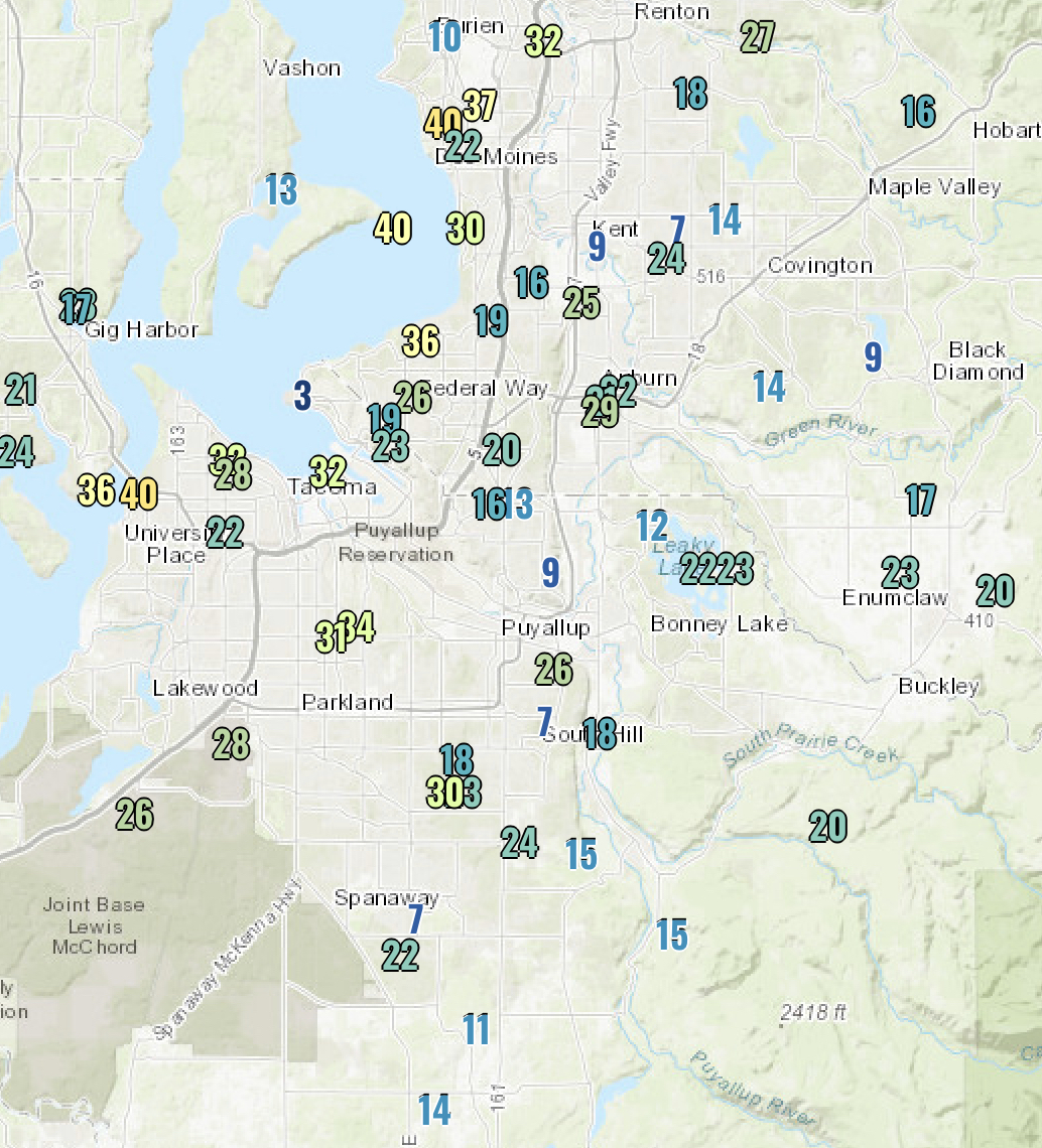
Winds gusted 25-40 mph across the Puget Sound area.
Guess what? More storms are on the way.
Perhaps the biggest headline is heavy rain that could drive rivers near or over flood stage. A Hydrologic Outlook is currently in effect regarding the potential of heavy rain and flooding due to high snow levels. You can view the alert below.

Let’s take a look at the rain forecast for Puyallup. You can expect similar amounts around the area.

This adds up to about 3 inches of rain. Even more rain will fall in the mountains, while snow levels are up to 4,500-6,500 feet.
Let’s time this out. Showers and rain will make their way into the area by midday Friday. Expect 0.1-0.4 inches of rain on Friday.
In addition to rain, expect another breezy to windy day on Friday. Take a look at the blend of 4 forecast models, showing sustained winds (big numbers) and gusts (small numbers) on Friday. This forecast is for Puyallup, and you can expect similar winds around the area, stronger near water.

Expect winds gusting 30-45 mph (locally stronger winds possible), increasing midday Friday and continuing through early Saturday morning.
The UW high resolution forecast model shows winds strongest around 3-5 PM Friday, with widespread gusts of 40-50 mph, and stronger 50-60 mph gusts near Puget Sound.
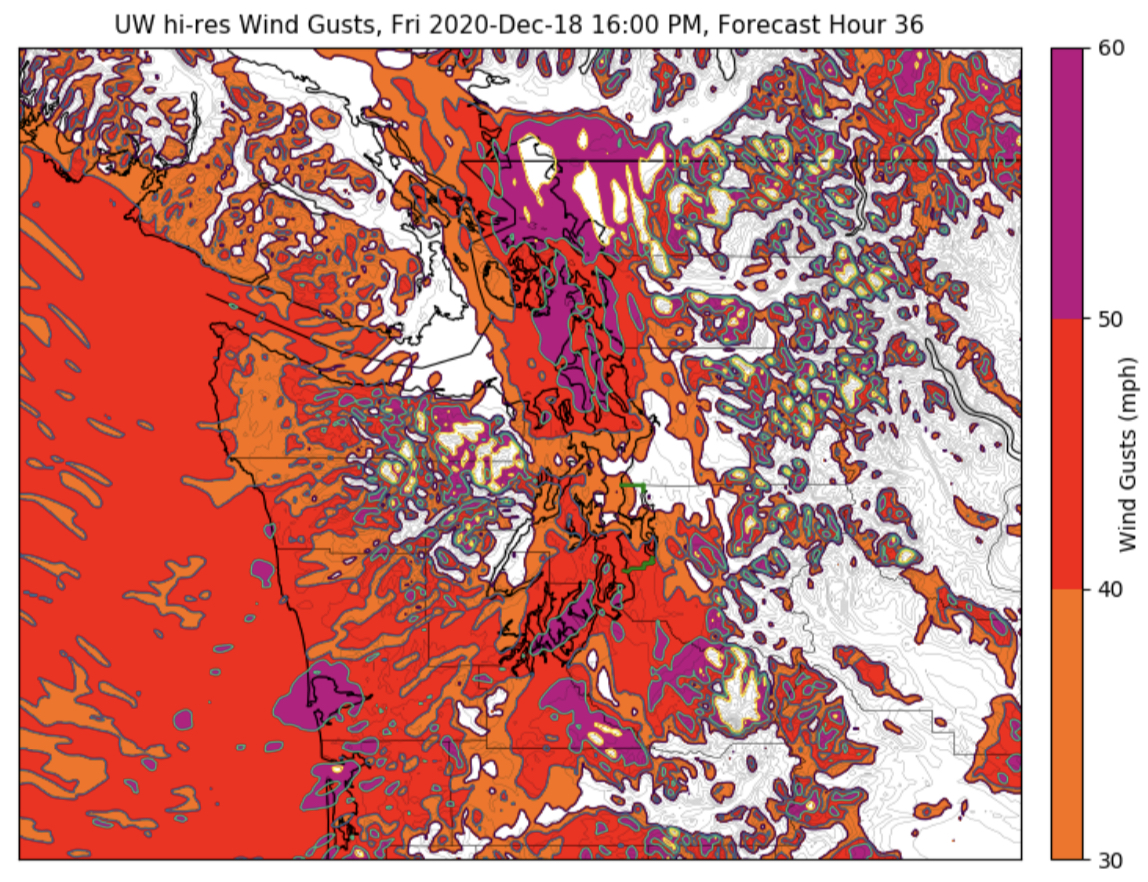
Be prepared for the winds, with isolated power outages and scattered tree damage possible. Secure your outdoor holiday decorations...we don’t want to see any real flying reindeer!
After a brief break Saturday morning, rain will increase again, as an atmospheric river is aimed at Western Washington. Take a look at the UW forecast for water vapor in the atmosphere at 7 PM Saturday.

Wow. A large and strong current of water vapor aimed straight at Western Washington.
The result? Lots of rain. Below is the forecast rain from 4 PM Friday to 4 PM Sunday.

Expect 0.6-2.5 inches of rain during this timeframe. Snow levels near above 4,500 feet during this time will allow for 2.5-10 inches of rain in the Cascades, contributing to possible flooding.
After Sunday, even more rain is possible on Monday. Snow levels fall below the passes by late Monday, and colder and drier air will be ushered in. Cold & dry weather looks likely from Tuesday to Thursday of next week. Good for viewing the “Christmas Star” in the SW sky (best right after sunset). The Christmas Star is a combination of Jupiter and Saturn making a bright star in the sky. It hasn’t been seen in 800 years!
Rain looks to make a return by Christmas.

No comments:
Post a Comment