FastCast—Sunday, July 9 to Friday, July 14:
A seasonable day is ahead on Sunday, with mostly sunny conditions and lowland highs in the mid 70s to low 80s. A noticeable cooldown is expected on Monday, with more clouds and highs dropping to the low to mid 70s. Morning clouds will remain, but temperatures will rebound on Tuesday, with highs increasing to the mid to upper 70s. Conditions will be classic Seattle for the 2023 MLB All-Star Game at T-Mobile Park, with light winds off Puget Sound and temperatures in the 60s to 70s during the game under partly sunny skies. On Wednesday, temperatures will remain in the mid to upper 70s, with morning clouds and afternoon sun. The same is expected on Thursday, with less morning clouds bringing warmer afternoon temperatures, likely into the upper 70s to low 80s. Extended forecasts show heat building by Friday, with sunny skies and highs in the low to mid 80s, with potentially hotter conditions to follow. I will be taking a break from full-length blogs after this post, but will continue to do FastCast-style abbreviated blogs before resuming full-length blogs later this summer. Stay tuned for more information!
———————————————————
Continue reading the full blog below!
An interesting mix of weather is ahead in the next few days. Let’s take a look at the forecast!
Below is the forecast for Sunday’s highs from the European model.

On Sunday, expect lowland highs in the mid 70s to low 80s, hottest from Seattle south. On the coast, expect highs in the upper 50s to mid 60s, and expect highs in the mid 90s to low 100s in Eastern Washington.
Monday will bring a statewide cooldown, more noticeable in some spots than others. Below is the European model forecast for Monday.

Expect Monday’s highs in the lowlands to drop to the low to mid 70s (due to more clouds). The coast will drop to the upper 50s to low 60s, and Eastern Washington will drop to the low 80s to low 90s.
Now, for the forecast we’ve all been waiting for…Tuesday’s forecast. This will be the forecast for the 2023 MLB All-Star Game at T-Mobile Park!

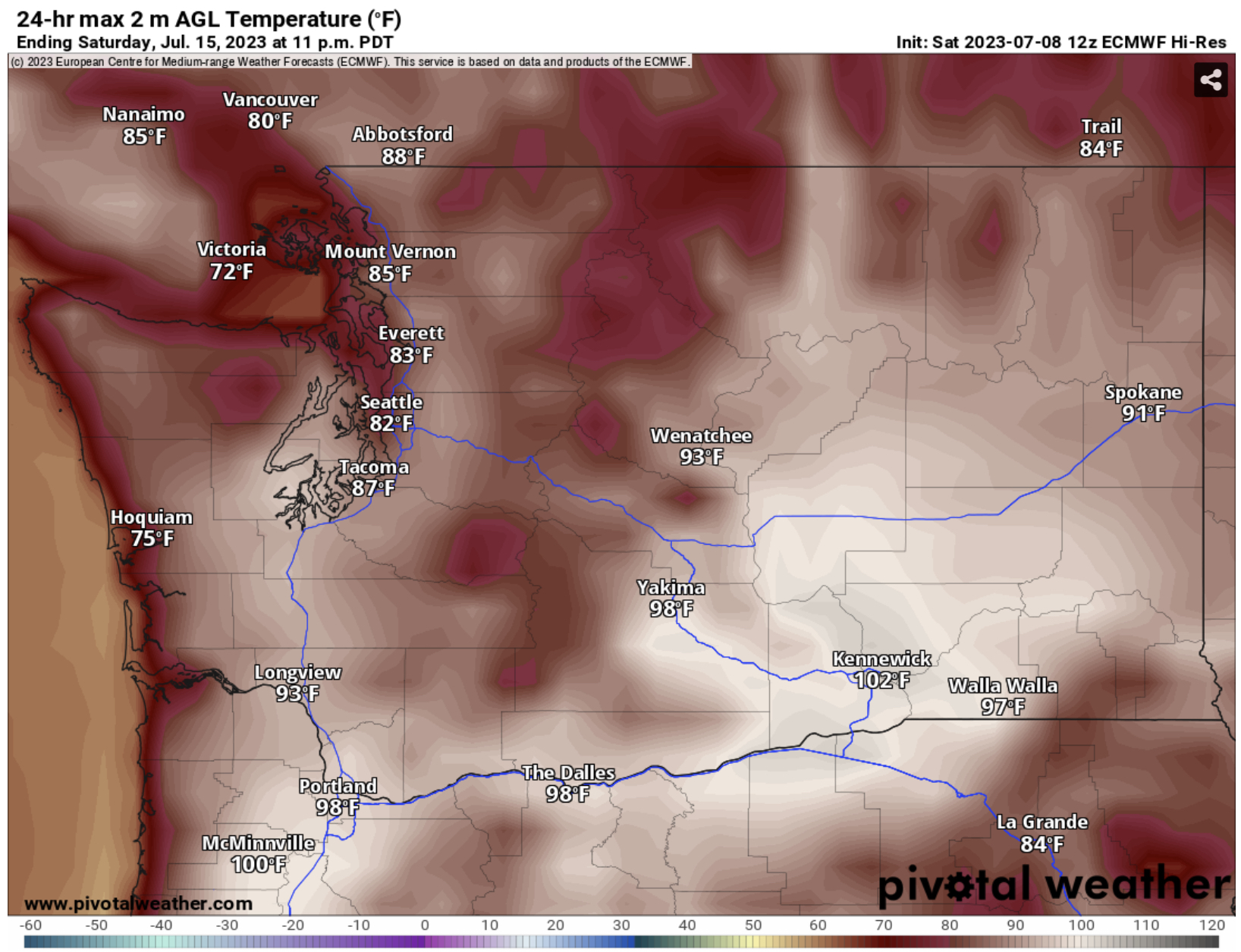
The European model shows a hot day on Saturday, with lowland highs in the mid to upper 80s, coastal highs in the mid 60s to mid 70s, highs from Olympia southward in the low to mid 90s, Portland area highs in the upper 90s to low 100s, and Eastern Washington’s highs in the low 90s to low 100s. This is a forecast pretty far out, but this shows the potential for hot weather in the coming days. Be sure to stay tuned!


Next, the precipitation outlook for the same time (July 14-18).

For precipitation, Washington is in the middle, with a 33-40% probability of above average precipitation for extreme NE Washington, a 33-40% probability of below average precipitation for the entire southern tier of the state, and equal chances everywhere else.

No comments:
Post a Comment