Colder weather is now impacting Western Washington. Here’s a look at current (8:40 PM Monday) temperatures around the region.

Temperatures are already cooling into the low 40s in the lowlands and upper 30s in the foothills.
A Frost Advisory is in effect for potential frost and near freezing temperatures from 11 PM-8 AM (Wednesday into Thursday). The advisory is in effect for the blue shaded area (approximately Bonney Lake eastward).

Even if you don’t live inside the advisory area, patchy frost is likely in some places.
Thursday morning will be the coldest morning since early May, with lows of 35-40 degrees in the South Sound.
Below is an event timeline for the next few days from NWS Seattle. (Click to enlarge)

A few days of cold weather are likely, but before the cold+dry weather arrives, a system will move by on Friday.
This system will drop snow levels to 2,000 feet, bringing accumulations on the passes and 0.05-0.3 inches of rain in the lowlands. Most of the rain will be on Friday.
Here’s the UW model forecast for rain through 5 AM Saturday. Our area is in the “rain shadow” when northwesterly flow is blocked by the Olympic Mountains, therefore lessening the Puget Sound precipitation totals.

Below is the forecast snow through 5 AM Saturday.
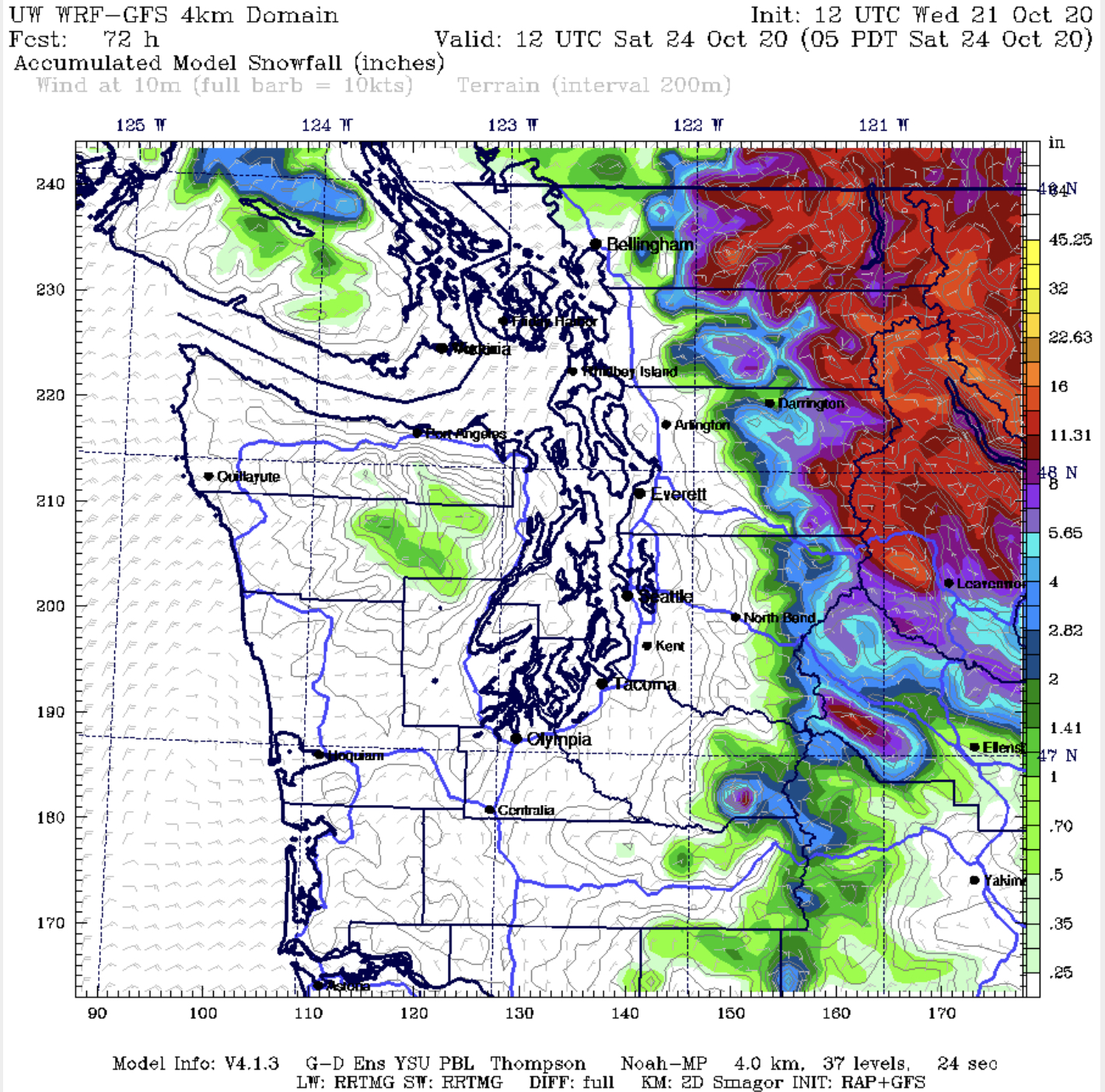
Wow. Lots of snow in the Cascades. 3-16 inches, with the most at higher elevations. There is a possibility of light snow north of Bellingham, and a slight chance of rain/snow mix above 700 feet.
After the system passes on Saturday morning, temperatures will be quite cold. Highs in Western Washington will be 40-50 degrees, with lows of 28-38 degrees, from Saturday to Tuesday. Expect the first widespread freeze & frost by Sunday morning.
In the mountains and Eastern Washington, lows will drop to 5-20 degrees...that makes you cold just thinking about it.
Stay tuned! I will have updates by Friday regarding the upcoming weather!

No comments:
Post a Comment