What an active last few days! We have had strong winds, heavy rain, power outages, and even thunderstorms!
Here are peak wind gusts from Tuesday. Widespread gusts of 30-50 mph were observed across the area. Forecast models & the NWS nailed this event.

In addition to these strong winds, over 100,000 people in Western Washington lost power on Tuesday.
This high number of power outages is because this was the first storm of the season, and trees had lots of leaves...many of which are gone now.
We also had a lot of rain over the weekend and early in the week. Here are rain totals from Friday to Wednesday night.
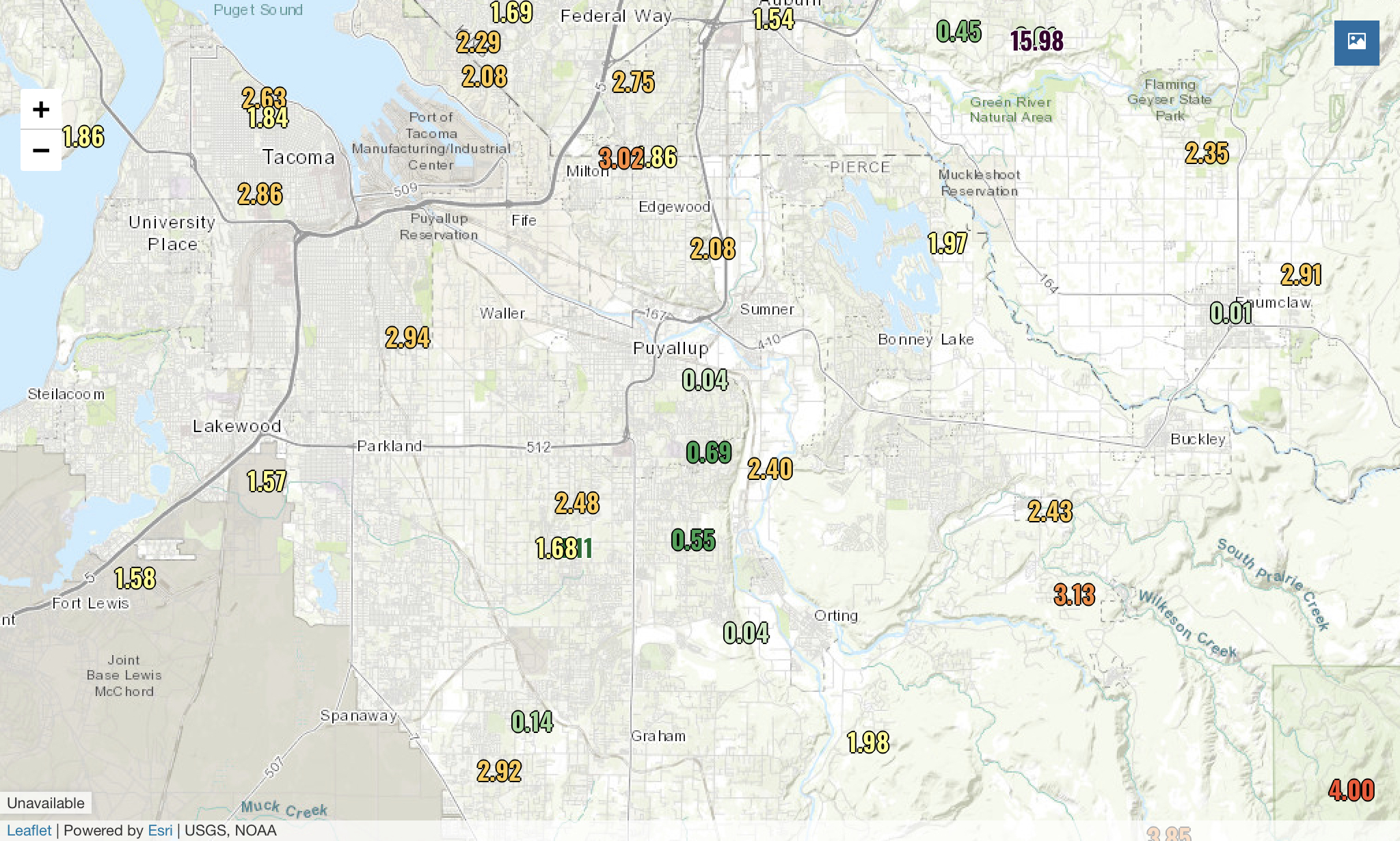
1.5-3 inches fell across the South Sound area. October totals are now in the 1.5-3.5 inch range. Add this to our end of September rain, and we have received 4-7 inches in the past month!
Now a look ahead...
We are under a big high pressure ridge. This ridge will bring a dry day with morning fog on Thursday. Morning lows will be cool...likely in the 40s.
A chance of rain returns on Friday, with mostly cloudy conditions and chances of rain for the next few days after that.
Here is the 10-day forecast for Puyallup from weather.com.

Near or slightly below normal temperatures for the foreseeable future. Enjoy the relatively “calm” weather!

No comments:
Post a Comment