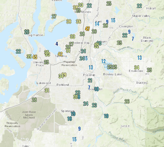
Monday was a stormy day around Western Washington. An atmospheric river brought rain, heavy at times, from Sunday night to Monday afternoon. Rain totals are below. In the second graphic, note the impact of the rain shadow on rain totals.
The South Sound generally received 0.5-1.5 inches, more in the foothills. The rain shadow was evident in the North Seattle and Hood Canal areas, but upslope precipitation enhancement can be seen on the slopes of the Olympics and Cascades.
Heavy rain Sunday night and Monday caused extreme avalanche danger in the Cascades and triggered the rare closure of all three mountain passes due to avalanche hazards. As of Monday night, Stevens Pass is closed.
As the atmospheric river moved south and away from the area, winds picked up this afternoon. Peak gusts are below.
Some scattered power outages and tree damage is possible. Expect breezy conditions at times, with winds gusting 20-35 mph through Tuesday afternoon.
Tuesday will bring showers and sunbreaks. These showers will bring the threat of heavy rain, hail, and a slight chance of lightning. Be prepared!
Convergence zone snow bands and heavy showers will bring heavy snow accumulations of 1-2 feet through Tuesday to the passes, with even more snow possible later in the week. See the map from NWS Seattle below.
This will bring difficult driving conditions to the Passes. Be prepared for delays if you’re traveling.


No comments:
Post a Comment