FastCast—Saturday, July 30 to Monday, Aug. 1:
Only 2 more days of hot temperatures remain in Western Washington. It has been a brutal stretch for many residents, with highs above 90 degrees since Tuesday (approaching a record…details below). As forecasts now indicate, the heat wave will continue through the weekend. NWS Seattle has extended the Excessive Heat Warning through 9 PM Sunday. On Friday, highs in the lowlands reached the low to mid 90s, the upper 90s in the Southwest Interior, and the upper 70s to mid 80s near the water and in the Northwest Interior. Eastern Washington is battling extreme heat, with highs today reaching the low 100s in most of the area to the low to mid 110s in the Columbia Basin. Saturday will be another day in the low to mid 90s in Western Washington, with the SW Interior reaching the upper 90s. Cooler weather can be found on the coast (60s) and along the Sound and north of Everett (upper 70s to upper 80s). Sunday will be a bit cooler, with highs only reaching the low 90s for the final day of the heat wave. Low temperatures will remain in the low to mid 60s. Eastern Washington will be quite literally baking, with highs reaching the low 100s to low 110s over the weekend. Overnight lows will only drop to the mid 70s to low 80s, providing almost no relief. Monday will bring partly cloudy skies and temperatures in the upper 70s to mid 80s in Western Washington, a big cooldown! Eastern Washington will barely feel relief, with temperatures again reaching the upper 90s to low 100s.
—————————————————————
Continue reading the full blog below!
What a brutal stretch of heat for the Pacific Northwest! If high temperatures reach 90+ degrees at Sea-Tac Airport on Saturday and Sunday, Seattle will set an all-time record of 6 straight 90+ degree days. Let’s see if that will become a reality…
The NAM high-resolution forecast for Saturday is below.

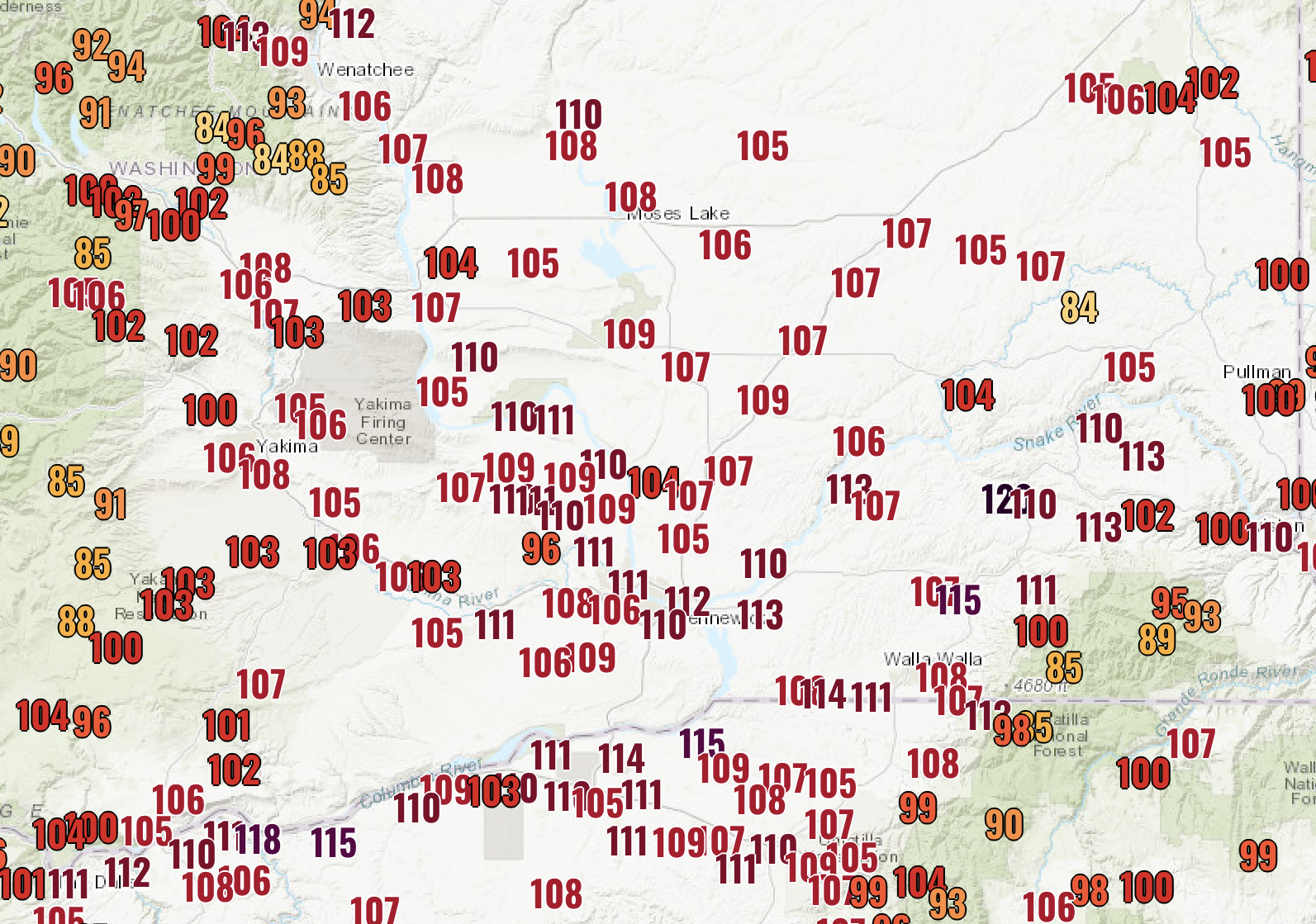
Expect another day of highs in the low to mid 90s (remember that this forecast has been a couple degrees too cold). Eastern Washington is dealing with extreme heat, with portions of the Columbia Basin reaching the upper 100s to low 110s. Portland and the surrounding area will reach the upper 90s.
The forecast for Sunday is below…and basically is the exact same thing (but a couple degrees cooler in the lowlands).

Expect a couple degrees of cooling in the lowlands, “only” reaching the upper 80s to low 90s. Eastern Washington will have highs in the low 100s to low 110s, with downright dangerous heat in the Columbia Basin. Portland will also have another day in the upper 90s.
This evening’s European model forecast shows the relief ahead for Monday.

On Monday, expect lowland highs in the upper 70s to low 80s, with some areas reaching the mid 80s. Relief will be slow in Eastern Washington, with highs dropping to the upper 90s to low 100s.
Even more relief will be felt early Tuesday morning, as seen in predicted temperatures from the European model.

There is a good chance that lowland temperatures will fall below 60 degrees for the first time in nearly a week. Extended forecasts show that temperatures will likely remain below 80 degrees through the remainder of next week.
I am sure that many of you have noticed the hazy skies these past few days, especially in the mornings and evenings. Light smoke aloft has been impacting the area due to California wildfires. The smoke will hang around through at least Sunday, but will get even lighter, as seen in the HRRR forecast for Sunday afternoon.


No comments:
Post a Comment