Saturday, October 31, 2020

Incredibly Devastating Super Typhoon Goni

While Western Washington experiences a few days of calm weather, the strongest tropical cyclone at landfall in recorded history is impacting the Philippines.

Super Typhoon Goni made landfall near Legazpi in the east central Philippines, with sustained winds of 195 mph, gusting to 230 mph. Below are 2 satellite images of the typhoon.


Goni is also the strongest storm of 2020. It is likely that this storm will cause widespread devastation in the impacted regions of the Philippines. 

Super Typhoon Goni is the preliminary record holder for the strongest storm at landfall in recorded history. It breaks the record set by Super Typhoon Haiyan in 2013, which made landfall in the Philippines at 190 mph. A humanitarian crisis followed Haiyan's impacts, and a similar crisis is likely after Goni as well.

Please pray for those impacted by Super Typhoon Goni. The Philippines is a country that is prone to strong typhoons, and the impacts can last for years.

Thursday, October 29, 2020

Breezy With Spotty Rain on Friday

Friday will be breezy, with wind gusts 25-40 mph across the area. Some light rain will also be possible, but due to westerly flow, most of Puget Sound will be “rainshadowed” bringing lesser rain accumulation.

Below is the Euro model forecast for Friday in Puyallup.


Expect some light rain in the morning, followed by winds gusting 25-40 mph from mid morning to late afternoon. A system moving into Northern Vancouver Island will bring pressure change to its south (causing winds here).

Below is the UW forecast precipitation.


Expect 0.0-0.15 inches of rain on Friday. Most of the rain will fall in the morning.

As Friday winds down, expect partly-mostly clear/sunny conditions through Monday night. Highs will be 50-60 degrees, with lows 37-45 degrees.

By the time we get to Tuesday, expect a more active weather pattern to begin. I’ll have details soon!

Sunday, October 25, 2020

Chilly Conditions & Local Weather Features

Sunday morning was chilly across the South Sound region. Recorded low temperatures were in the mid 20s-mid 30s.


Notice that the coldest temperatures were observed in outlying areas, but also take note of warmer temperatures in the areas downstream of Enumclaw. We’ll get back to that later.

Sunday night-Monday morning will be cold as well. A Frost Advisory is in effect from 2-10 AM Monday, and is posted below.


Frost will form with cold temperatures overnight, potentially killing sensitive plants. Be careful on your morning commute, as patchy black ice is possible.

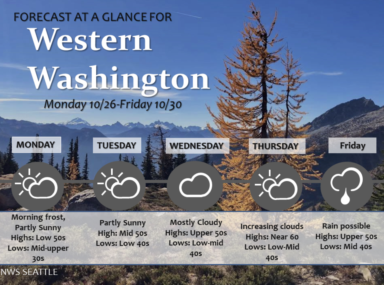
Temperatures will warm up a bit through the week, with highs of 50-62 degrees and lows of 35-49 degrees. Here’s a graphic from NWS Seattle.


Back to the localized warmer temperatures I mentioned earlier. Remember back in September, when strong winds gusted out of the Cascade gaps? Those winds impact the areas circled below.


Well, the same thing happened last night, just to a much lesser extent. Take a look at the peak wind gusts on Sunday.


Winds gusted 20-30 mph. Compare the circled areas in both graphics...they are nearly the same. You might be wondering why this happened. 

A massive high pressure ridge (black outline) has been moving down from Arctic Canada. This ridge accelerated winds through the gaps in the Cascades (blue arrow).


If it felt drier this morning in areas impacted by the winds, it was. Below is the minimum relative humidity on Sunday.


Notice very dry conditions with 29-35% humidity in parts of Puyallup, Auburn, Edgewood/Milton, and Federal Way.

Sunday night will have calmer winds, and areas that were impacted by the winds will likely cool more tonight, with frost likely.

It’s fun to see local “microclimates” in action!

Next Storm System Hits Western Washington

  8-26 Video Briefing: Next Storm System Hits Western Washington