After a very stormy last few weeks, it’s calm! Some light rain is possible in the next few days.
Below, the UW model shows rain totals through 4 PM Sunday.

Expect 0.1-0.7 inches of rain, most falling Thursday night/Friday and Saturday night/Sunday.
Patchy fog is possible on Friday night into Saturday. It looks like Saturday will be a partly sunny day.
Besides this rain, no weather events are in the near future. However, a pattern switch to colder weather is likely starting on the 20th/21st.
Take a look at the 10 day forecast for Puyallup. Notice a switch to colder temperatures (especially low temps) around the 20th.

I’m sure you notice the snow icons showing up next week and beyond. Some forecasts have been showing a chance of snow, but no definitive predictions can be made at this time.
It is likely that the Pacific Northwest will experience colder than average temperatures. The NOAA/NWS Climate Prediction Center graphic below shows temperature departure from average for January 22-28.
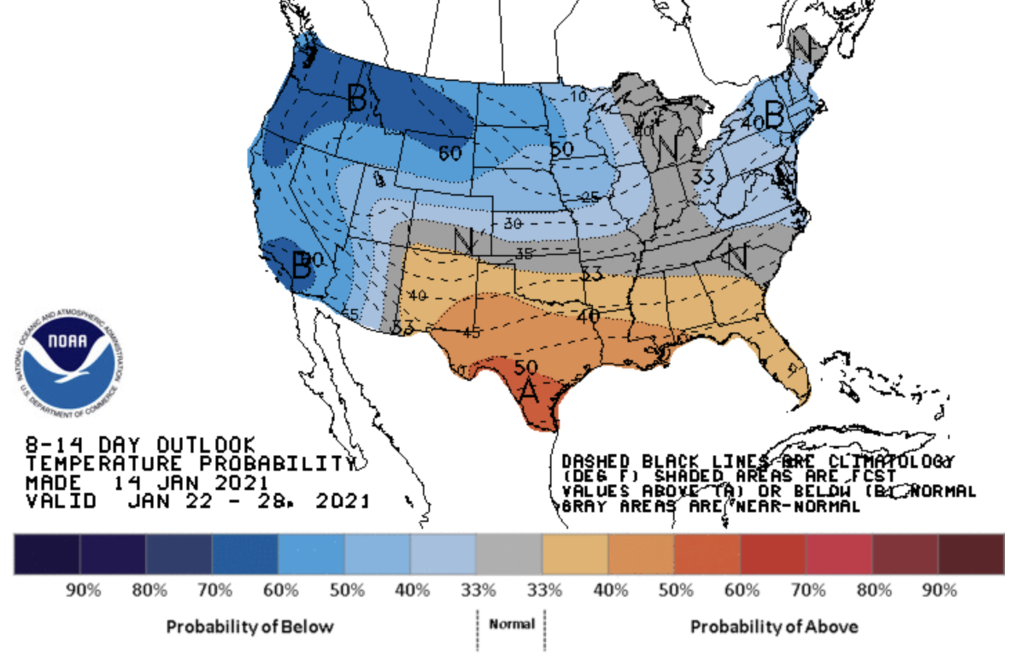
The graph shows a 60% chance of below average temperatures across Washington.
Stay tuned as details about this setup get clearer!
Upcoming blog post: “Analysis of the Strength & Impacts of the January 13th Windstorm”

No comments:
Post a Comment