It has been a rainy day across Western Washington as the atmospheric river begins impacting us. 24 hour rain totals as of 8:45 PM Monday are below.

Totals range from 0.4-1.2 inches, and an additional 1-2.5 inches are possible through Wednesday.
Monday’s satellite image was incredible, showing the atmospheric river (plume of moisture) impacting us. The atmospheric river stretches thousands of miles all the way across the Pacific Ocean!

Due to all this rain, a Flood Watch (posted below) is in effect through Wednesday night.


Expect an additional 0.5-2.5 inches of rain. This will prompt urban, small stream, and river flooding, landslides, high soil moisture, and avalanche danger in the mountains.
Additionally, gusty winds are possible as well. Two timeframes of gusty winds are possible...Tuesday morning and Tuesday night/Wednesday morning.
Expect winds gusting 20-40 mph Tuesday morning and 25-45 mph Tuesday night into Wednesday morning.
Elevated soil moisture (in turn a very saturated ground) will cause an increased possibility of tree damage.
For those along Puget Sound, there is also a chance of tidal overflow (up to 1 foot) due to king tides and low atmospheric pressure. Peak tidal overflow will likely occur between 5 and 6 AM Tuesday.
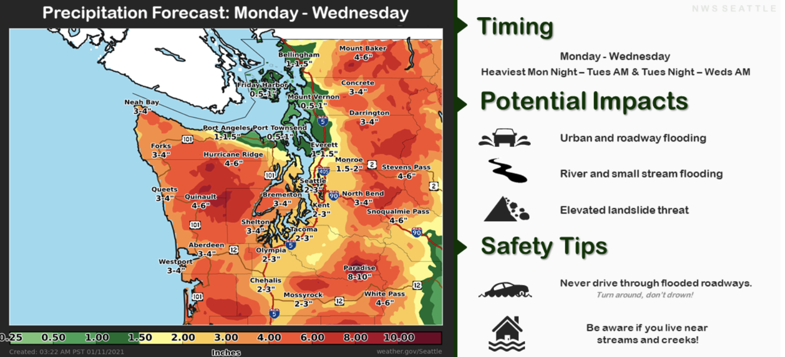
The graphic below from NWS Seattle shows our Monday to Wednesday rain forecast with impacts on the side.
One more thing...the “subtropical” component of the atmospheric river will bring highs of 52-57 degrees on Tuesday.

No comments:
Post a Comment