It will be a relatively calm week weather-wise, with relatively no rain and pleasant conditions for this time of year.
Before we begin the forecast, I would like to highlight a photo of windstorm damage from this past Wednesday’s storm that was shared with me by a Puyallup area resident.
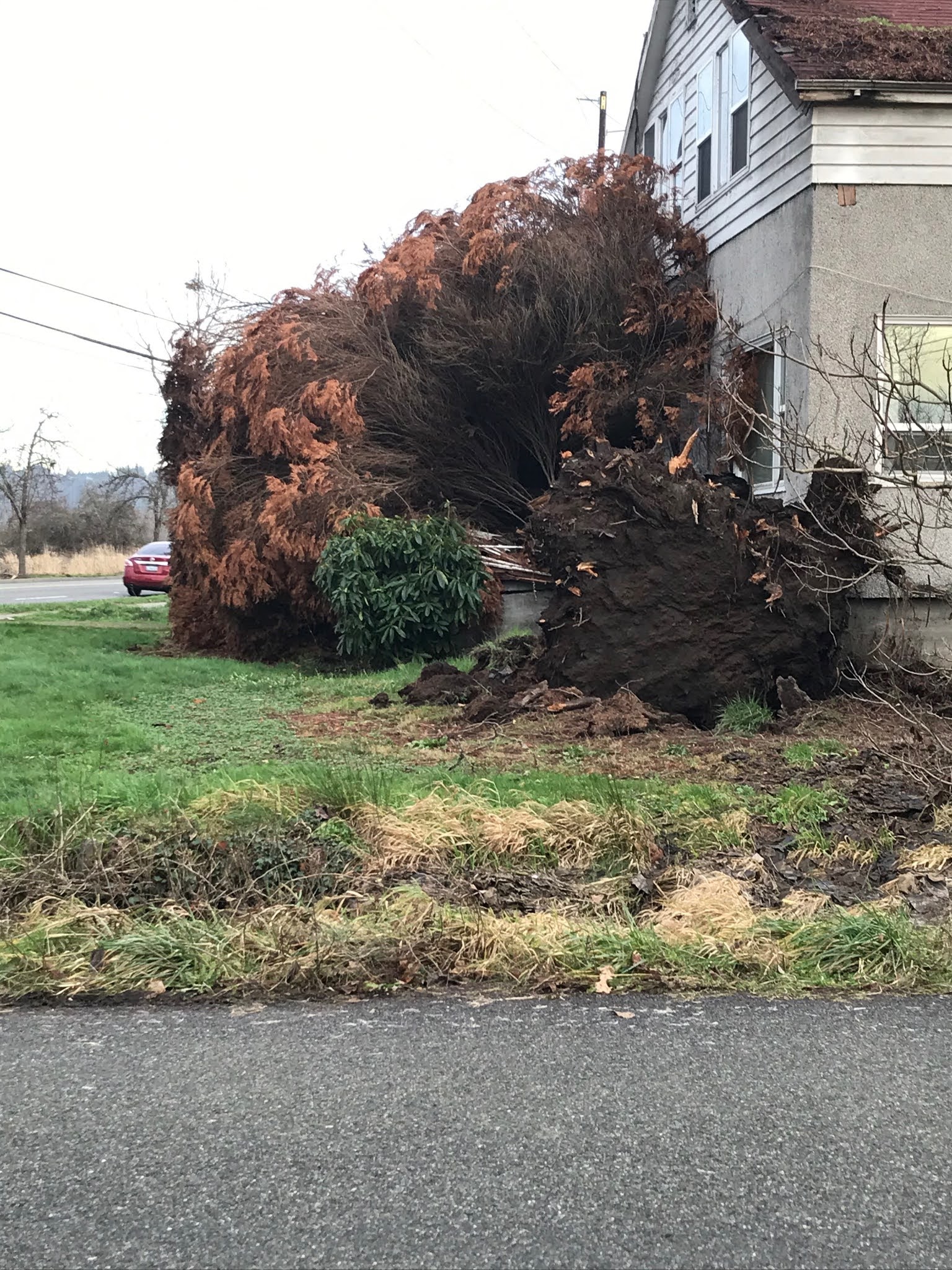
Notice the shallow root base of the fallen tree. This is a classic example of extremely saturated soils combining with strong winds and easily uprooting trees. Another reminder to be prepared for strong winds and the damage they cause.
Now...back to this week’s forecast. Below is the 10-day forecast for Puyallup from weather.com.

While high temperatures aren’t much different than seasonal normals, notice low temperatures, particularly from the 22nd to 27th. Those are the colder temperatures that could contribute to possible snow.
Before we get to snow...there’s a small chance of rain on Thursday, but besides that expect a mix of clouds and sun with overnight lows of 30-38 degrees. The coldest morning of the week will be Tuesday (30-34 degrees), then much colder weather moves in starting Friday.
Patchy fog is also possible in the mornings and late at night this week. Take caution in the fog!
Also, if you’re tired of rain and clouds, Tuesday, Friday, and Saturday will be partly-mostly sunny!!
The temperature outlook for January 24-28 from the NWS Climate Prediction Center is calling for a 60-70% probability of below average temperatures during that time.

It’s a safe bet that we will have cold morning temperatures in the 20s and 30s. However, even though snow icons show up on your weather apps, it’s a far cry from certain snow right now.
Here’s what I can say regarding lowland snow...
It will be colder. That means we will have lower than normal snow levels. How low the snow levels are, the temperature, and the amount of moisture are all unknown. In short: snow is NOT certain, and the best thing to do is stay tuned and be prepared for rain, snow, or neither.
Regarding a reliable snow forecast, I recommend NWS Seattle and any of our local news stations (KOMO 4, KING 5, KIRO 7, Q13FOX).
I’ll have an update on Wednesday night unless something drastically changes in the forecast.

No comments:
Post a Comment