After recent heat, smoke, and degraded air quality, a period of calmer and cooler weather is ahead. A cold front is moving through, bringing a chance of some light showers around the area.
Below is the UW forecast for rain through Thursday, though nearly all of it will fall by Tuesday morning.
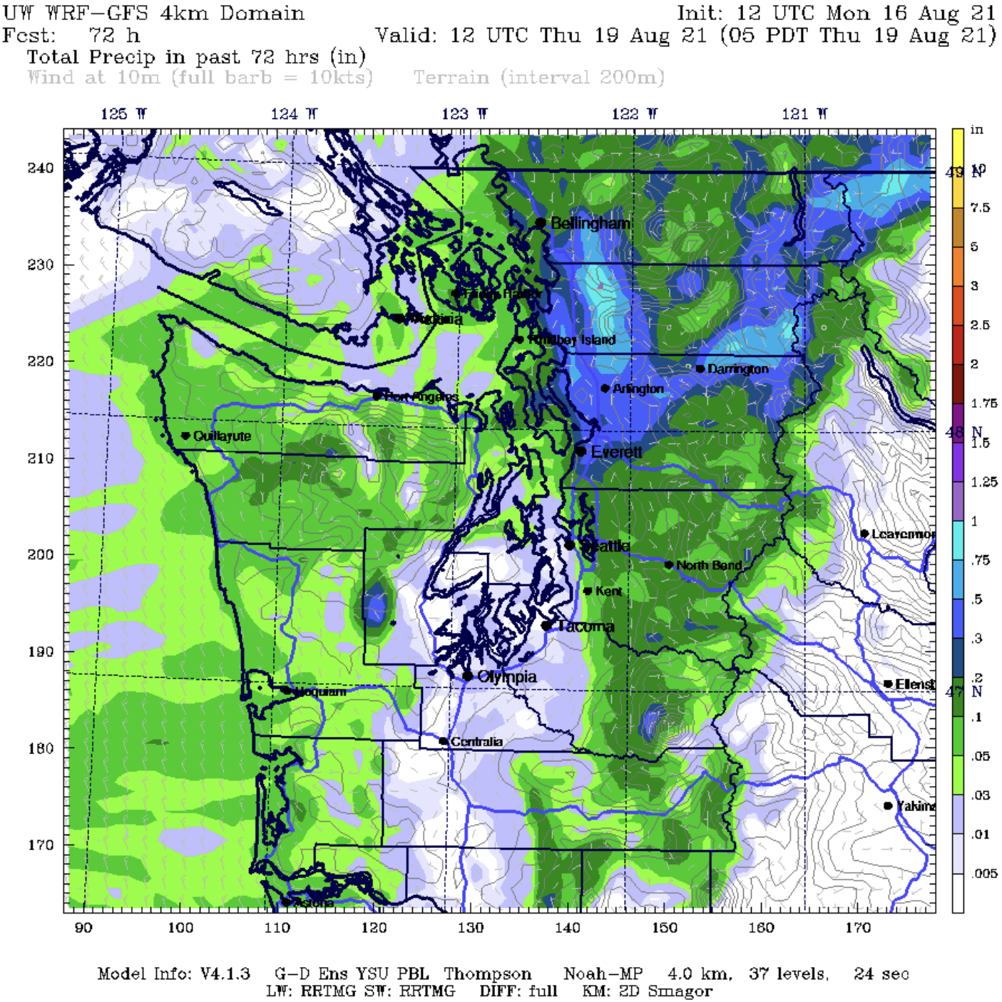
The Puget Sound area will mostly be in the rain shadow. As the map shows, the most rain (up to 1.25”) will fall in the North Cascades. Expect 0.01-0.10 inches of rain in the Puget Sound area, though areas south and west of Seattle may get no rain at all, or just a few drops. All of this rain is good for fire suppression, although the east slopes of the Cascades need the rain most.
It was also cooler on Monday, with temperatures only reaching the mid 70s to low 80s.

Additionally, the incoming cold front brought some breezy conditions, with gusts up to 20-25 mph across most of the area.
The approach of cooler air to the coast accelerated winds moving toward Eastern Washington, resulting in a large smoke plume from the growing Schneider Springs Fire, burning about 20 miles northeast of Naches, WA. It is at 18,840 acres and growing, and has prompted some evacuations in the area. Below is a satellite image of the fire’s smoke plume Monday afternoon.

The plume is dominant in Central Washington as the fire continues to burn actively.
Below is the forecast for Federal Way from Weather Underground.

One of the coolest days in awhile is likely on Tuesday, with highs only reaching the low 70s, and lows in the low-mid 50s. Temperatures warm to the upper 70s-low 80s for Thursday and Friday, then cools back to the low-mid 70s as clouds move into the area.
One thing to watch will be the southward movement of smoke aloft from British Columbia starting late Tuesday. The heaviest concentrations of this smoke (which doesn’t look heavy as of Monday night) will move through overnight Tuesday into Wednesday, and light smoke aloft will be present on Wednesday. Below is smoke aloft at 11 PM Tuesday.

No impact to air quality is expected, but you might notice a very slight haze when you wake up on Wednesday.
Enjoy the calmer weather!
Find information about the Schneider Springs Fire below:

No comments:
Post a Comment