In the past few weeks, conditions across the Cascades and Eastern Washington have been favorable for many new wildfires to start, many of which have grown significantly after starting. This blog will take a look at 10 fires across the state.
Schneider Springs Fire: 56,422 acres (as of 1:30 PM Thursday), (31,868 acres at original writing of blog)
This fire was started by lightning on August 4th and is burning approximately 20 miles northeast of Naches. The map below shows its location.
Favorable winds have generated large pyrocumulus smoke plumes, as seen in the satellite image below from the afternoon of August 18th.
The fire will continue to spread and large smoke plumes are likely to continue for at least the next few days.
Updates & photos found here: https://inciweb.nwcg.gov/incident/7775/
Green Ridge Fire: 38,410 acres, 29% contained
This fire started due to lightning on July 7th, and has been growing slowly ever since. It has expanded enough to run into the Lick Creek Fire scar, which has slowed burning on the east side. The map below shows the Green Ridge Fire and Lick Creek Fires, which are both located in rural SE Washington (between Walla Walla and Lewiston, ID), not threatening towns.
A black line on the perimeter of a fire indicates containment, and a red line indicates the fire’s current perimeter.
Lick Creek Fire: 80,421 acres, 97% contained
In an earlier blog, I talked about this fire as it was initially growing as the Asotin Complex. It has now grown to over 80K acres and is the largest fire of the year so far in Washington State. It is very near full containment after being started by lightning on July 7th and rapidly growing in the following weeks.
Green Ridge updates: https://inciweb.nwcg.gov/incident/7628/
Lick Creek updates: https://inciweb.nwcg.gov/incident/7615/
Ford Corkscrew Fire: 15,019 acres, 14% contained
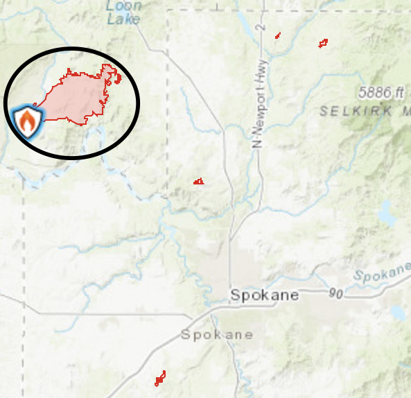
This fire is burning northeast of Spokane (see map below). It has burned 15,019 acres since starting on Sunday.
The cause of this fire is unknown. Firefighters expect generally active fire behavior for the next few days, with a bit of a break in the next day or so before more winds arrive late this weekend/early next week.
Updates here: https://inciweb.nwcg.gov/incident/7803/
Twentyfive Mile Fire: 7,072 acres
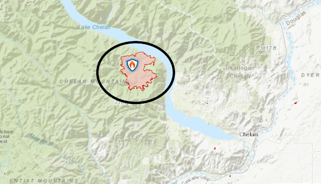
This fire started early Sunday morning, and has since burned over 7K acres in the hills on the south side of Lake Chelan (see map below).
Many aircraft, including large DC-10’s converted to tankers, have been fighting this fire. The photo below from 10 Tanker Air Carrier on Twitter shows a line of aircraft that were fighting the Twentyfive Mile Fire.
Special shoutout to 10 Tanker for letting me use this photo, and thank you all for fighting these fires!
Updates & photos here: https://inciweb.nwcg.gov/incident/7804/
Cedar Creek Fire: 54,261 acres, 50% contained
This fire started due to lighting on July 11th, and has since spread along the south hills of the Methow Valley. At one point, this fire threatened and made an extremely close approach to Sun Mountain Lodge, but has since been contained in that area. The map below shows the Methow Valley, Cedar Creek, and Cub Creek 2 Fires.
The valley side of the Cedar Creek Fire is contained, while the mountain side continues to burn. Moderate fire behavior is expected in the next few days.
Cedar Creek updates: https://inciweb.nwcg.gov/incident/7655/
Updates here: https://inciweb.nwcg.gov/incident/7776/
Updates here: https://inciweb.nwcg.gov/incident/7677/


No comments:
Post a Comment