It is rare to be able to count the number of times it has rained in Seattle on one hand…but that’s exactly what has happened this summer. At my weather station in Federal Way, Thursday was only the 2nd day with measurable rain since June 16th.
Rain fell in many locations in the Central Sound, but a rain shadow is evident on the 24 hour precipitation map ending at 10 PM Thursday.
Most areas east of Puget Sound received 0.01-0.15 inches, good enough to wet most surfaces and freshen things up. Areas around Everett (Convergence Zone) and in the Cascades received 0.15-0.5 inches.
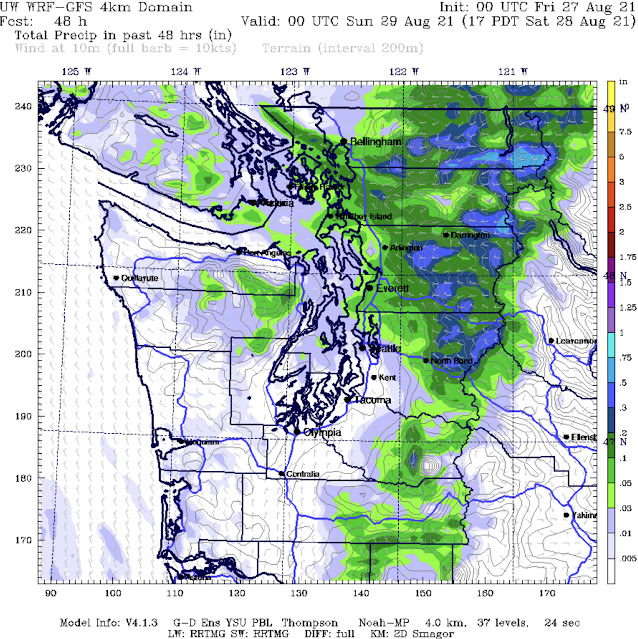
Looking ahead, some more rain is possible through Friday, but only from Everett northward and in the mountains. The UW forecast is below.
Cooler air moved in behind the cold front that produced Thursday’s rain. This cooler air will be present on Friday before temperatures warm up a bit for the weekend. The Weather Underground forecast for Federal Way is below.
Expect morning clouds on each day but the weekend. Highs will be in the upper 60s to low 70s, except in the mid 70s on the weekend…perfect weekend weather in my opinion. Cool morning lows in the upper 40s to low 50s are likely for the foreseeable future.
Additionally, for the first time in a very long time, the NWS Climate Prediction Center is forecasting below average temperatures for the Pacific Northwest! Below is the 6-10 day temperature outlook for September 1st-5th.
The outlook shows a 40-50% chance of below average temperatures for all of Washington State. The cooler weather is welcome after a hot and dry summer…enjoy it!
For information on Tropical Storm Ida, (threatening the Gulf Coast as a major hurricane this weekend), click below:
Wildfire Updates: https://inciweb.nwcg.gov/


No comments:
Post a Comment