FastCast—Saturday, Apr. 9 to Tuesday, Apr. 12:
After a very warm day on Thursday (highs 67-78 degrees), we have plunged 20 to 30 degrees as a much colder pattern arrives across the Pacific Northwest. Friday was showery with scattered heavy showers and gusty winds at times (30-40 mph). More showers and isolated thunderstorms are possible on Saturday. Persistent Convergence Zone bands may bring rain to parts of the Central Sound, but their main impact will be heavy, localized snow at times in the Central Cascades. Expect this localized heavy snow (rates of 1-2” per hour) to last through Saturday evening. Accumulations of 6-14” are possible under these bands (Snoqualmie and Stevens are the passes that may be impacted). A weak system will move SE across the area on Sunday morning, and with temperatures in the low to mid 30s, brief lowland snow is possible. Rain/snow mix is the most likely probability, but snow showers are possible on Sunday morning, especially on higher hills. (Read below for more information). Additional systems are expected in the next few days, as the troughing pattern over the Pacific Northwest ushers in more systems. For the next few days, expect highs in the upper 40s to low 50s, and lows in the low to mid 30s.
————————————————————
Continue reading the full blog below!
Is lowland snow really possible this weekend? This blog will attempt to answer the question.
Generally, the odds are stacked against lowland snow. By this time of year, it is hard for temperatures west of the Cascades to drop below freezing, the sun is much too strong, and it is harder to get lowland snow-producing patterns in springtime.
However…it’s not impossible. When the correct conditions line up, springtime lowland snow can happen.
Let’s take a look at the high-resolution HRRR forecast for snowfall through Sunday evening.
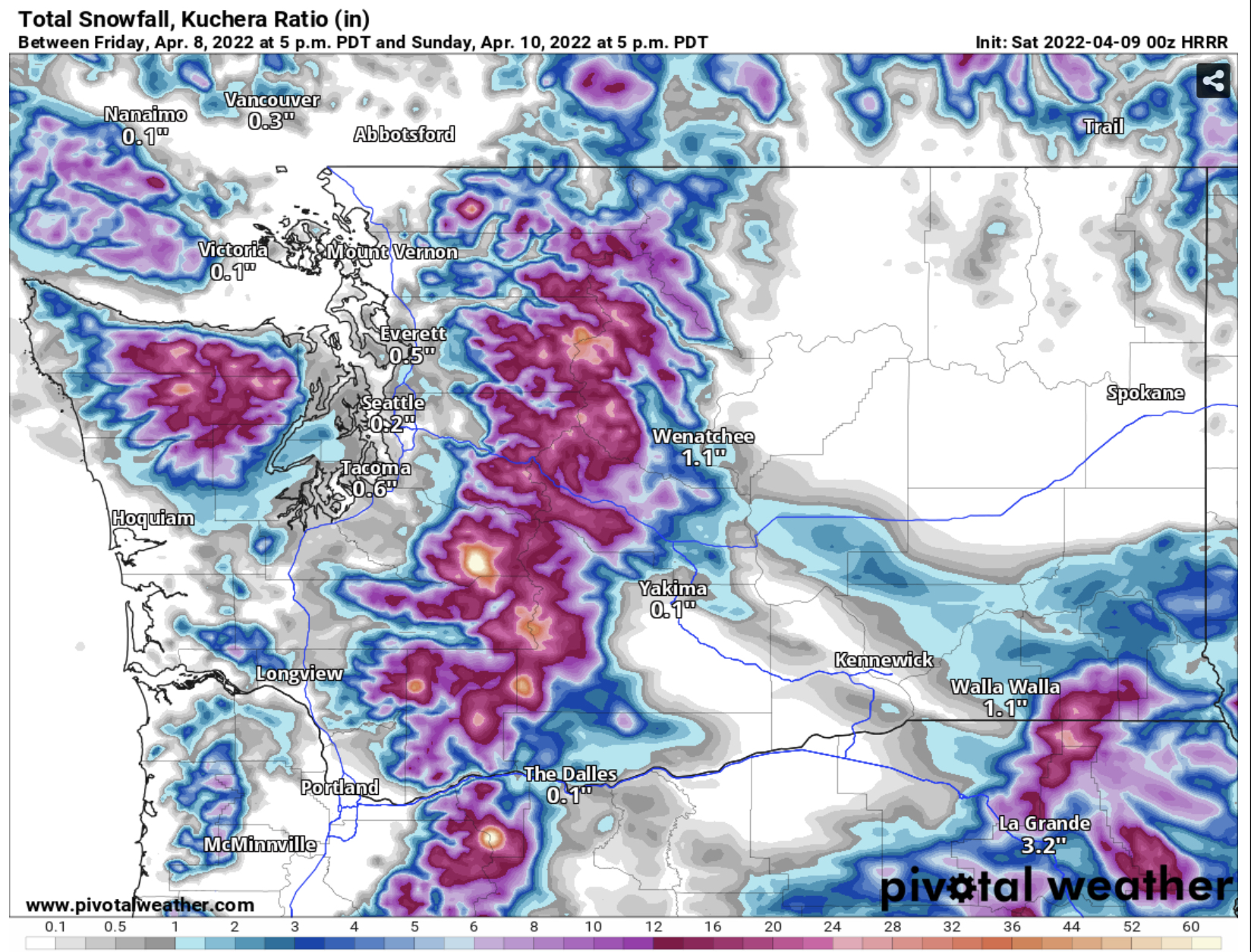
It does show light lowland snowfall (not necessarily what will actually accumulate, should snow happen).
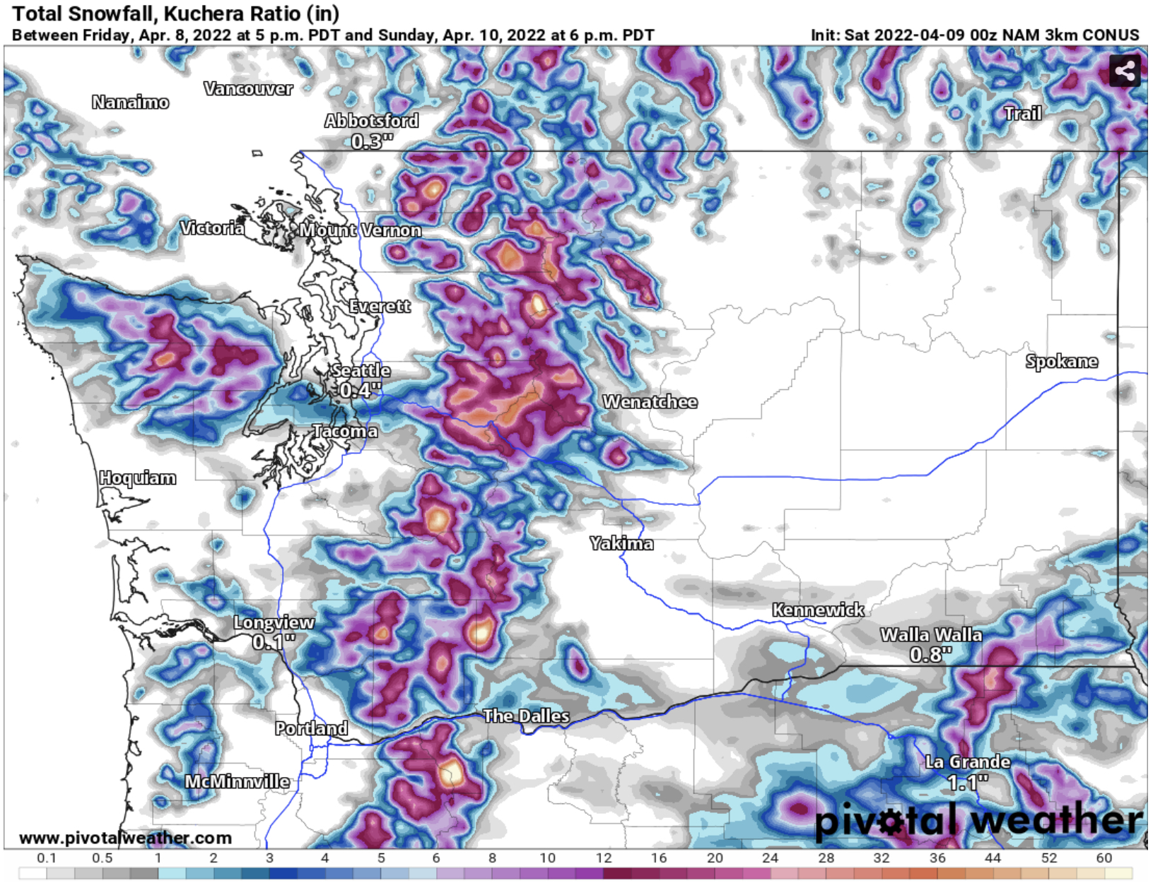
The NAM’s forecast predicts a localized snow band setting up between Seattle and Tacoma on Sunday morning, vs. the HRRR, which suggests a more widespread (but brief) band of snow on Sunday morning.

Temperatures over the lowlands are quite marginal, in the mid to upper 30s. The only way snow could fall in this situation would be if precipitation is heavy enough…because that will lower snow levels briefly, and also drop temperatures a few degrees.

There is a caveat with the NAM’s prediction. Notice that inside the red box I added to the forecast, the green is a shade darker. This represents colder temperatures (34-35 degrees). These colder temperatures line up with where the NAM predicted a snow band.

The UW forecast also shows that temperatures will be quite marginal (seen below).

Temperatures on Sunday morning are in the 34 to 38 degree range around the lowlands.

No comments:
Post a Comment