FastCast—Wednesday, Apr. 6 to Sunday, Apr. 10:
After a significant spring storm, an interesting period of weather is ahead. Expect a chilly morning on Wednesday, with lows in the low 30s and frost possible around the region. Expect partly cloudy conditions on Wednesday and Thursday, with Wednesday highs in the upper 50s to low 60s (lows in the upper 30s to low 40s). Thursday will be the warmest day of 2022 so far, with highs in the upper 60s to low 70s, and lows in the low to mid 40s. A significant pattern change begins on Friday. From Friday onwards, strong troughing will bring consistent showers and far below average temperatures. Expect highs in the upper 40s to low 50s, and lows in the mid 30s. These temperatures will be comparable to late February/early March, and will be around 5 degrees below average. Expect 0.1 to 0.3” of showers in the lowlands (likely rainshadowed) on Friday and Saturday, with 0.75 to 1.5 inches north of Everett, in the foothills, and on the coast.
——————————————————
Continue reading the full blog below!
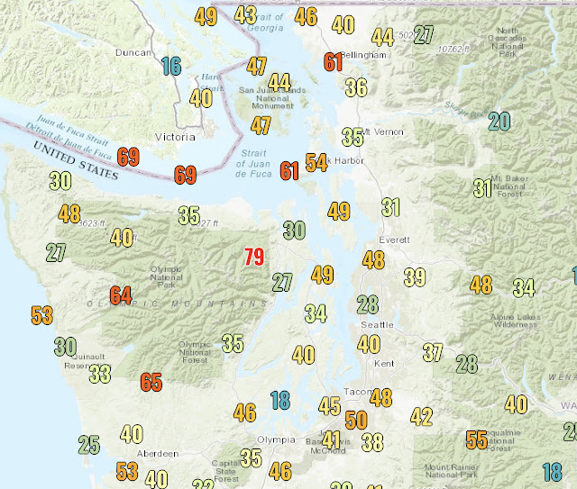
A roller coaster of temperatures is ahead for Western Washington! Let’s start with low temperatures on Wednesday morning, seen in the European model forecast below.
Expect lows near or just below freezing across the lowlands, even into the upper 20s in some outlying areas. Places near the water will only get to the mid 30s. Be prepared for frost…especially if you have outdoor plants.
High temperatures will reach the upper 60s to low 70s in the lowlands! The Willamette Valley will even get to the mid 70s!
What will this bring? Significantly below average temperatures (more reminiscent of late February & early March) and an open door for weather systems.
Western Washington has a 60-80% chance of below average temperatures, a probability usually seen in winter. Also, notice how the areas of below average temperatures and areas of troughing on the forecast model are nearly the same!


No comments:
Post a Comment