This is Blog Post #400 on The_Weatherman2 Weather Blog!! Thank you for following along!
FastCast—Monday, Aug. 8 to Friday, Aug. 12:
The short heat wave currently impacting the Pacific Northwest will continue on Monday, with temperatures again reaching the mid 80s to low 90s, as they did on Sunday. The coast will be much cooler, with highs in the low to mid 60s, after reaching the mid to upper 80s on Sunday. It will be different story in Eastern Washington, with temperatures reaching the mid to upper 90s, except the low to mid 100s in the Columbia Basin. Most of Washington state will be impacted by light smoke aloft for the next couple days, with some surface smoke at times in Eastern Washington. A change is ahead from late Tuesday through Wednesday morning. A low pressure system offshore will push showers through Western Washington (stay tuned for updates on the chance of thunderstorms), bringing 0.1-0.2 inches of rain to most of the area. Temperatures will drop to the low to mid 70s in Western Washington and back down to the upper 80s to mid 90s in Eastern Washington. Western Washington will have temperatures rebound with sunnier conditions on Thursday and Friday. Temperatures in the lowlands will reach the low 80s, and will reach the mid 60s on the coast. It will be back to the 90s in Eastern Washington.
—————————————————————————
Continue reading the full blog below!
The brief heat wave will continue on Monday, with another day of highs in the mid 80s to low 90s for most of the lowlands. The NAM model forecast for Monday is below.

This forecast tends to be 2-3 degrees too cool for Western Washington. Generally, expect highs in the lowlands to be in the mid 80s to low 90s, except in the low to mid 60s on the coast. Eastern Washington will be scorching, in the upper 90s to mid 100s. Portland and SW WA will be in the upper 80s to low 90s.
Most of you probably noticed the increasing haziness in the sky on Sunday. That is due to wildfire smoke from a combination of fires in California, Oregon, and Eastern Washington. The HRRR forecast for smoke aloft on Monday evening is below.
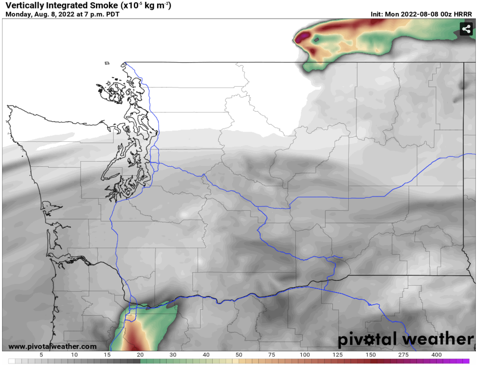
Smoke will be increasing on Monday evening, and a denser plume of smoke (seen in Northern Oregon in this graphic) will move through Western Washington overnight.
By Tuesday afternoon, the effects of continuous southerly flow will be noticeable, as smoke aloft moves through the area in a constant stream because of winds from the south.


No comments:
Post a Comment