Friday, March 13, 2020

Active Weather Day Starts With Snow

It can snow in March!! As the morning's snow melts away, it will bring forth a day of active weather. It was a little "boost" to everyone to see some pretty snow on the ground today, and I took some time to take some pictures of the event...take a look!


As the temperature warms into the mid-40s for today's cold high...this snow will melt. It will give way to rain, as a cold front moves through today. This cold front will also draw in cold NE winds. Let's get right to the details...
Image

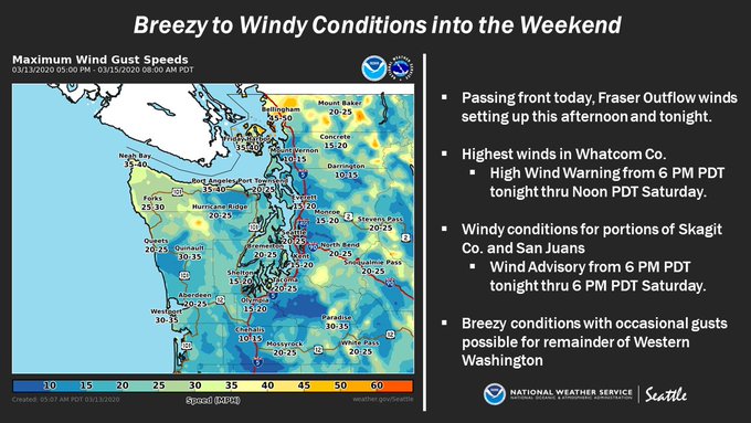
This graphic from NWS Seattle shows the expected winds. In the Central & South Sound, expect NE winds 15-25 mph, with gusts 25-40 mph from Friday afternoon through midday Saturday. 

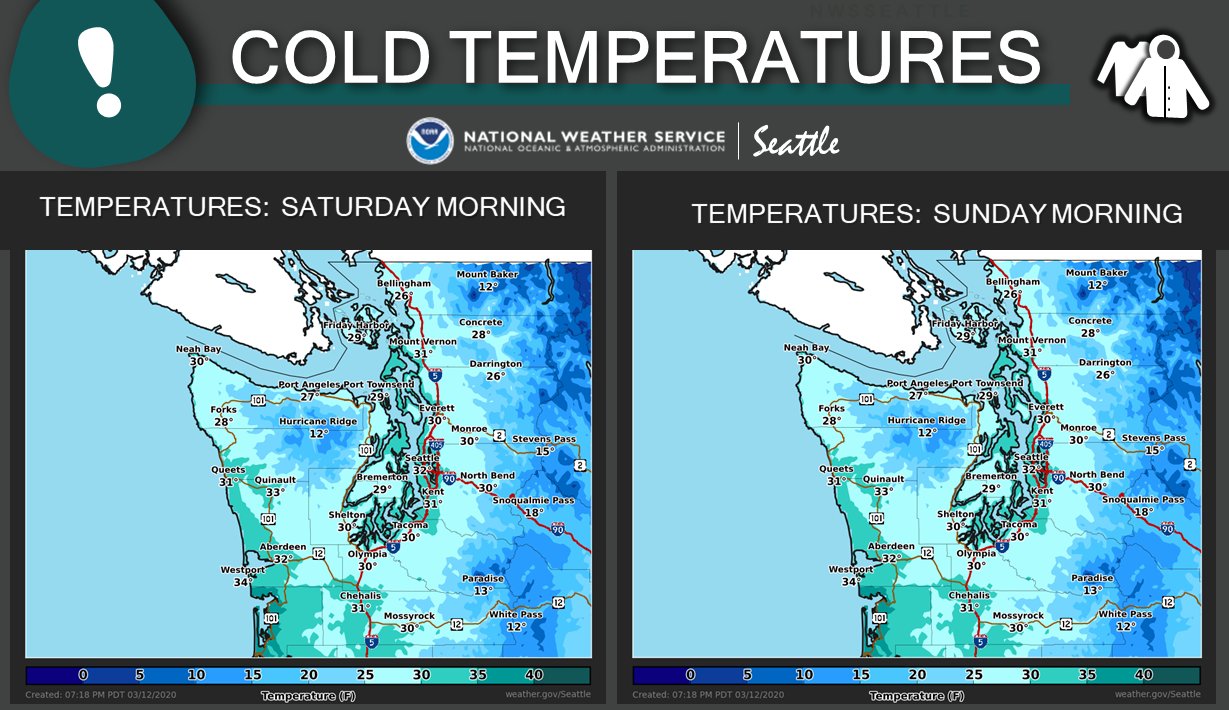
Another weather impact that will be arriving is unseasonably cold temperatures. Lows on Saturday, Sunday, and Monday will dip below 30 degrees, and it will be as cold as the mid-20s in some spots. Another graphic from NWS Seattle shows some expected low temperatures this weekend.
Image

Remember, it will most likely get colder than this at times, especially in the valleys and closer to the mountains. Expect dry conditions with lows 24-30 degrees.

High temperatures will stay in the mid-upper 40s through Sunday. After that, expect sunny days and cold+clear nights! Highs approach 60 degrees by the middle of next week!!

Tuesday, March 10, 2020

Unseasonably Cold Weather This Weekend

2020 has been a year of strange weather. As we roll in to March, that will continue. This week has already featured a monthly low of 27 degrees. For the rest of the week, rain, sun, and snow are possible. Let's take a look at the details, especially that chance of snow :)

A system moves through on Wednesday, then we will have a dry day for most of Thursday. After that, it gets interesting. This graphic from NWS Seattle shows expected weather impacts for these next couple days. Gusty east winds will be prevalent from Friday through Sunday, with winds gusting 15-35 mph in our area. 


As we move in to the night on Thursday, cold air will be moving slowly south. This model from the UW shows the cold air just north of Washington on Friday afternoon. 


This cold air is the white, blue, and purple colors on the map. This air will sag south in to Western Washington by Saturday. Temperatures will struggle to reach 50 during the day, and at night we will see low temperatures between 25 and 32 degrees. That is unseasonably cold for March. 

Because of this cold air, and some left over precipitation from the days before, there is a chance of snow from Friday night through Saturday. Here is the UW WRF model, which shows 0.7-1 inches of snow. 


The Canadian (GEM) model is more ambitious, showing up to 2 inches of snow through late Saturday. Take a look...


As always in Washington, this is only a *CHANCE*...so we will have to see how this situation changes as the week moves forward. 

The cold weather will intensify as we get later in to the weekend, and temperatures on this UW model for Sunday morning shows temperatures 20-25 degrees for Western Washington and 15-20 degrees in Eastern Washington. 


This will be a significant problem to anyone who has plants or crops planted already. Saturday and Sunday nights will be the coldest, in the 20s for nearly all of Western Washington.

Saturday, March 7, 2020

Sunny Days & Unseasonably Cold Nights

Yesterday felt abnormally chilly...and today has been another one of those days. Let’s take a look at what to expect the next few days:

Like I mentioned earlier, today was chilly, and as the showers & clouds clear out tonight, lows will dip down to the upper 20s-low 30s. There is a slight chance that pockets of left over precipitation will fall as light snow on hilltops, but this is unlikely.

As we “Spring Forward” into Sunday, the weather will get nicer! Sunday and Monday will be mostly sunny and crisp with highs 48-52. No clouds will allow for temperatures to get colder these few nights, with lows 26-32 and possible frost/ice. Those overnight temperatures are unseasonably cold for March, but we will moderate slowly after Monday night. 

Clouds increase on Tuesday, and temperatures become more seasonable, with highs in the mid 50s and lows in the mid-upper 30s. Chances of rain increase with a system on Wednesday, and then again as a stronger, more organized system makes its way in on Friday. 

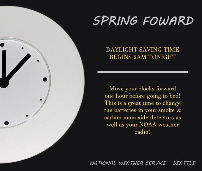
Also, be sure to get some more sleep tonight...as we transition in to Daylight Savings Time

Image

Next Storm System Hits Western Washington

  8-26 Video Briefing: Next Storm System Hits Western Washington