Laura is now a tropical depression (winds of 35 mph) NE of Little Rock, Arkansas. It is moving towards the Mid-Atlantic and out to sea.
Hurricane Laura became the strongest storm to ever impact SW Louisiana/SE Texas. It was stronger than Ike (‘08), Rita (‘05), and Audrey (‘57). And, it made landfall 2 days from the 15th anniversary of catastrophic Hurricane Katrina.
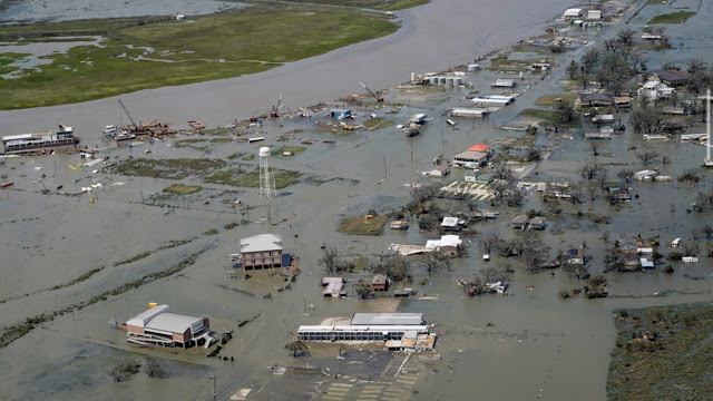
Take a look at these pictures of Laura’s aftermath from weather.com.
Before and after images of the CapitalOne Tower in Lake Charles, LA.
Major damage along a street in Lake Charles, LA.
Damage from storm surge and winds in Cameron, LA.
I’m sure you noticed the large amount of windows blown out on the Lake Charles skyscraper. The area around Lake Charles had wind gusts of 100-135 mph.
Let’s take a look at some interesting observations from Cameron, LA. This weather station is located right on the coast of Louisiana, and the core of Hurricane Laura passed right over this station.
The observation time is on the left, and wind is the colored numbers in the middle. Blue is the northern (strongest) eyewall, black is the eye, and red is the southern eyewall.
Winds gust over 100 mph consistently in both eyewalls, with a decrease all the way down to 15 mph in the eye. Also notice the gradual wind shift from NE/ENE to WSW. All part of a textbook major hurricane.
Here are a couple more articles for further reading on Laura’s devastation:


No comments:
Post a Comment