The biggest change is the upgrading of the Excessive Heat Watch.

In the East Lowlands and east of I-405, there is an Excessive Heat Warning. West of the black line, there is a Heat Advisory. I have listed the alerts below:
Excessive Heat Warning: East Lowlands
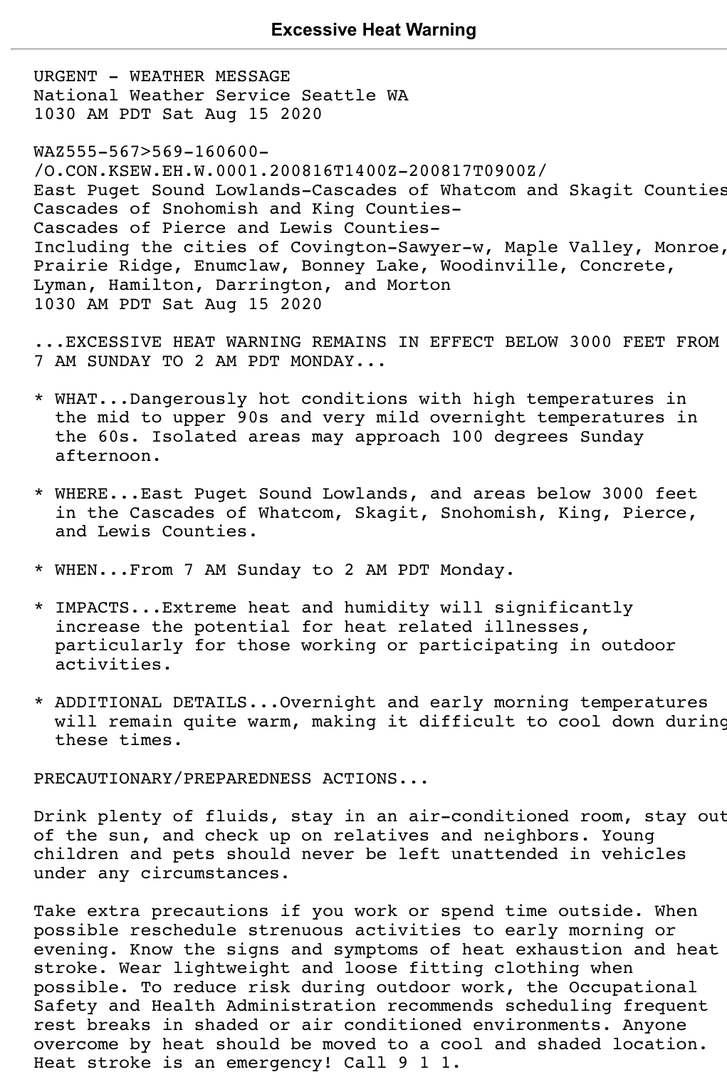
Biggest hazards with this warning is the very hot temperatures and quite warm nights (60-70 degrees).
Heat Advisory: Lowlands west of Bonney Lake & north of Graham

Biggest hazards here are the very hot temperatures and (although it’s not listed) very mild nights.
In addition to these alerts, the Red Flag Warning for fire danger and low humidity is currently in effect until 11 PM Sunday. It has been slightly changed to say that humidity will be as low as 15-25%, which is very dry for us here in WA and will significantly aid fire development.
There is also a small chance of thunderstorms late Sunday into early Monday. This could aid fire growth substantially, and could start fires. Storms are most likely to be confined to the Cascades, but there will be instability in the lowlands, as shown by the UW model below (instability at 2 AM Monday).

This small thunderstorm potential is subject to change, but regardless, fire danger is high.
As for temperatures...the forecast remains on track for 85-92° for Saturday, 95-100° for Sunday, and 85-92° for Monday.

No comments:
Post a Comment